MyTopo
Pocahontas Arkansas US Topo Map
Couldn't load pickup availability
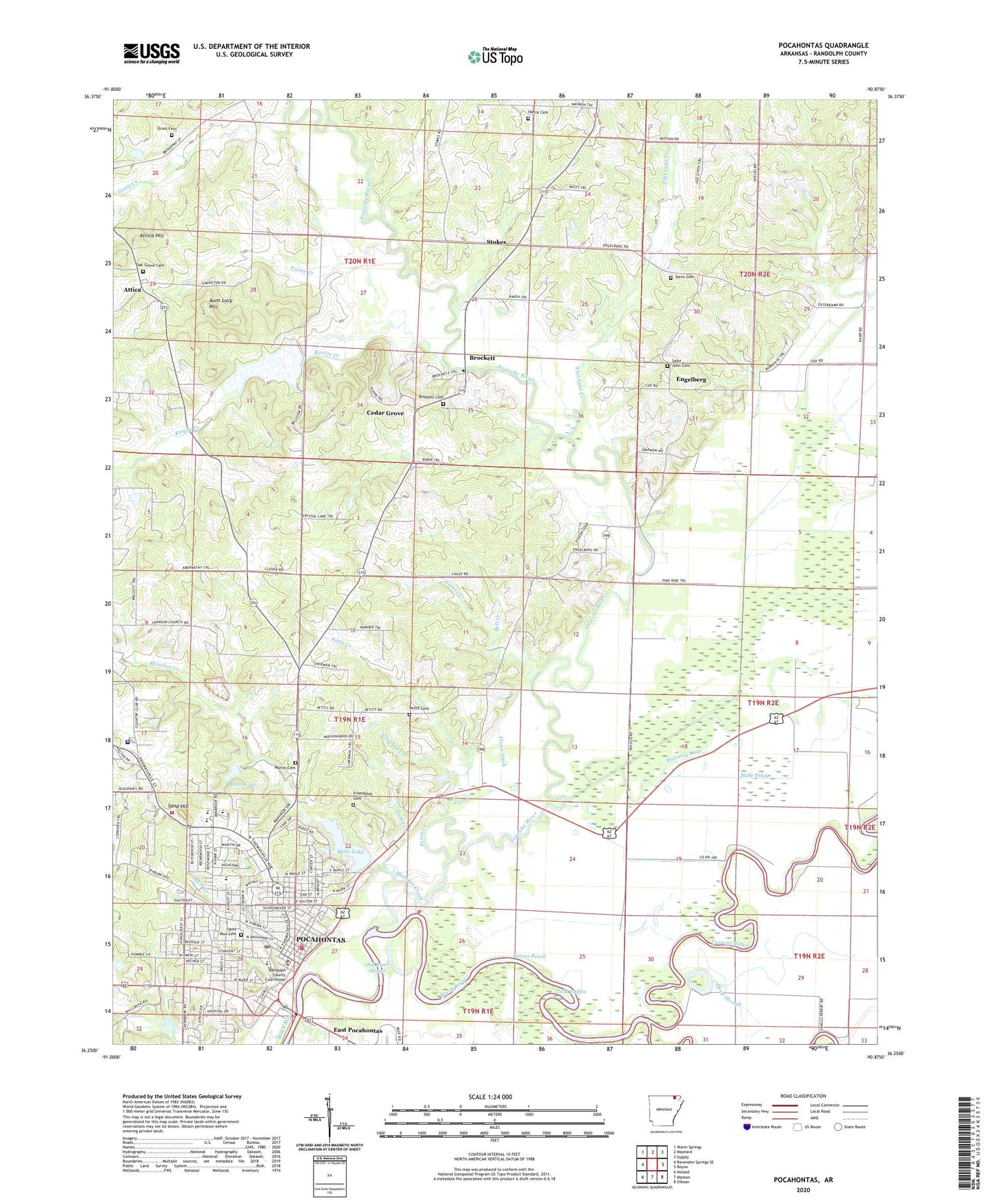
2024 topographic map quadrangle Pocahontas in the state of Arkansas. Scale: 1:24000. Based on the newly updated USGS 7.5' US Topo map series, this map is in the following counties: Randolph. The map contains contour data, water features, and other items you are used to seeing on USGS maps, but also has updated roads and other features. This is the next generation of topographic maps. Printed on high-quality waterproof paper with UV fade-resistant inks.
Quads adjacent to this one:
West: Ravenden Springs SE
Northwest: Warm Springs
North: Maynard
Northeast: Supply
East: Reyno
South: Manson
Southwest: Noland
This map covers the same area as the classic USGS quad with code o36090c8.
Contains the following named places: Alexander Park, Alma Spikes Elementary School, Attica, Attica Hill, Attica School, Aunt Lucy Hill, Baltz Lake, Baltz Lake Dam, Bates Lake, Bates Lake Dam, Beaver Ditch, Bell Creek, Broadway Shopping Center, Brockett, Brockett Cemetery, Cedar Grove, City of Pocahontas, Crooked Creek, Current River, Davis Cemetery, Davis School, Debrow, Deep Slough, East Pocahontas, Engelberg, First Baptist Church, First United Methodist Church, Five Rivers Medical Center, Flat Lake Creek, Foster Creek, Fourche River, Friendship Cemetery, Frisco Ditch, Gaines Creek, Gross Cemetery, Gross Creek, Hamil Creek, Harris Cemetery, Hillside Church of Christ, Hope Evangelical Free Church, Johnson Church, Johnson School, KCYN-FM (Pocahontas), Keller T Farms, Knotts Creek, KPOC-AM (Pocahontas), Lateral Number 7, M D Williams Middle School, Mansker Creek, Marr Creek, Martin Cemetery, Mule Ditch, Oak Grove Cemetery, Old River Slough, Old Skaggs Ferry, Pettit Cemetery, Pettit Church, Pettit Creek, Pleasant View School, Pocahontas, Pocahontas Convalescent Center, Pocahontas Fire Department Station 3, Pocahontas High School, Pocahontas Junior High School, Pocahontas Middle School, Pocahontas Police Department, Pocahontas Post Office, Pocahontas Volunteer Fire Station 1, Poluca, ProMed Ambulance, Pyburn Street Church of Christ, Randolph County Courthouse, Randolph County Law Enforcement Center, Randolph County Library, Randolph County Medical Center Heliport, Randolph Memorial Hospital, Reeves Reach, Running Lake, Running Lake School, Saint John Cemetery, Saint John the Baptist Catholic Church, Saint Paul Cemetery, Saint Pauls Catholic Church, Saint Pauls High School, Sand Hill, School Number 19, Stokes, Stokes Church of Christ, Stokes School, Throgmortan Slough, Township of Columbia, Township of Demun, Township of Foster, Township of Running Lake, Twin Eddies, Y Shopping Center