MyTopo
Reyno Arkansas US Topo Map
Couldn't load pickup availability
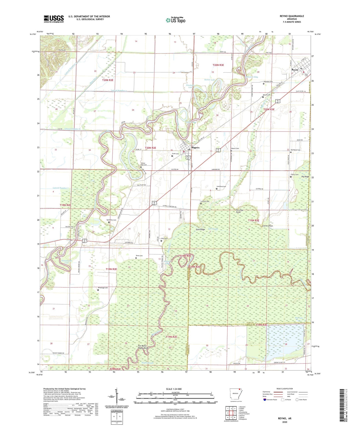
2024 topographic map quadrangle Reyno in the state of Arkansas. Scale: 1:24000. Based on the newly updated USGS 7.5' US Topo map series, this map is in the following counties: Randolph, Clay, Greene. The map contains contour data, water features, and other items you are used to seeing on USGS maps, but also has updated roads and other features. This is the next generation of topographic maps. Printed on high-quality waterproof paper with UV fade-resistant inks.
Quads adjacent to this one:
West: Pocahontas
Northwest: Maynard
North: Supply
Northeast: Datto
East: Peach Orchard
Southeast: Delaplaine
Southwest: Manson
This map covers the same area as the classic USGS quad with code o36090c7.
Contains the following named places: Big Lake, Biggers, Biggers - Reyno Volunteer Fire Department, Biggers Church of Christ, Biggers Ferry, Biggers Post Office, Biggers-Reyno Elementary School, Biggers-Reyno High School, Blount Cemetery, Brimmage Cemetery, Brown School, Canoe Slough, Carter Point, Cherokee Bay, Cherry Cemetery, City of Reyno, Dunn Cemetery, Gar Slough, Gas Plant Lake, Gum Ridge, Hite Cemetery, Hite School, Jim Johnson Landing, Johnston Cemetery, Johnston Eddy, Keller, Lake Ashbaugh, Lateral Number 3, Lateral Number 4, Lateral Number 5, Lateral Number 8, Lawnbird Cemetery, Legate Lake, Little Lake, Luttrell Cemetery, Main Ditch, Maple Slough, Murray Creek, Old McElroy Ferry, Old Reyno, Old Reyno Airport, Old Reyno Cemetery, Old Reyno Church, Old River Island Lake, Osburn Cemetery, Peachtree Lake, Peru School, Pig Ridge, Reyno, Reyno - Biggers Volunteer Fire Department, Reyno Post Office, Reyno School, Richardson Ferry, Schnabaum Lake, Scott Cemetery, Scotts Ferry, Shavers Eddy, Sore Eye Point, Sparkman Cemetery, Sparkman Lake, Sumac Lake, Town of Biggers, Township of Current River, Township of Reyno, Two Board Shanty Bend, Yellow Hall Cemetery, ZIP Code: 72413