MyTopo
Marsden Arkansas US Topo Map
Couldn't load pickup availability
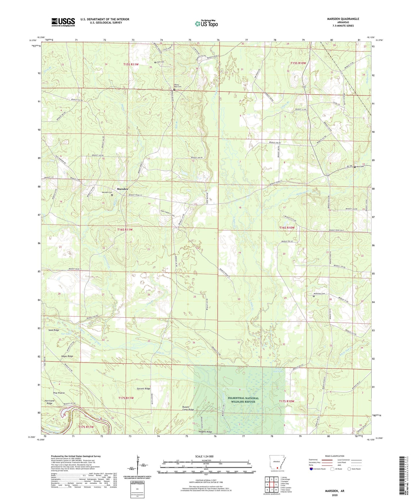
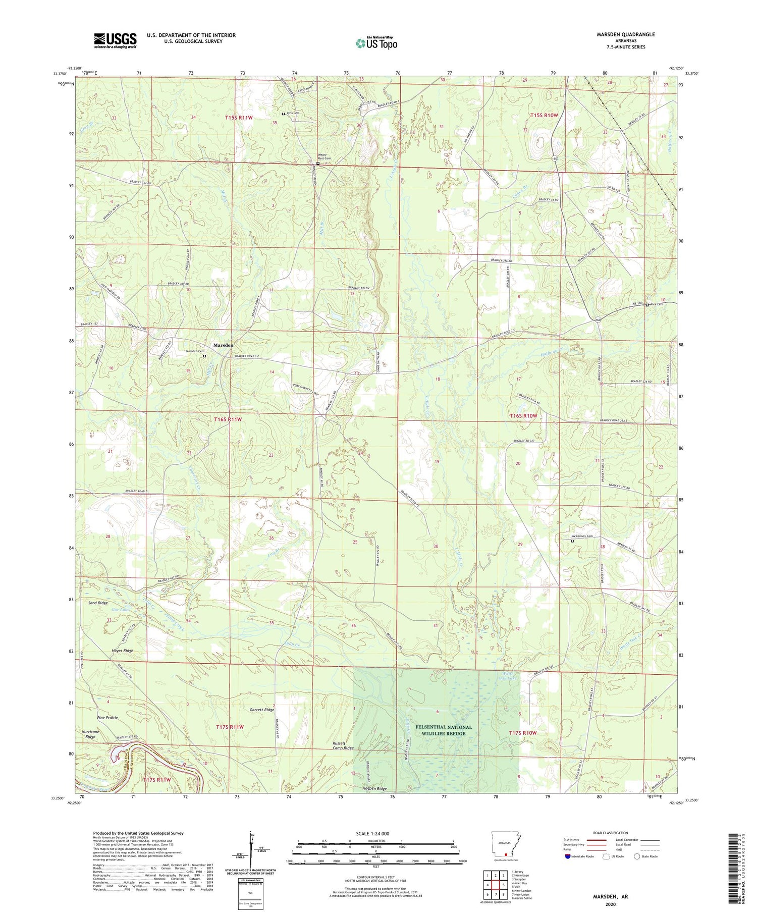
2024 topographic map quadrangle Marsden in the state of Arkansas. Scale: 1:24000. Based on the newly updated USGS 7.5' US Topo map series, this map is in the following counties: Bradley, Union. The map contains contour data, water features, and other items you are used to seeing on USGS maps, but also has updated roads and other features. This is the next generation of topographic maps. Printed on high-quality waterproof paper with UV fade-resistant inks.
Quads adjacent to this one:
West: Moro Bay
Northwest: Jersey
North: Hermitage
Northeast: Sumpter
East: Vick
Southeast: Marais Saline
South: New Union
Southwest: New London
This map covers the same area as the classic USGS quad with code o33092c2.
Contains the following named places: Caney Branch, Charivari Creek, Crossroads Baptist Church, Eagle Lake Church, Gar Lake, Garrett Ridge, Halfway Creek, Hayes Ridge, Lay Branch, Lyns Cemetery, Magnolia Hospital Heliport, Marsden, Marsden Baptist Church, Marsden Cemetery, Marsden Methodist Church, McKenney Cemetery, Mill Branch, Mill Creek, Pine Prairie, Pine Prairie Bay, Russell Camp Ridge, Sand Ridge, Spring Slough, Sturgis, Thomas School, Township of Eagle, Tulip Lake, Wearied Rest Church, Weary Rest Cemetery, White Oak Creek, White Oak Lake, York Cemetery