
MyTopo
New Union Arkansas US Topo Map
Couldn't load pickup availability
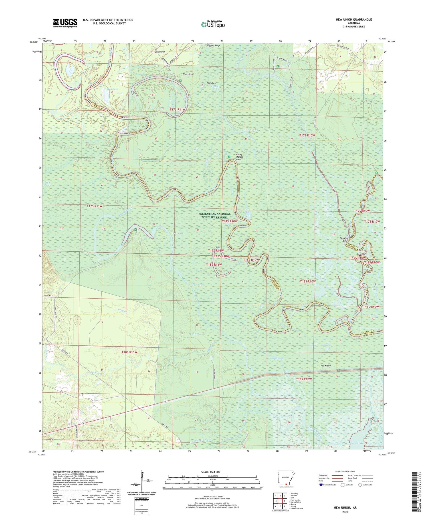
2024 topographic map quadrangle New Union in the state of Arkansas. Scale: 1:24000. Based on the newly updated USGS 7.5' US Topo map series, this map is in the following counties: Union, Bradley, Ashley. The map contains contour data, water features, and other items you are used to seeing on USGS maps, but also has updated roads and other features. This is the next generation of topographic maps. Printed on high-quality waterproof paper with UV fade-resistant inks.
Quads adjacent to this one:
West: New London
Northwest: Moro Bay
North: Marsden
Northeast: Vick
East: Marais Saline
Southeast: Felsenthal Dam
South: Huttig
Southwest: Strong
This map covers the same area as the classic USGS quad with code o33092b2.
Contains the following named places: Bend Lake, Blue Lake, Boeut Brake, Bolding Lake, Buck Lake, Caney Bayou, Caney Marais Bend, Cedar Ridge, Crosstie Slough, Deep Slough, Eagle Lake, Fishtrap Lake, Frank Lake, Hogpen Ridge, Hoop Lake, Horsehead Creek, Jones Lake, Lagle Creek, L'Aigle Creek, Lapoile Creek, Little Bay, Long Branch, Middle Lake, Mud Lake, New Union, Oak Ridge, Open Brake, Pea Ridge, Pereogeethe Lake, Pig Island, Pine Island, Prairie Island Log, Saline River, Staveyard Bend, Stormhole Bend, Straight Lake, Tulip Creek


