MyTopo
Prattsville Arkansas US Topo Map
Couldn't load pickup availability
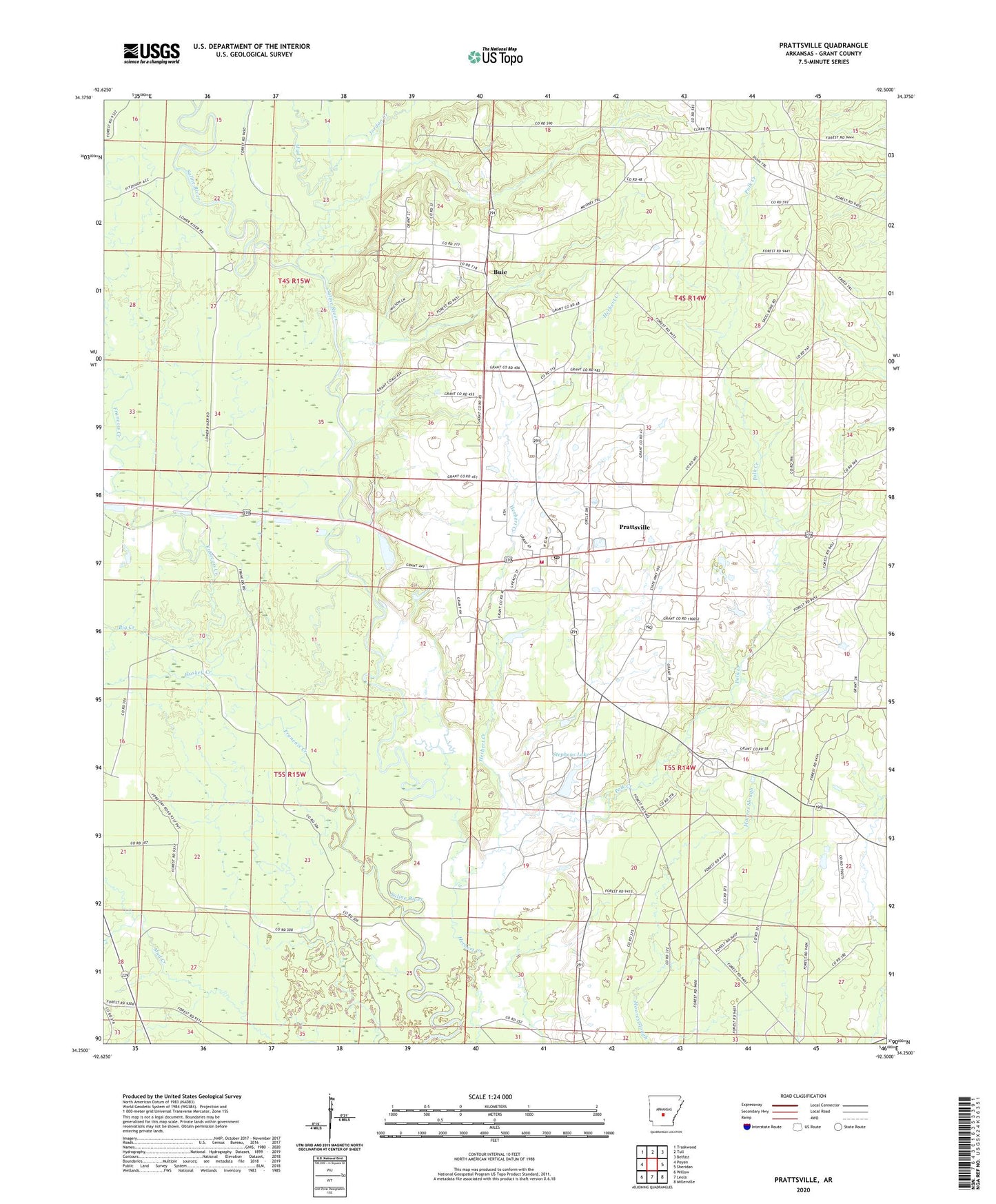
2024 topographic map quadrangle Prattsville in the state of Arkansas. Scale: 1:24000. Based on the newly updated USGS 7.5' US Topo map series, this map is in the following counties: Grant. The map contains contour data, water features, and other items you are used to seeing on USGS maps, but also has updated roads and other features. This is the next generation of topographic maps. Printed on high-quality waterproof paper with UV fade-resistant inks.
Quads adjacent to this one:
West: Poyen
Northwest: Traskwood
North: Tull
Northeast: Belfast
East: Sheridan
Southeast: Millerville
South: Leola
Southwest: Willow
This map covers the same area as the classic USGS quad with code o34092c5.
Contains the following named places: Arthur, Big Creek, Buie, Cooper School, Francois Creek, Huskey Creek, Jordan Creek, Mud Creek, Philadelphia Church, Polk Creek, Prattsville, Prattsville Elementary School, Prattsville Fire Department, Prattsville High School, Prattsville Post Office, Stephens Lake, Stephens Lake Dam, Sweet Home Church, Town of Prattsville, Township of River, ZIP Codes: 72128, 72129