MyTopo
Sheridan Arkansas US Topo Map
Couldn't load pickup availability
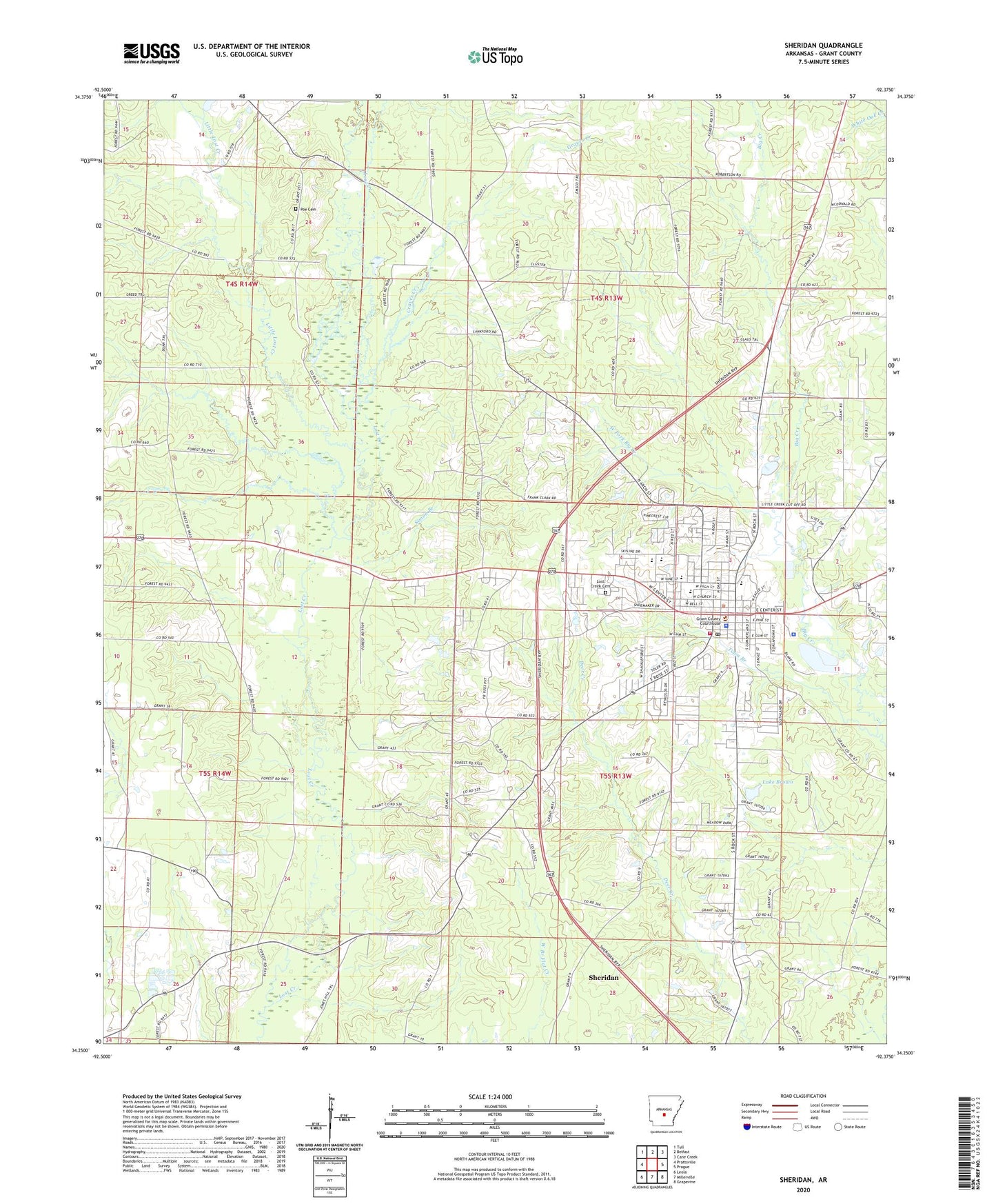
2024 topographic map quadrangle Sheridan in the state of Arkansas. Scale: 1:24000. Based on the newly updated USGS 7.5' US Topo map series, this map is in the following counties: Grant. The map contains contour data, water features, and other items you are used to seeing on USGS maps, but also has updated roads and other features. This is the next generation of topographic maps. Printed on high-quality waterproof paper with UV fade-resistant inks.
Quads adjacent to this one:
West: Prattsville
Northwest: Tull
North: Belfast
Northeast: Cane Creek
East: Prague
Southeast: Grapevine
South: Millerville
Southwest: Leola
This map covers the same area as the classic USGS quad with code o34092c4.
Contains the following named places: Calvary Church, Cherry Grove, City of Sheridan, Ephesus Church, Grant County, Grant County Sheriff's Office, Graves Creek, Kelly Branch, KGHT-AM (Sheridan), Lake Brown, Lake Brown Dam, Little Creek Church, Little Lost Creek, Lost Creek Cemetery, Metropolitan Emergency Medical Service Sheridan, Poe Cemetery, Sheridan, Sheridan Elementary School, Sheridan Fire Station, Sheridan High School, Sheridan Intermediate School, Sheridan Middle School, Sheridan Police Department, Sheridan Post Office, Simon Branch, Slabtown, Town Branch, Township of Merry Green, Turin, West Fork Big Creek, Whitworth Lake, Whitworth Lake Dam, ZIP Code: 72150