MyTopo
O'Kean Arkansas US Topo Map
Couldn't load pickup availability
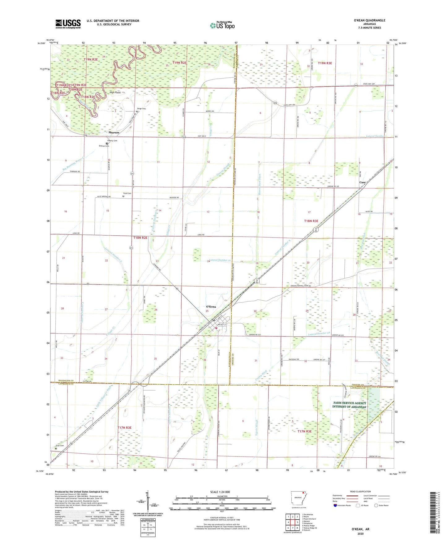
2024 topographic map quadrangle O'Kean in the state of Arkansas. Scale: 1:24000. Based on the newly updated USGS 7.5' US Topo map series, this map is in the following counties: Greene, Randolph, Lawrence. The map contains contour data, water features, and other items you are used to seeing on USGS maps, but also has updated roads and other features. This is the next generation of topographic maps. Printed on high-quality waterproof paper with UV fade-resistant inks.
Quads adjacent to this one:
West: Manson
Northwest: Pocahontas
North: Reyno
Northeast: Peach Orchard
East: Delaplaine
Southeast: Walcott
South: Walnut Ridge SE
Southwest: Walnut Ridge
This map covers the same area as the classic USGS quad with code o36090b7.
Contains the following named places: Alice Brooks Freewill Baptist Church, Beaver Dam Ditch, Big Slough, Case, Conley Ditch, Conley School, Dean School, Denman School, Eveland Chapel, Ford Cemetery, Freyers School, Frye Cemetery, Giles Spur, Grassy Slough, High Point, India Ford, Lateral Number 1, Lateral Number 10, Lateral Number 2, Lateral Number 3, Lateral Number 5A, Lateral Number 7, Lateral Number 8, Lateral Number 9, Liberty Cemetery, Little Village Creek Ditch, O'Kean, O'Kean Post Office, O'Kean School, O'Kean Volunteer Fire Station, Post Oak Ditch, Rickey Chapel, Rocky Ford, Sanders School, Serge Cemetery, Sharum, Sharum Cemetery, Town of O'Kean, Township of O'Kean, ZIP Code: 72449