MyTopo
Alpena Arkansas US Topo Map
Couldn't load pickup availability
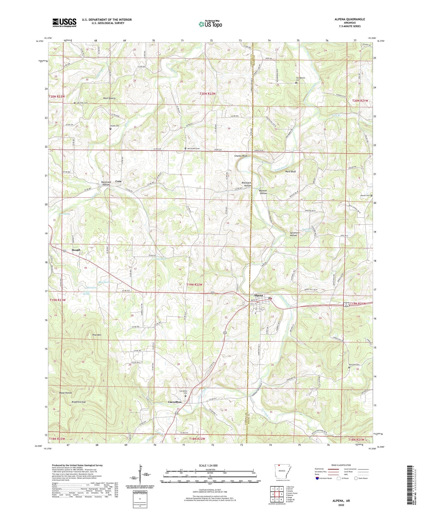
2024 topographic map quadrangle Alpena in the state of Arkansas. Scale: 1:24000. Based on the newly updated USGS 7.5' US Topo map series, this map is in the following counties: Carroll, Boone. The map contains contour data, water features, and other items you are used to seeing on USGS maps, but also has updated roads and other features. This is the next generation of topographic maps. Printed on high-quality waterproof paper with UV fade-resistant inks.
Quads adjacent to this one:
West: Green Forest
Northwest: Blue Eye
North: Denver
Northeast: Omaha
East: Batavia
Southeast: Gaither
South: Osage NE
Southwest: Osage
This map covers the same area as the classic USGS quad with code o36093c3.
Contains the following named places: Alpena, Alpena Elementary School, Alpena High School, Alpena Police Department, Alpena Post Office, Alpena Volunteer Fire Department, Basin Spring, Blackjack Hollow, Blanton Hollow, Blantons Mill, Bobo Creek, Bradfield Gap, Bull Spring, Carrollton, Carrollton Cemetery, Carrollton School, Chaney Bluff, Coin, Duncard Cemetery, Hanbys Mill, Hough, Lick Branch, McCracken Cemetery, Nunnally, Oak Hills Cemetery, Patty Spring, Pine Mountain, Racetrack Hollow, Reves Spring, Riddle Cemetery, Rock Quarry, Roscoe Church, Shaver, South Fork Dry Creek, Sycamore Hollow, Sycamore Spring, Tanyard Spring, Terrapin Creek, Town of Alpena, Township of Carrollton, Township of Coin, Ward Bluff, Youngblood Cemetery