MyTopo
Byron Arkansas US Topo Map
Couldn't load pickup availability
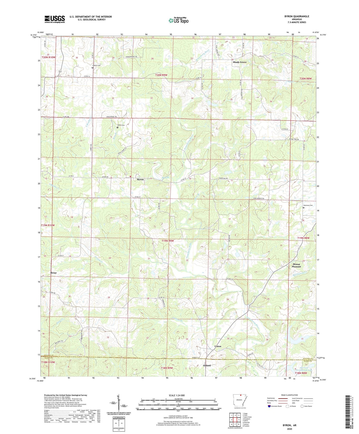
2024 topographic map quadrangle Byron in the state of Arkansas. Scale: 1:24000. Based on the newly updated USGS 7.5' US Topo map series, this map is in the following counties: Fulton, Izard. The map contains contour data, water features, and other items you are used to seeing on USGS maps, but also has updated roads and other features. This is the next generation of topographic maps. Printed on high-quality waterproof paper with UV fade-resistant inks.
Quads adjacent to this one:
West: Elizabeth
Northwest: Gepp
North: Viola
Northeast: Salem Knob
East: Salem
Southeast: Franklin
South: Oxford
Southwest: Pineville
This map covers the same area as the classic USGS quad with code o36091c8.
Contains the following named places: Bexar, Bray Branch, Bulls Eye Lake, Bulls Eye Lake Dam, Byron, Byron Volunteer Fire Department, Cochran Branch, Greasy Creek, Harmony Cemetery, Liberty Cemetery, Markleroad Creek, Mount Pleasant, Rose Branch, Shady Grove, Spiritual Development Lake, Spiritual Development Lake Dam, Talley Cemetery, Township of Union, Union, Wesley Chapel