MyTopo
Wittsburg Arkansas US Topo Map
Couldn't load pickup availability
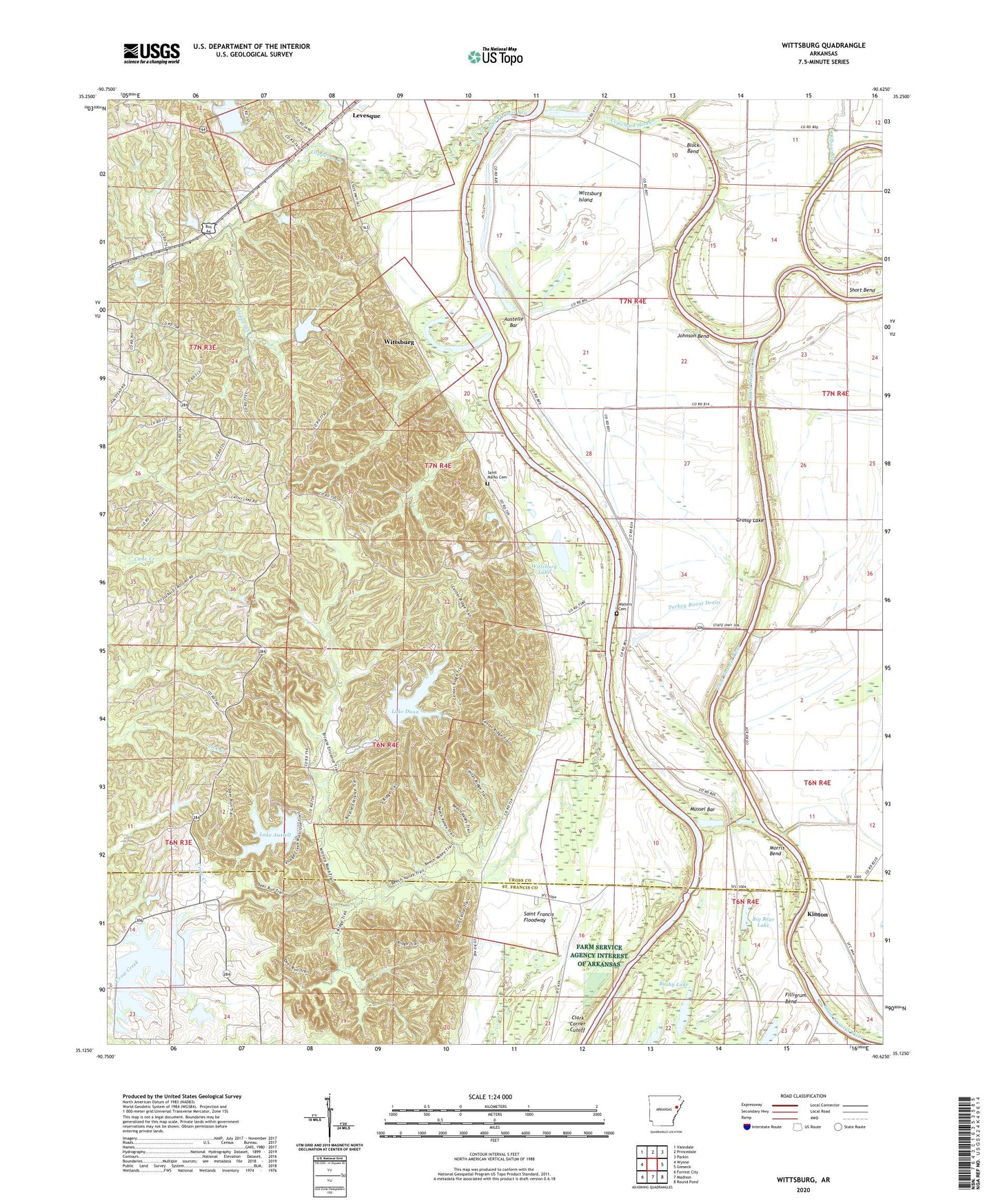
2024 topographic map quadrangle Wittsburg in the state of Arkansas. Scale: 1:24000. Based on the newly updated USGS 7.5' US Topo map series, this map is in the following counties: Cross, St. Francis. The map contains contour data, water features, and other items you are used to seeing on USGS maps, but also has updated roads and other features. This is the next generation of topographic maps. Printed on high-quality waterproof paper with UV fade-resistant inks.
Quads adjacent to this one:
West: Wynne
Northwest: Vanndale
North: Princedale
Northeast: Parkin
East: Gieseck
Southeast: Round Pond
South: Madison
Southwest: Forrest City
This map covers the same area as the classic USGS quad with code o35090b6.
Contains the following named places: Allens Lake, Antioch Church, Antioch School, Austelle Bar, Bay Ferry Church, Big Bear Lake, Block Bend, Budsmith, Bushy Lake, Clark Corner Cutoff, Copeland Slough, Copperas Creek, Dillon School, Elbow Slough, Filligrum Bend, Flag Lake Crossing, Grassy Lake, Harefarm Creek, Harris Chapel Baptist Church, Hidden Valley Lake, Hidden Valley Lake Dam, Hunter Rest Club Lake, Hunter Rest Club Lake Dam, Johnson Bend, Johnson Chapel, Kinton, KWYN-FM (Wynne), Lake Austell, Lake Austell Dam, Lake Dunn, Lake Dunn Dam, Levesque, Levesque Assembly of God Church, Little Bear Lake, Morledge School, Morris Bend, Mussel Bar, New Hope Baptist Church, New Hope School, Rolfe School, Saint Francis Bay, Saint Francis Floodway, Saint James Baptist Church, Saint Marks Cemetery, Saint Marks Church, Short Bend, Township of Smith, Turkey Roost Drain, Valley View Baptist Church, Village Creek, Village Creek State Park, Walters Cemetery, Wittsburg, Wittsburg Ferry, Wittsburg Island, Wittsburg Lake, Yancopin Lake