
MyTopo
Shirley Arkansas US Topo Map
Couldn't load pickup availability
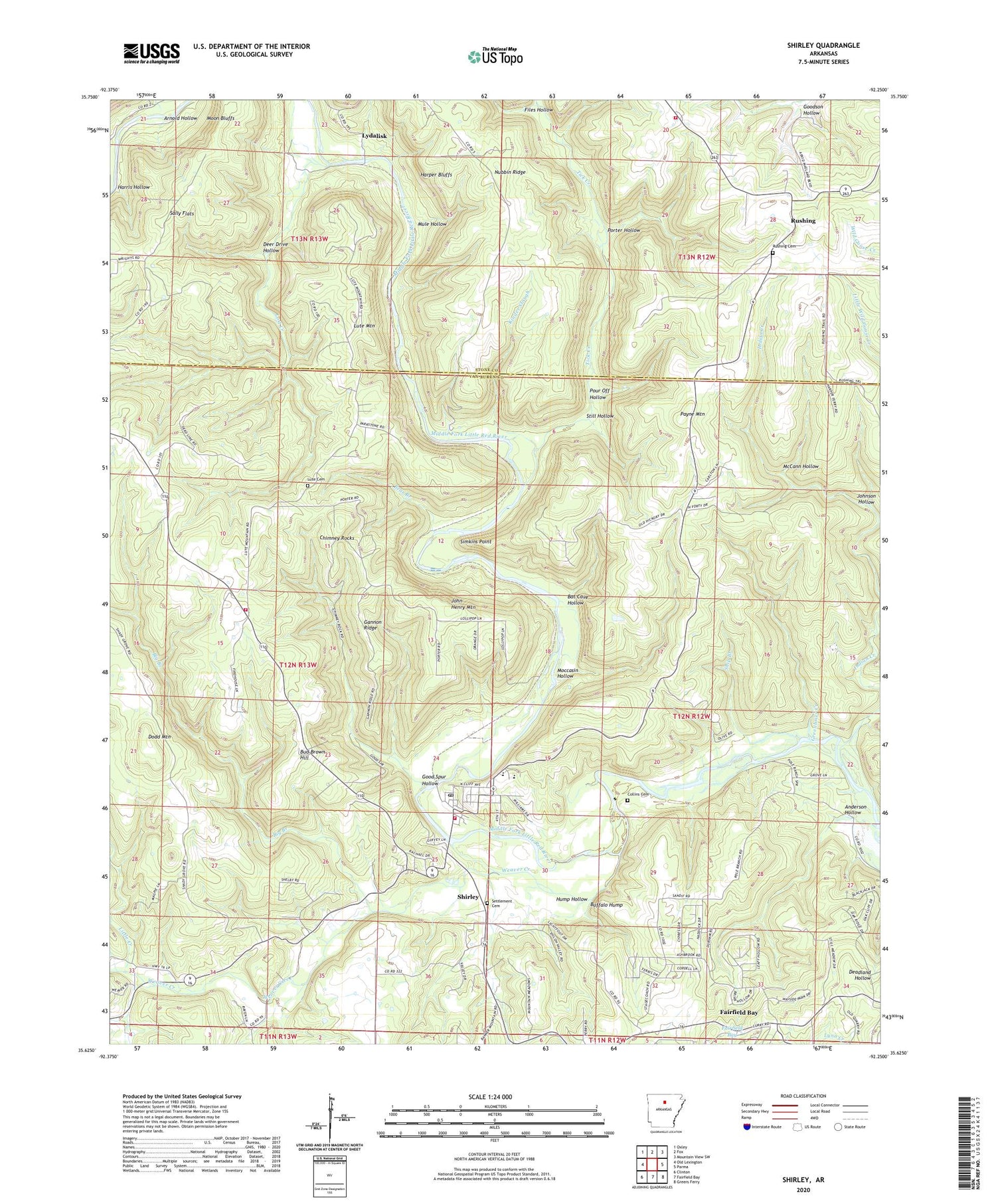
2024 topographic map quadrangle Shirley in the state of Arkansas. Scale: 1:24000. Based on the newly updated USGS 7.5' US Topo map series, this map is in the following counties: Van Buren, Stone. The map contains contour data, water features, and other items you are used to seeing on USGS maps, but also has updated roads and other features. This is the next generation of topographic maps. Printed on high-quality waterproof paper with UV fade-resistant inks.
Quads adjacent to this one:
West: Old Lexington
Northwest: Oxley
North: Fox
Northeast: Mountain View SW
East: Parma
Southeast: Greers Ferry
South: Fairfield Bay
Southwest: Clinton
This map covers the same area as the classic USGS quad with code o35092f3.
Contains the following named places: Anderson Hollow, Antioch Church, Arnold Hollow, Bat Cave Hollow, Bear Branch, Bud Brown Hill, Buffalo Hump, Chimney Rocks, Collins Cemetery, Deer Drive Hollow, Dodd Mountain, Fairfield Bay, Files Hollow, Fox Fire Department Station 1, Full Gospel Tabernacle, Gannon Ridge, Good Spur Hollow, Greenbrier Creek, Harper Bluffs, Harris Hollow, Hump Hollow, Indian Creek, John Henry Mountain, Johnson Hollow, KFFB-FM (Fairfield Bay), Kinder Slough, Little Creek, Lost Creek, Lute Cemetery, Lute Mountain, Lydalisk, McCann Hollow, Moccasin Hollow, Moon Bluffs, Mule Hollow, Nubbin Ridge, Payne Mountain, Pekin, Poe, Porter Hollow, Pour Off Hollow, Rushing, Rushing Cemetery, Sally Flats, Settlement, Settlement Cemetery, Ship Branch, Shirley, Shirley Elementary School, Shirley Fire Department Station 1, Shirley Fire Department Station 2, Shirley High School, Shirley Post Office, Simkins Point, Still Hollow, Tick Creek, Town of Shirley, Township of Union, Weaver Creek, ZIP Code: 72153


