MyTopo
Norfork Dam North Arkansas US Topo Map
Couldn't load pickup availability
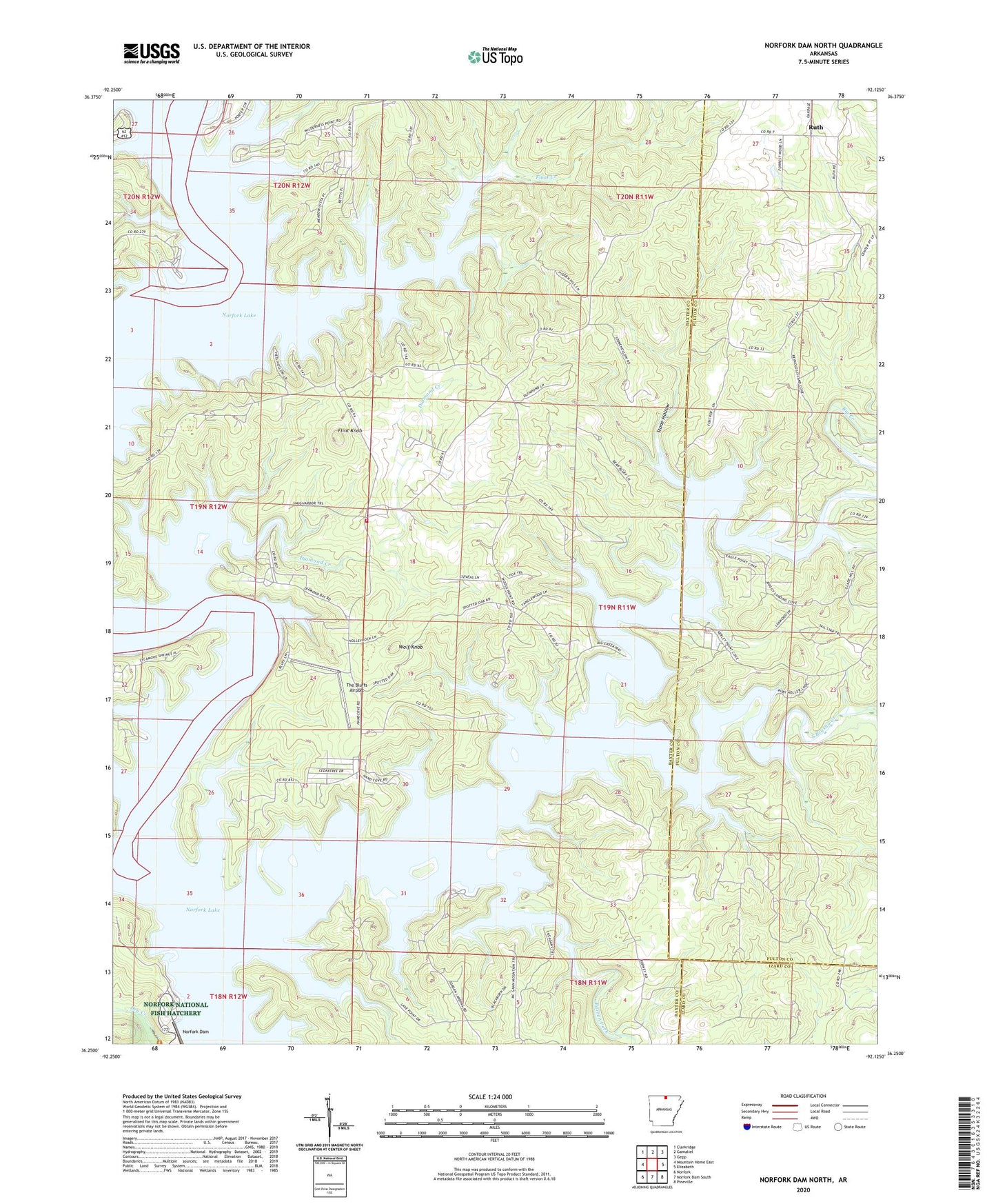
2024 topographic map quadrangle Norfork Dam North in the state of Arkansas. Scale: 1:24000. Based on the newly updated USGS 7.5' US Topo map series, this map is in the following counties: Baxter, Fulton, Izard. The map contains contour data, water features, and other items you are used to seeing on USGS maps, but also has updated roads and other features. This is the next generation of topographic maps. Printed on high-quality waterproof paper with UV fade-resistant inks.
Quads adjacent to this one:
West: Mountain Home East
Northwest: Clarkridge
North: Gamaliel
Northeast: Gepp
East: Elizabeth
Southeast: Pineville
South: Norfork Dam South
Southwest: Norfork
This map covers the same area as the classic USGS quad with code o36092c2.
Contains the following named places: Barren Fork, Big Creek, Center Point Church, Conley Ford, Covey, Diamond Bay, Diamond Creek, Flint Knob, Float Creek, Georges Cove Public Use Area, Hand, Hand Cove Volunteer Fire Department, Hand Landing, Hand School, Hand Use Area, Henderson Use Area, Holiday Hills, Jordan Landing, Jordan Use Area, Newton Landing, Norfork National Fish Hatchery, Quarry Landing, Quarry Use Area, Robinson Point Landing, Robinson Point Use Area, Ruth, Salem Landing, South Brushy Creek, Spencer, Stone Hollow, Sycamore Spring, The Bluffs Airport, Timber Lake Manor, Township of Union, United States Fish and Wildlife Norfolk National Fish Hatchery Park Security, Wake, Wates Church, Wolf Knob, Wood Point Use Area, Woods Point Landing, ZIP Code: 72531