MyTopo
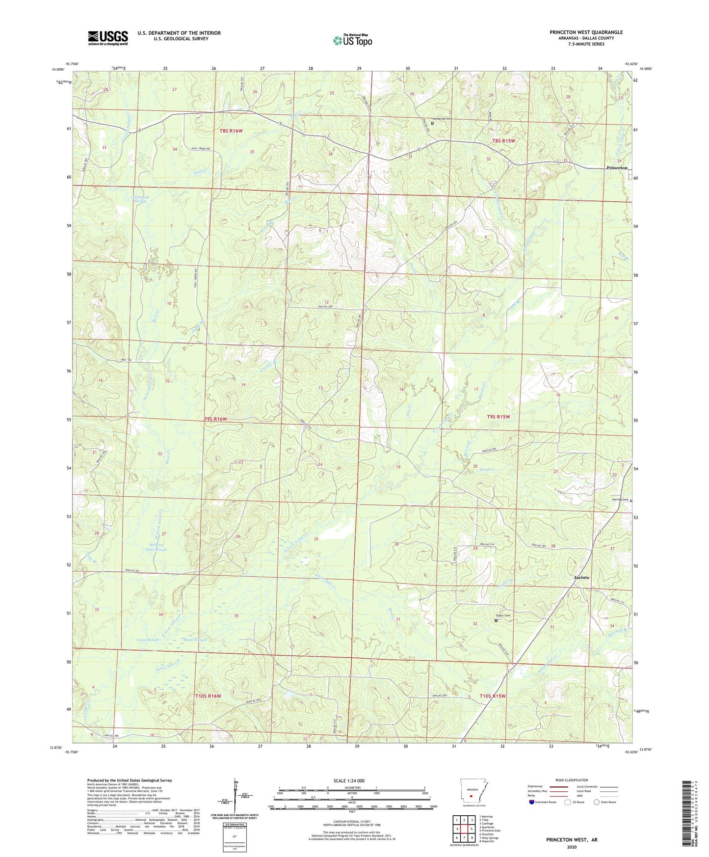
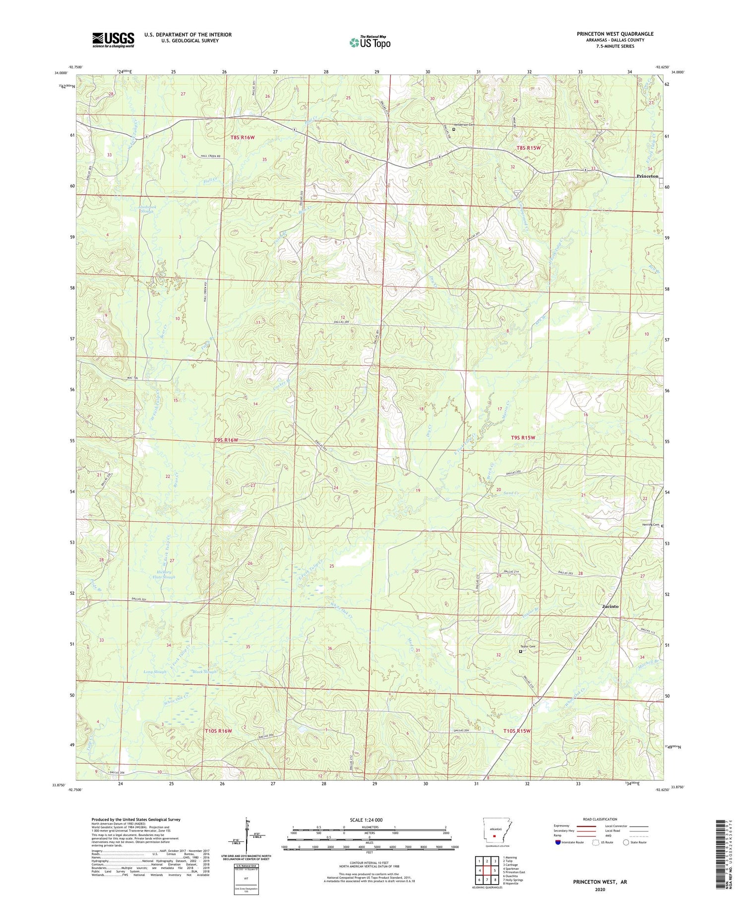
Princeton West Arkansas US Topo Map
Couldn't load pickup availability
2024 topographic map quadrangle Princeton West in the state of Arkansas. Scale: 1:24000. Based on the newly updated USGS 7.5' US Topo map series, this map is in the following counties: Dallas. The map contains contour data, water features, and other items you are used to seeing on USGS maps, but also has updated roads and other features. This is the next generation of topographic maps. Printed on high-quality waterproof paper with UV fade-resistant inks.
Quads adjacent to this one:
West: Sparkman
Northwest: Manning
North: Tulip
Northeast: Carthage
East: Princeton East
Southeast: Hopeville
South: Holly Springs
Southwest: Ouachita
This map covers the same area as the classic USGS quad with code o33092h6.
Contains the following named places: Alsobrook Slough, Bear Creek, Beech Creek, Ben Few Campground, Black Slough, Campground Creek, Cooker Branch, Cruse, Dallas County, Dry Creek, East Fork Tulip Creek, Futch Branch, Hall Creek, Henderson Cemetery, Herring Cemetery, Hickory Flats Slough, Jacinto, Long Slough, Macedonia Church, Martin Creek, Mitchell Branch, Mount Olivet Church, Mount Zion Church, Mud Creek, Nix, Oakhurst, Pride Branch, Red Branch, Sand Creek, Taylor Branch, Taylor Cemetery, Township of Princeton, West Fork Tulip Creek, White Oak Creek