MyTopo
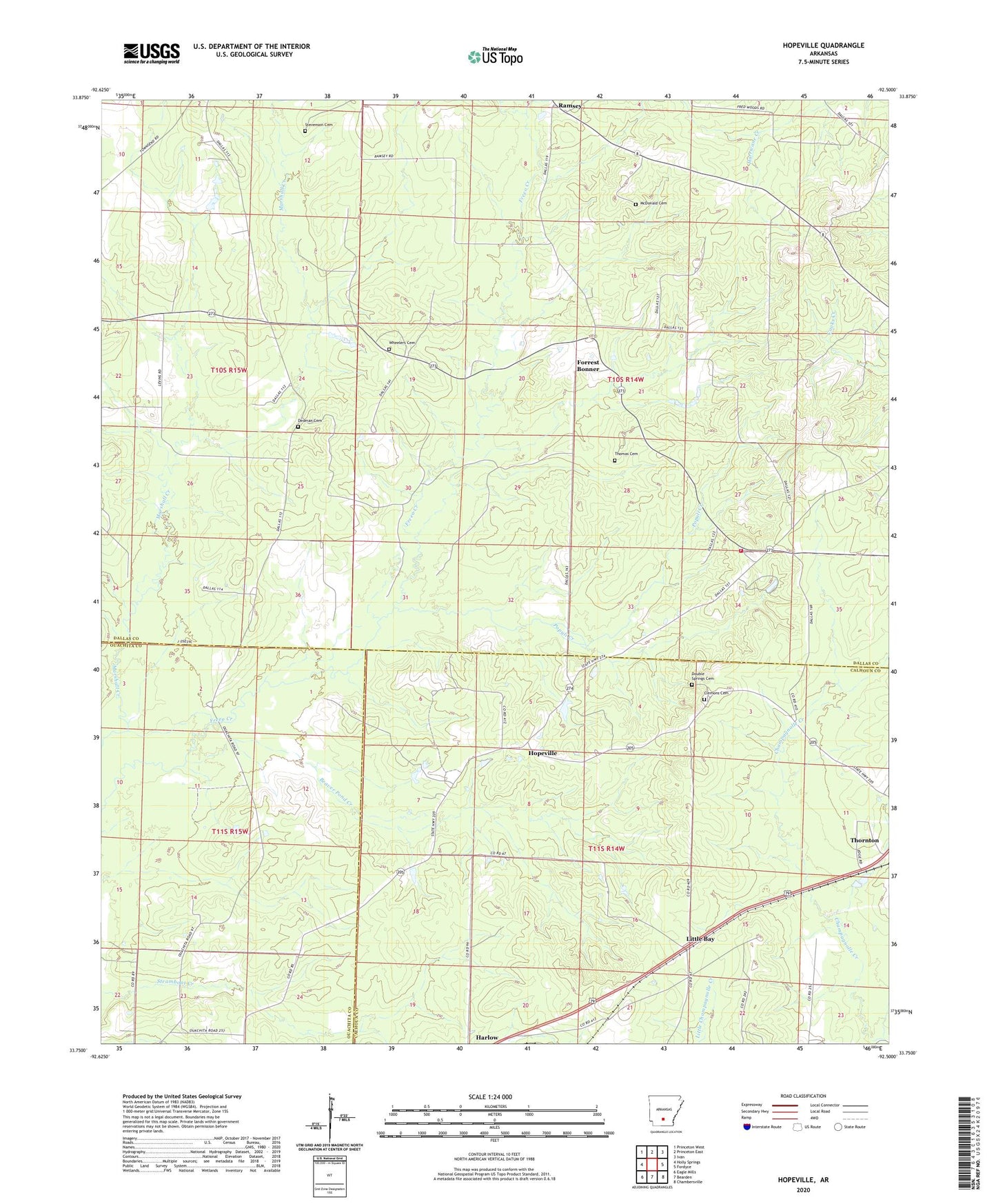
Hopeville Arkansas US Topo Map
Couldn't load pickup availability
2024 topographic map quadrangle Hopeville in the state of Arkansas. Scale: 1:24000. Based on the newly updated USGS 7.5' US Topo map series, this map is in the following counties: Dallas, Calhoun, Ouachita. The map contains contour data, water features, and other items you are used to seeing on USGS maps, but also has updated roads and other features. This is the next generation of topographic maps. Printed on high-quality waterproof paper with UV fade-resistant inks.
Quads adjacent to this one:
West: Holly Springs
Northwest: Princeton West
North: Princeton East
Northeast: Ivan
East: Fordyce
Southeast: Chambersville
South: Bearden
Southwest: Eagle Mills
This map covers the same area as the classic USGS quad with code o33092g5.
Contains the following named places: Beaver Pond Creek, Bethel Church, Clemons Cemetery, Dedman Cemetery, Double Springs Cemetery, Eaglette Church, Forrest Bonner, Hopeville, Hopeville Church, Little Bay, McDonald Cemetery, Mount Gillard Baptist Church, Mount Olive Church, New Bethel Church, Oak Grove Church, Populi Creek, Ramsey, Stevenson Cemetery, Temperance Hill Church, Temperance Hill Volunteer Fire Department, Thomas Cemetery, Township 1, Township of Caswell, Township of Jackson, Township of Union, Wheelers Cemetery