MyTopo
Holly Springs Arkansas US Topo Map
Couldn't load pickup availability
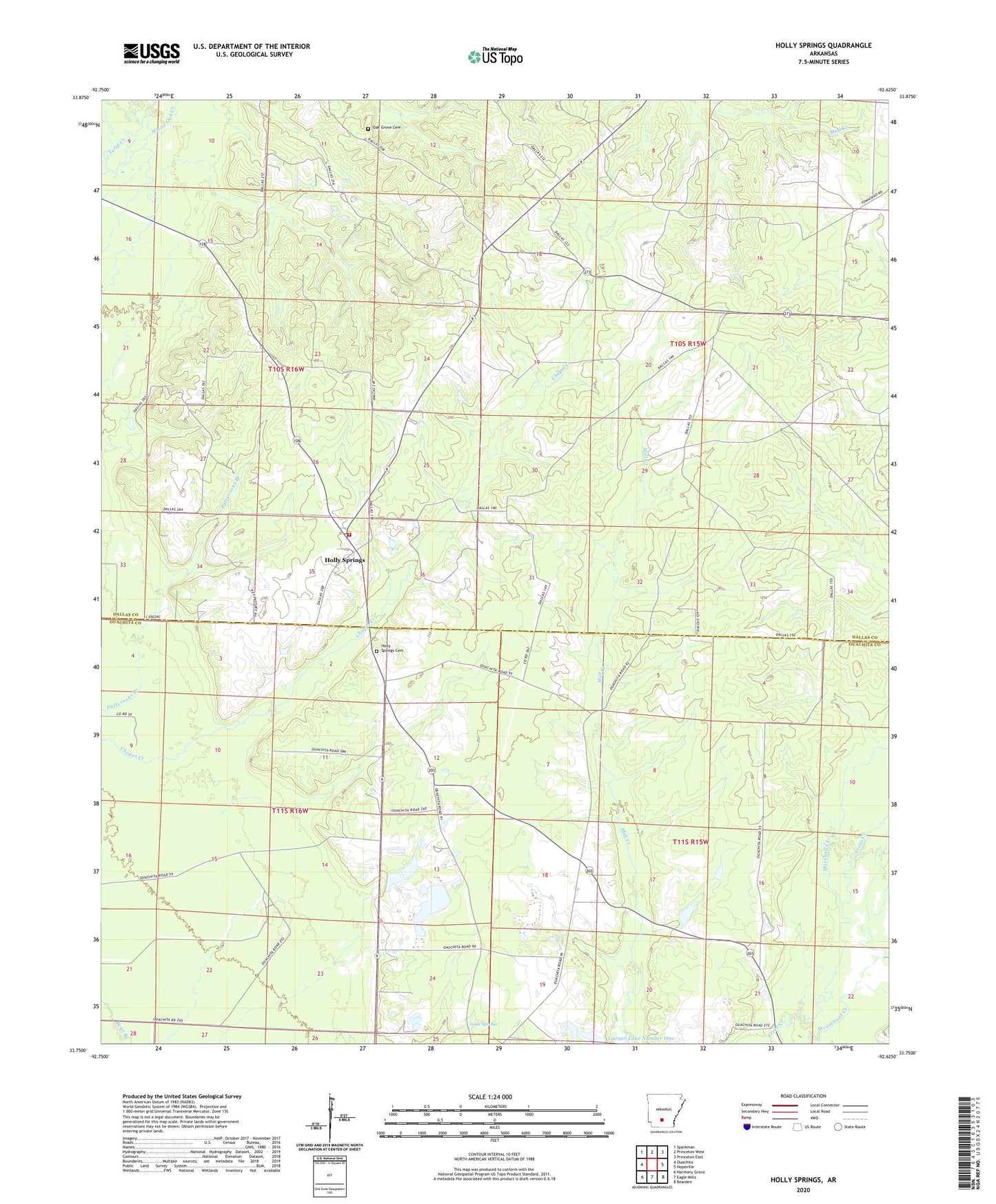
2024 topographic map quadrangle Holly Springs in the state of Arkansas. Scale: 1:24000. Based on the newly updated USGS 7.5' US Topo map series, this map is in the following counties: Ouachita, Dallas. The map contains contour data, water features, and other items you are used to seeing on USGS maps, but also has updated roads and other features. This is the next generation of topographic maps. Printed on high-quality waterproof paper with UV fade-resistant inks.
Quads adjacent to this one:
West: Ouachita
Northwest: Sparkman
North: Princeton West
Northeast: Princeton East
East: Hopeville
Southeast: Bearden
South: Eagle Mills
Southwest: Harmony Grove
This map covers the same area as the classic USGS quad with code o33092g6.
Contains the following named places: Garner Lake Number One, Garner Lake Number One Dam, Holly Grove Church, Holly Spring Lookout Tower, Holly Springs, Holly Springs Cemetery, Holly Springs Fire Station, Marshall Creek, Oak Grove Cemetery, Scale Springs, Township of Freeo, Township of Holly Springs, White Oak Church, White Spring Church, ZIP Code: 71720