MyTopo
Rosa Arkansas US Topo Map
Couldn't load pickup availability
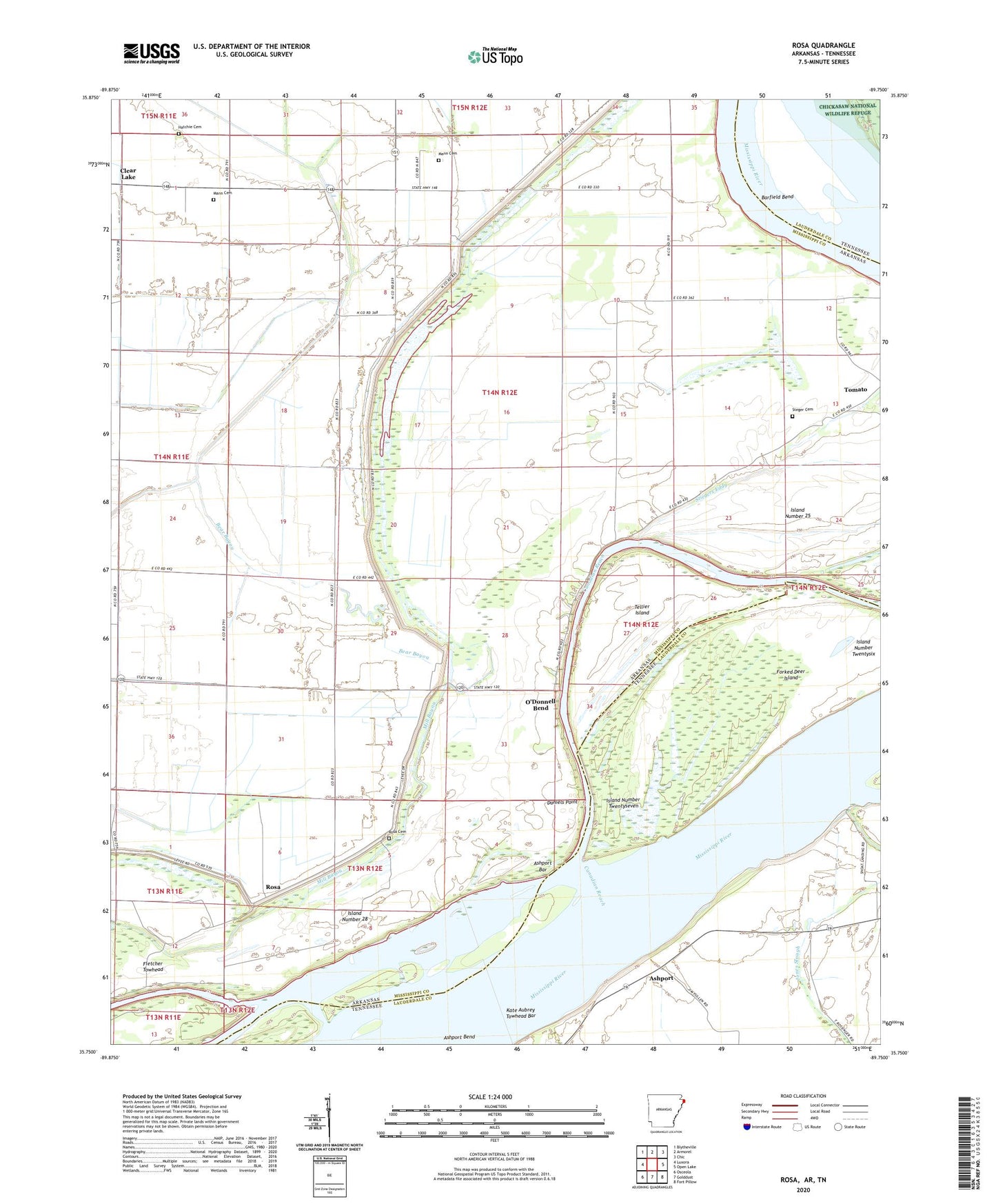
2024 topographic map quadrangle Rosa in the states of Arkansas, Tennessee. Scale: 1:24000. Based on the newly updated USGS 7.5' US Topo map series, this map is in the following counties: Mississippi, Lauderdale. The map contains contour data, water features, and other items you are used to seeing on USGS maps, but also has updated roads and other features. This is the next generation of topographic maps. Printed on high-quality waterproof paper with UV fade-resistant inks.
Quads adjacent to this one:
West: Luxora
Northwest: Blytheville
North: Armorel
Northeast: Chic
East: Open Lake
Southeast: Fort Pillow
South: Golddust
Southwest: Osceola
Contains the following named places: Ashport, Ashport Bar, Ashport Bend, Ashport Church, Ashport Ferry, Ashport Landing, Ashport Revetment, Ashport School, Bear Bayou, Canadian Reach, Church of Christ, Clear Lake, Clear Lake Baptist Church, Clear Lake Farm, Clear Lake School, Daniels Point, Daniels Point Landing, Daniels Point Revetment, Ditch Number 13, Ditch Number 32, Ditch Number 33, Double Bridges, Fisher Landing, Forked Deer Island, Hatchie Cemetery, Island Number 28, Island Number Twentyseven, Island Number Twentysix, Island Number Twentysix Revetment, Johnson Landing, Kate Aubrey Towhead Bar, Long Lake, Lower Forked Deer Landing, Lower Forked Deer River, Mann Cemetery, O'Donald Bend School, O'Donnell Bend, Pentecostal Church, Pilgrim Rest Church, Princess Chapel, Rosa, Rosa Baptist Church, Rosa Cemetery, Rosa Church, Sadie Lee Landing, Saint John Church, Saint Luke Church, Sanctified Church, Steger Cemetery, Stiegers Eddy, Tellier Island, Tow Head Island, Township of Swayne, West Bayou, Woods Lake