MyTopo
Fort Pillow Tennessee US Topo Map
Couldn't load pickup availability
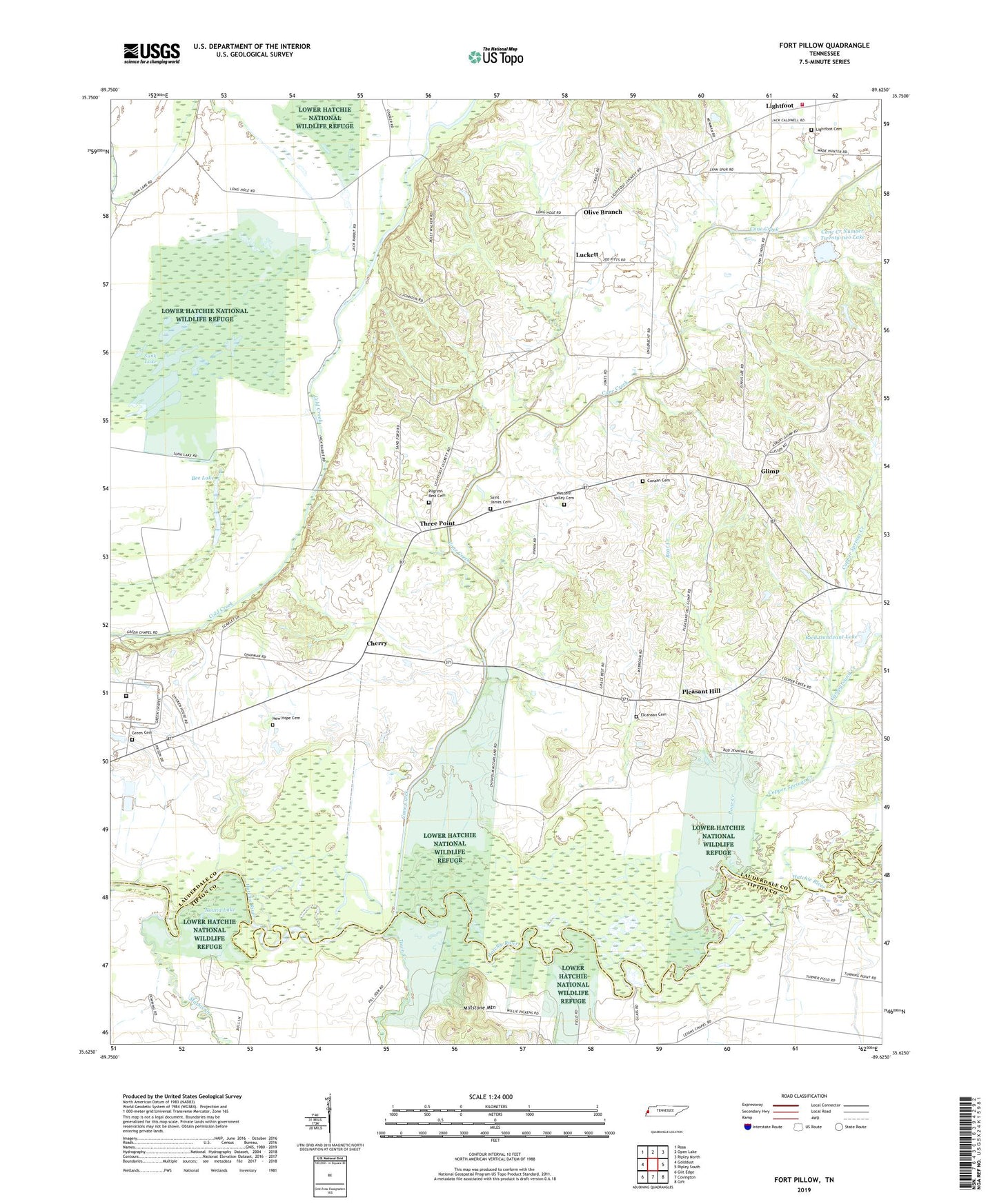
2022 topographic map quadrangle Fort Pillow in the state of Tennessee. Scale: 1:24000. Based on the newly updated USGS 7.5' US Topo map series, this map is in the following counties: Lauderdale, Tipton. The map contains contour data, water features, and other items you are used to seeing on USGS maps, but also has updated roads and other features. This is the next generation of topographic maps. Printed on high-quality waterproof paper with UV fade-resistant inks.
Quads adjacent to this one:
West: Golddust
Northwest: Rosa
North: Open Lake
Northeast: Ripley North
East: Ripley South
Southeast: Gift
South: Covington
Southwest: Gilt Edge
This map covers the same area as the classic USGS quad with code o35089f6.
Contains the following named places: Ashport-Three Point Division, Bee Lake, Bethel Church, Boar Creek, Campground Creek, Canaan Cemetery, Canaan Church, Cane Creek, Cane Creek Number Twenty-two Dam, Cane Creek Number Twenty-two Lake, Cherry, Cherry School, Copper Springs Creek, El Canaan Church, El Canaan Missionary Baptist Church Cemetery, Elcannan School, Fort Pillow, Fort Pillow State Farm, Glimp, Green Cemetery, Green Chapel, Johnson Luckett School, Lighfoot Church, Lightfoot, Lightfoot Cemetery, Lightfoot School, Luckett, Luckett Church, Luckett School, Lynn School, Mack, Mathis Creek, Millstone Mountain, New Hope Cemetery, New Hope Church, Olive Branch, Olive Branch Church, Pilgrims Rest Cemetery, Pilgrims Rest Church, Pleasant Hill, Ried Dunavant Dam, Ried Dunavant Lake, Rosenwald School, Round Lake, Saint James Church, Saint James Church Cemetery, Sunk Lake, Three Point, Town Creek, West Lauderdale County Fire Department, West Tennessee State Penitentiary, Western Valley Cemetery, ZIP Code: 38041