MyTopo
Open Lake Tennessee US Topo Map
Couldn't load pickup availability
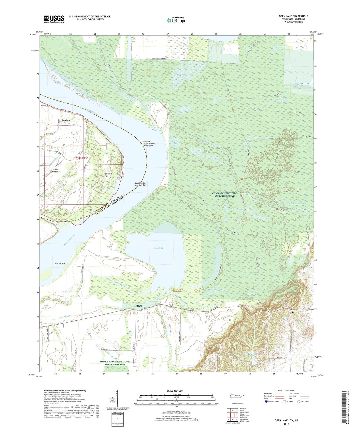
2022 topographic map quadrangle Open Lake in the states of Tennessee, Arkansas. Scale: 1:24000. Based on the newly updated USGS 7.5' US Topo map series, this map is in the following counties: Lauderdale, Mississippi. The map contains contour data, water features, and other items you are used to seeing on USGS maps, but also has updated roads and other features. This is the next generation of topographic maps. Printed on high-quality waterproof paper with UV fade-resistant inks.
Quads adjacent to this one:
West: Rosa
Northwest: Armorel
North: Chic
Northeast: Knob Creek
East: Ripley North
Southeast: Ripley South
South: Fort Pillow
Southwest: Golddust
This map covers the same area as the classic USGS quad with code o35089g6.
Contains the following named places: Anderson-Tully State Wildlife Management Area, Ashport Cemetery, Ashport Church, Barfield Point, Bend of Island Number Twentyfive, Bend of Island Number Twentyfive Revetment, Camp Slough, Cane Creek Number Three Dam, Cane Creek Number Three Lake, Cane Ridge Church, Cane Ridge School, Carr Landing, Chickasaw National Wildlife Refuge, Coker Slough, Commissioner District 6, Cypress Hole Church, Dry Arm, Forked Deer Dikes, Goose Pond, Goses Landing, Grassy Lake, Island 25 Dikes, Island Number 25, Island Number Twentysix Bar, Lassiter Bar, Lauderdale County, Litler Landing, Lost Lake, Middle Fork Forked Deer River, Obion-Tamm Revetment, Open Lake, Right Hand Arm, Rush Slough, Swan Lake, The Reach, Tomato, Tomato Landing, Wardlows Pocket, Wardlows Pocket Landing, ZIP Code: 38063