MyTopo
Old Lexington Arkansas US Topo Map
Couldn't load pickup availability
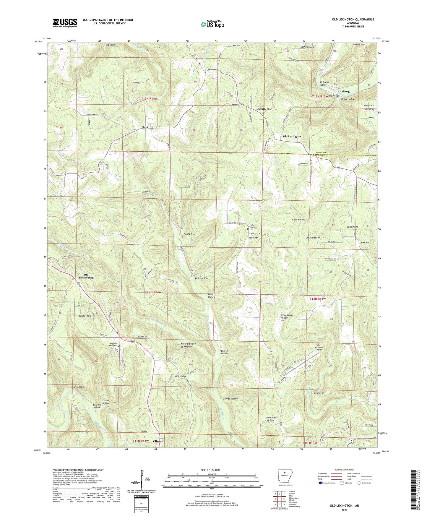
2024 topographic map quadrangle Old Lexington in the state of Arkansas. Scale: 1:24000. Based on the newly updated USGS 7.5' US Topo map series, this map is in the following counties: Van Buren, Stone. The map contains contour data, water features, and other items you are used to seeing on USGS maps, but also has updated roads and other features. This is the next generation of topographic maps. Printed on high-quality waterproof paper with UV fade-resistant inks.
Quads adjacent to this one:
West: Botkinburg
Northwest: Leslie
North: Oxley
Northeast: Fox
East: Shirley
Southeast: Fairfield Bay
South: Clinton
Southwest: Scotland
This map covers the same area as the classic USGS quad with code o35092f4.
Contains the following named places: Ab Smith Hollow, Arlberg, Bane Hollow, Beavers Hollow, Big Branch, Botkinburg Volunteer Fire Department, Cedar Hill, Charles Hollow, Church Hollow, Clark Hollow, Clinton Mountain, Coley Knob, Collins Hollow, Corinth Church, Elliott Hollow, Garretts Roost Airport, George Hollow, Highway 110 Volunteer Fire Department, Holley Mountain Airpark, Holly Mountain, Holly Mountain Cemetery, Lexington Mountain, Lick Hollow, Little Johnnies Creek, Miller Hollow, Mountain View Cemetery, Mountain View Church, Natural Bridge of Arkansas, Old Botkinburg, Old Lexington, Plant, Plant Baptist Church, Round Mountain, Schoolhouse Hollow, Shady Grove Church, Township of Holley, Township of Holly Mountain, Township of Linn Creek, Township of Red River, White Hollow