MyTopo
Slovak Arkansas US Topo Map
Couldn't load pickup availability
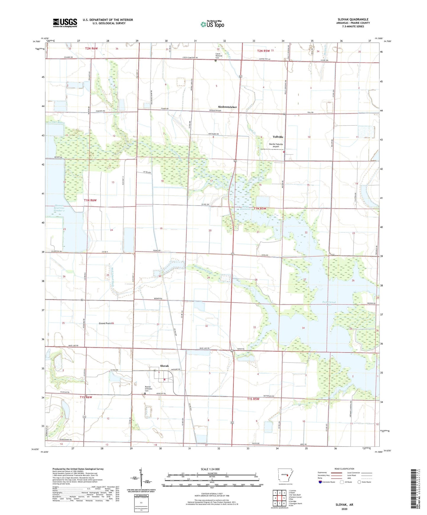
2024 topographic map quadrangle Slovak in the state of Arkansas. Scale: 1:24000. Based on the newly updated USGS 7.5' US Topo map series, this map is in the following counties: Prairie. The map contains contour data, water features, and other items you are used to seeing on USGS maps, but also has updated roads and other features. This is the next generation of topographic maps. Printed on high-quality waterproof paper with UV fade-resistant inks.
Quads adjacent to this one:
West: Parkers Corner
Northwest: Carlisle
North: Hazen
Northeast: De Valls Bluff
East: Roe
Southeast: Ulm
South: Stuttgart North
Southwest: Geridge
This map covers the same area as the classic USGS quad with code o34091f5.
Contains the following named places: Balle, Czech National Cemetery, Fisher School, Hartz Reservoir, Hartz Reservoir Dam, Kreger School, La Grue, Nahay, Oak Creek, Peckerwood Lake, Russian Orthodox Cemetery, Saint Peters Church, Siedenstricker, Skarda/Tollville Airport, Skorda School, Slovak, Slovak Volunteer Fire Department, Slovaktown, Spear, Thomas Reservoir Number 2, Tollville, Tollville Volunteer Fire Department, Township of Tyler, Veits, Wolf Island Slash