MyTopo
Parkers Corner Arkansas US Topo Map
Couldn't load pickup availability
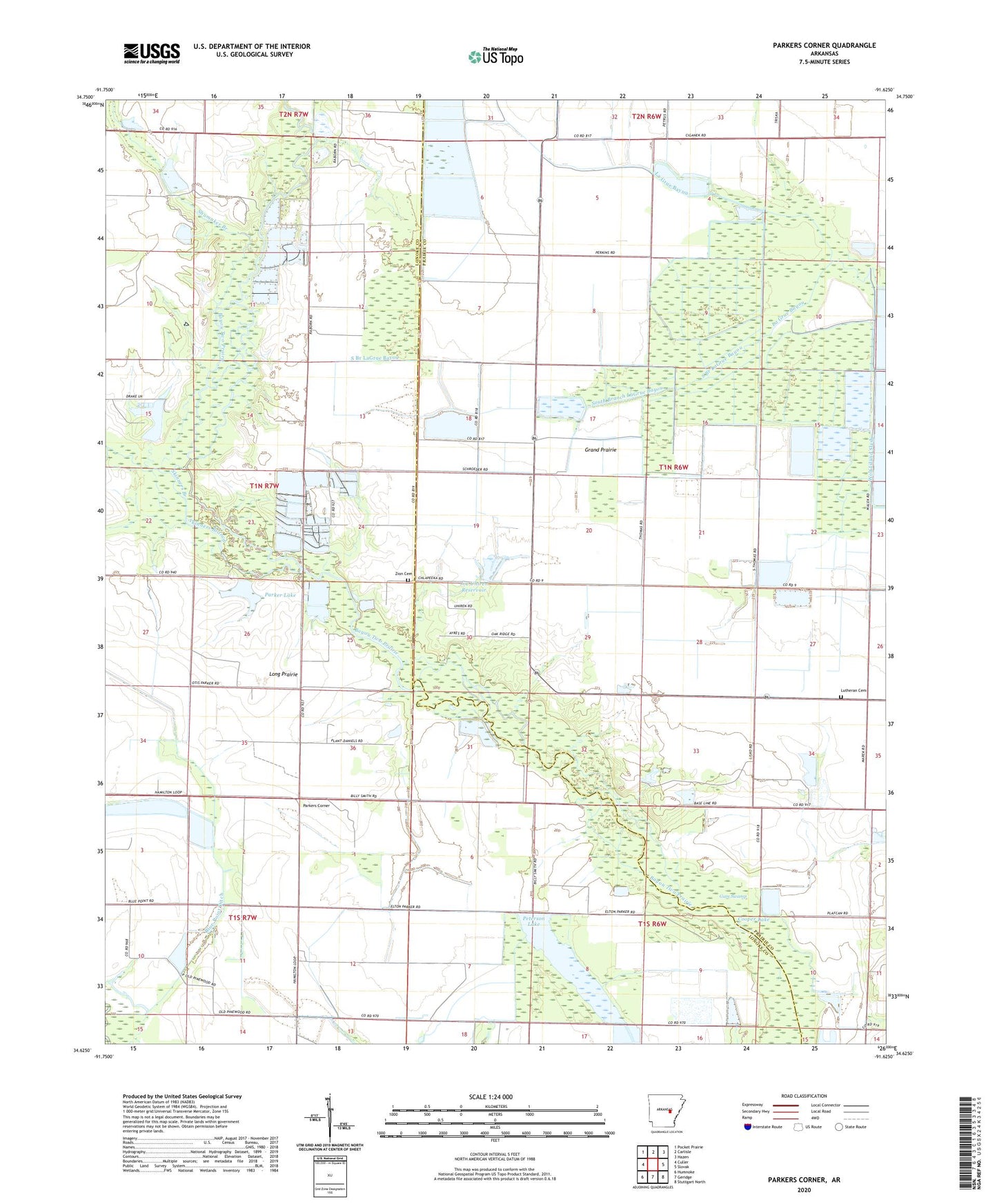
2024 topographic map quadrangle Parkers Corner in the state of Arkansas. Scale: 1:24000. Based on the newly updated USGS 7.5' US Topo map series, this map is in the following counties: Lonoke, Prairie. The map contains contour data, water features, and other items you are used to seeing on USGS maps, but also has updated roads and other features. This is the next generation of topographic maps. Printed on high-quality waterproof paper with UV fade-resistant inks.
Quads adjacent to this one:
West: Culler
Northwest: Pocket Prairie
North: Carlisle
Northeast: Hazen
East: Slovak
Southeast: Stuttgart North
South: Geridge
Southwest: Humnoke
This map covers the same area as the classic USGS quad with code o34091f6.
Contains the following named places: Blue Point Ditch, Cook School, Cooper Lake, Dyers Ridge School, Gately Bridge, Grand Prairie, Jarvis Lake, Joe Uhiren Reservoir, Joe Uhiren Reservoir Dam, Lutheran Cemetery, Parker Lake, Parker Lake Dam, Parkers Corner, Peterson Lake, Peterson Lake Dam, Piney Woods School, Pleasant Grove School, Shumaker Branch, Skinners Branch, Smoke Hole Natural Area, South Branch LaGrue Bayou, Township of Hamilton, Tyler Lake, Wylie School, Zion Cemetery, Zion Church, Zion School