MyTopo
Stuttgart North Arkansas US Topo Map
Couldn't load pickup availability
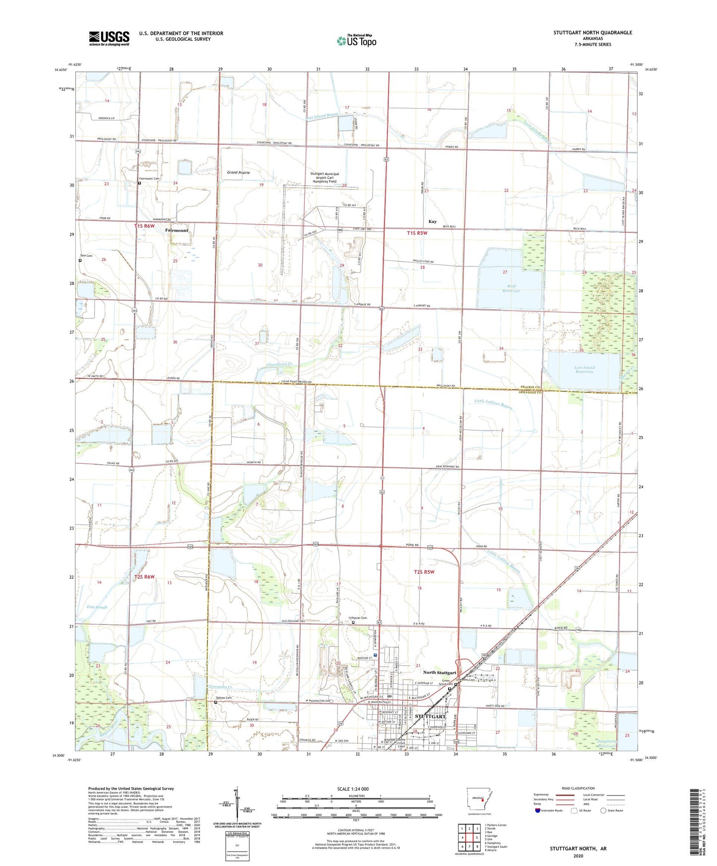
2024 topographic map quadrangle Stuttgart North in the state of Arkansas. Scale: 1:24000. Based on the newly updated USGS 7.5' US Topo map series, this map is in the following counties: Prairie, Arkansas. The map contains contour data, water features, and other items you are used to seeing on USGS maps, but also has updated roads and other features. This is the next generation of topographic maps. Printed on high-quality waterproof paper with UV fade-resistant inks.
Quads adjacent to this one:
West: Geridge
Northwest: Parkers Corner
North: Slovak
Northeast: Roe
East: Ulm
Southeast: Almyra
South: Stuttgart South
Southwest: Humphrey
This map covers the same area as the classic USGS quad with code o34091e5.
Contains the following named places: Allen Temple Baptist Church, Baptist Health Medical Center Stuttgart, Beecher, Benton Temple of God, Big Island, Bryant Park, Bull-Galloway Reservoir, Central Christian Church, Clearpoint School, Dockery Airfield, Eastside School, Emanuel Lutheran Church, Fairmount, Fairmount Cemetery, Fairmount Station, First Assembly of God Church, First Baptist Church, Fish Slough, Grand Prairie Christian Academy, Green Grove Cemetery, Gum Pond, Hargrove Airport, Holman High School, Holy Benton Church of God in Christ, Independence School, Kay, Kingdom Hall of Jehovahs Witnesses, Lost Island, Lost Island Reservoir, Love Rest Cemetery, Lutheran Cemetery, Mount Zion Church of God, New Hope Missionary Baptist Church, North Baptist Church, North Stuttgart, Northside Elementary School, Ona, Parham, Pontiac School, Stuttgart, Stuttgart Army Air Field, Stuttgart Memorial Hospital Heliport, Stuttgart Municipal Airport Carl Humphrey Field, Stuttgart Post Office, Super, Talman Cemetery, Tate Cemetery, Township of Gum Pond, Travellers Rest Missionary Baptist Church