MyTopo
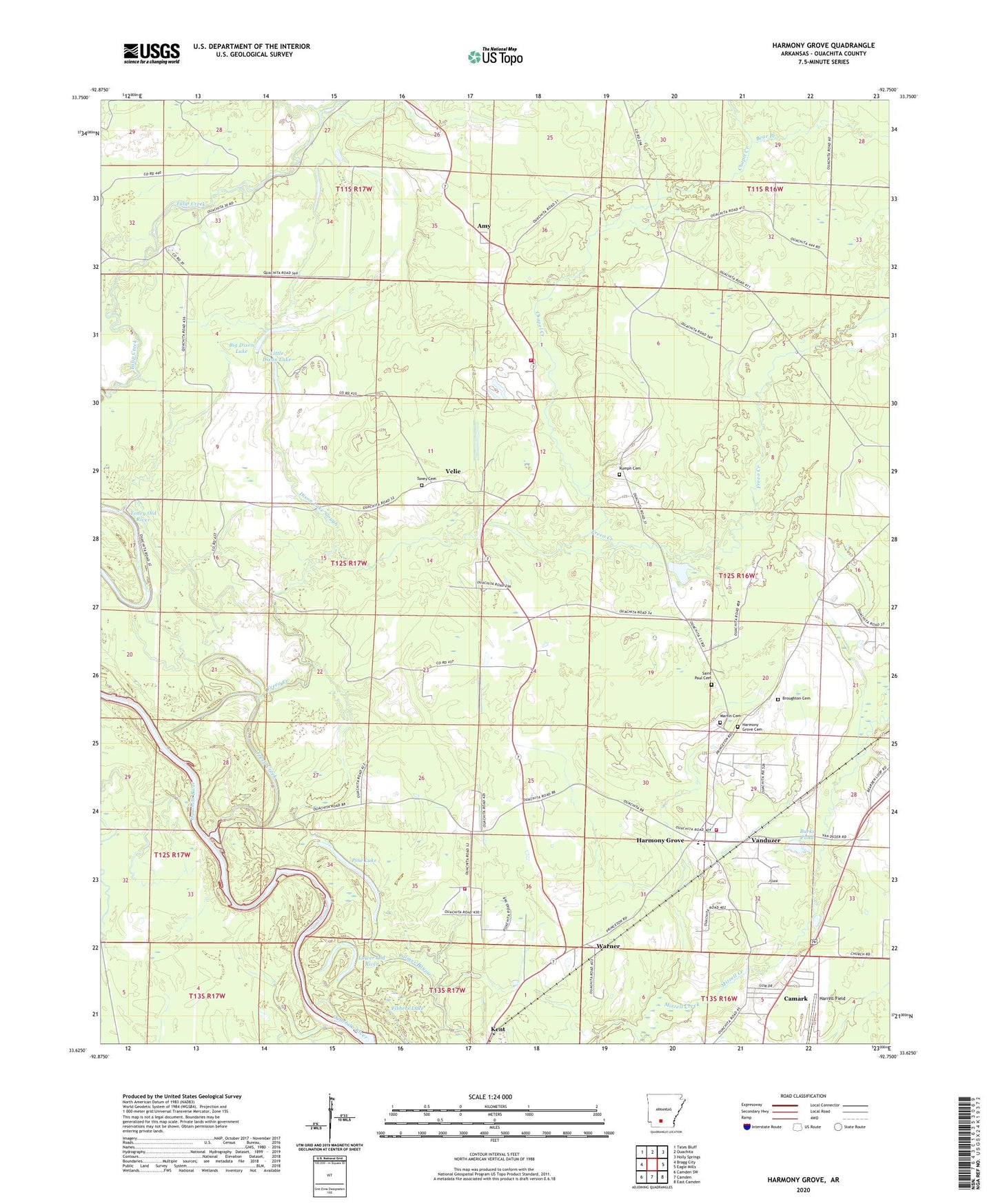
Harmony Grove Arkansas US Topo Map
Couldn't load pickup availability
2024 topographic map quadrangle Harmony Grove in the state of Arkansas. Scale: 1:24000. Based on the newly updated USGS 7.5' US Topo map series, this map is in the following counties: Ouachita. The map contains contour data, water features, and other items you are used to seeing on USGS maps, but also has updated roads and other features. This is the next generation of topographic maps. Printed on high-quality waterproof paper with UV fade-resistant inks.
Quads adjacent to this one:
West: Bragg City
Northwest: Tates Bluff
North: Ouachita
Northeast: Holly Springs
East: Eagle Mills
Southeast: East Camden
South: Camden
Southwest: Camden SW
This map covers the same area as the classic USGS quad with code o33092f7.
Contains the following named places: Amy, Bear Branch, Bethel Temple, Big Dixon Lake, Broughton Cemetery, Burks Pond, Camark, Chapel Creek, Dixon Lake Slough, Faith Church, Fishers Lake, Freeo Creek, Harmony Grove, Harmony Grove Cemetery, Harmony Grove Elementary School, Harmony Grove High School, Kemp, Kent, Little Dixon Lake, Lower Old River, Martin Cemetery, Ouachita County Volunteer Fire Department Fire District 1 Amy Station 5, Ouachita County Volunteer Fire Department Fire District 1 Harmony Grove Station 1, Ouachita County Volunteer Fire Department Fire District 1 Pine Lake Station 3, Pine Lake, Rumph Cemetery, Saint Mary Church, Saint Paul Cemetery, Saint Paul Church, Shady Grove Baptist Church, Toney Cemetery, Toney Old River, Township of Carroll, Township of Valley, Union Grove Community Center, Vanduzer, Velie, Velie Church of God in Christ, Warner