MyTopo
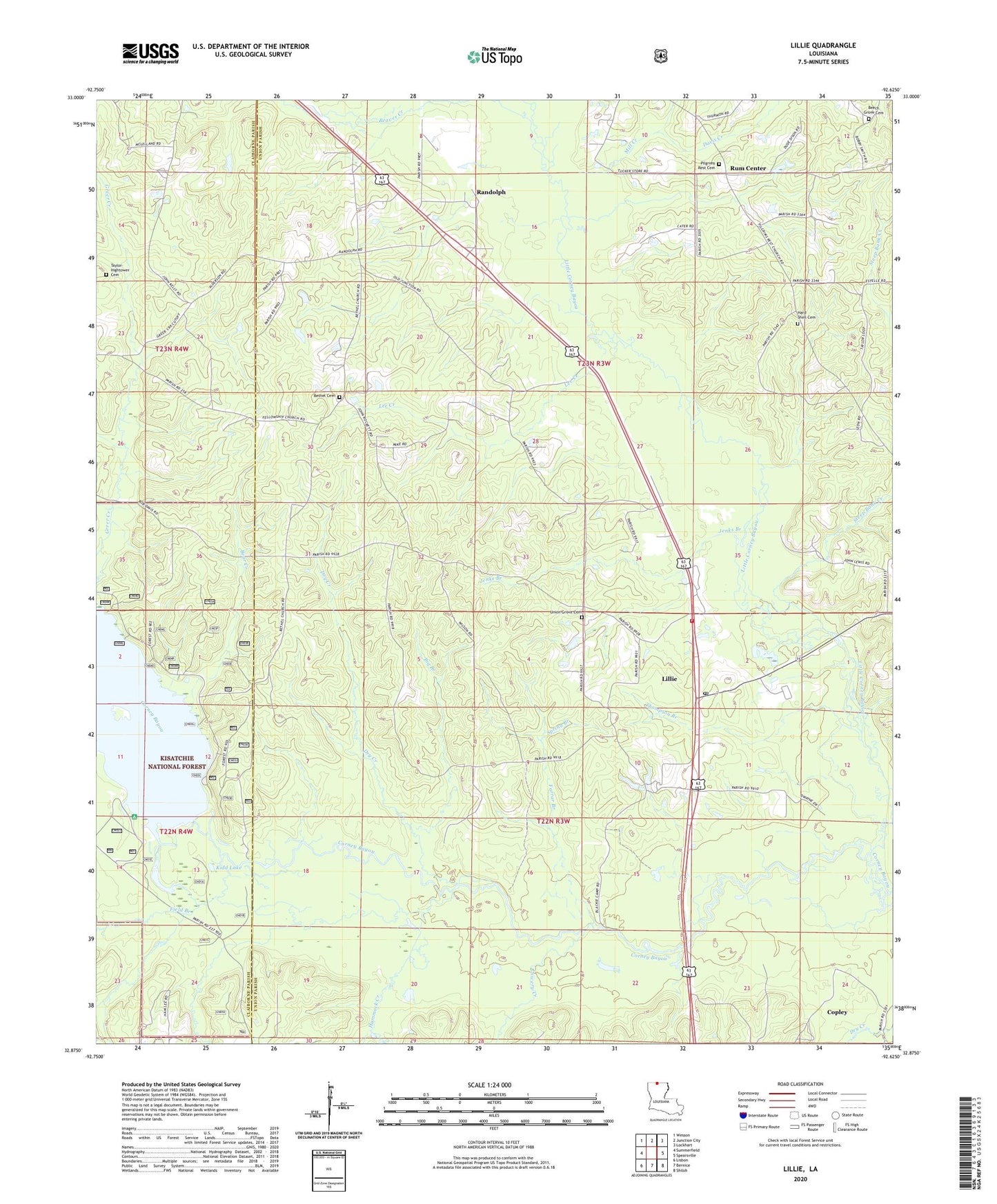
Lillie Louisiana US Topo Map
Couldn't load pickup availability
Also explore the Lillie Forest Service Topo of this same quad for updated USFS data
2024 topographic map quadrangle Lillie in the state of Louisiana. Scale: 1:24000. Based on the newly updated USGS 7.5' US Topo map series, this map is in the following counties: Union, Claiborne. The map contains contour data, water features, and other items you are used to seeing on USGS maps, but also has updated roads and other features. This is the next generation of topographic maps. Printed on high-quality waterproof paper with UV fade-resistant inks.
Quads adjacent to this one:
West: Summerfield
Northwest: Wesson
North: Junction City
Northeast: Lockhart
East: Spearsville
Southeast: Shiloh
South: Bernice
Southwest: Lisbon
This map covers the same area as the classic USGS quad with code o32092h6.
Contains the following named places: Bear Creek, Beaver Creek, Beech Grove Cemetery, Beech Grove Church, Bethel Cemetery, Bethel Church, Bethel Springs, Big Branch, Copley, Corney Lake, Corney Lake Picnic Area, Davis Creek, Dry Creek, Evergreen Church, Farrar Branch, Field Branch, Hammock Creek, Jenks Branch, Kidd Lake, Lee Creek, Lillie, Lillie Middle School, Lillie Post Office, Lillie Volunteer Fire Department, Little Cornie Bayou, Lowery Creek, Mill Creek, Parish Governing Authority District 9, Pilgrim Church, Pilgrims Rest Cemetery, Randolph, Rum Center, Saint John Church, Spearsville Cemetery, Spring Branch, Steep Bank Creek, Taylor Cemetery, Thompson Branch, Union Grove Baptist Church Cemetery, Union Grove Church, Village of Lillie, Ward Nine, Wards Mill, ZIP Code: 71256