MyTopo
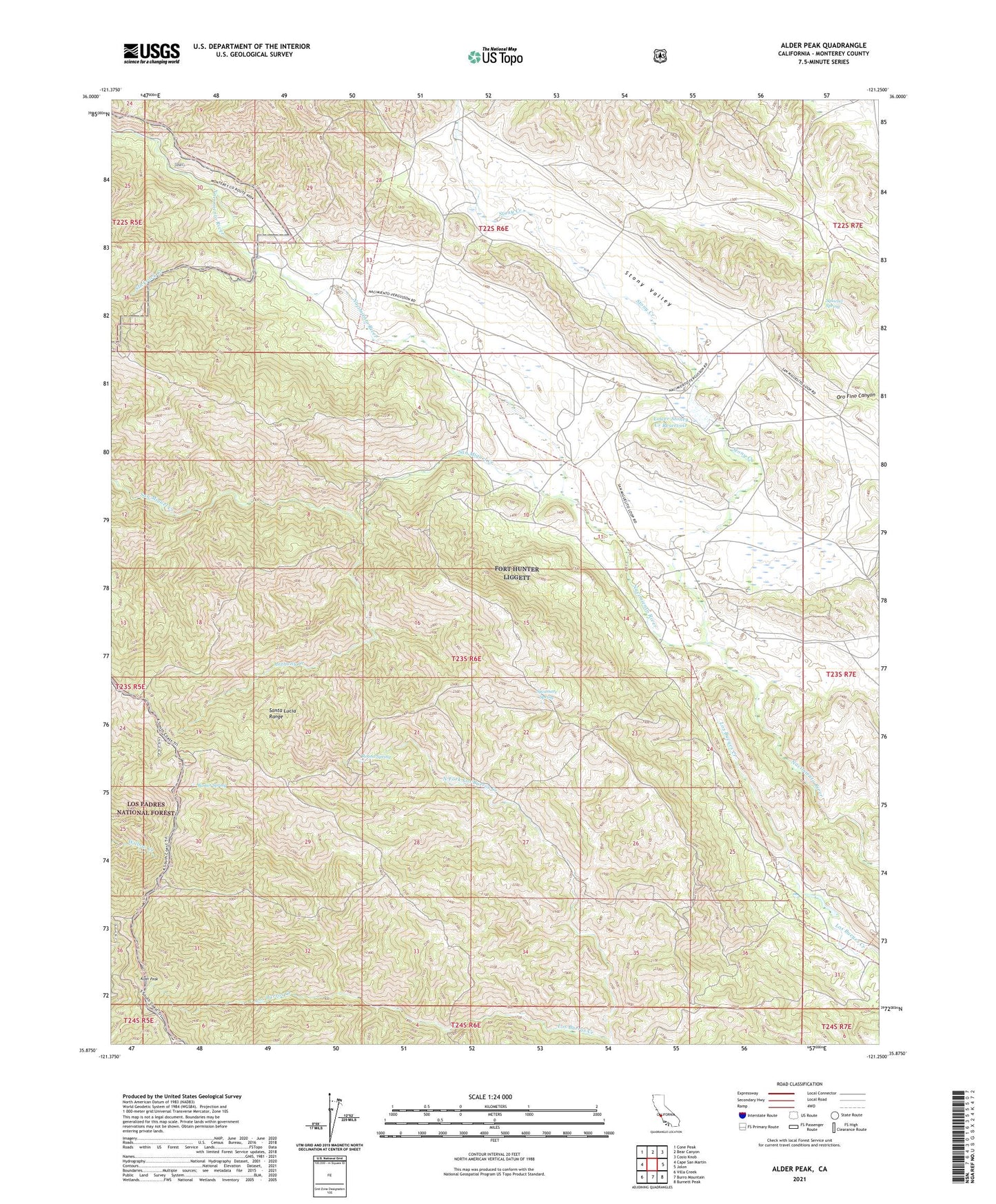
Alder Peak California US Topo Map
Couldn't load pickup availability
Also explore the Alder Peak Forest Service Topo of this same quad for updated USFS data
2021 topographic map quadrangle Alder Peak in the state of California. Scale: 1:24000. Based on the newly updated USGS 7.5' US Topo map series, this map is in the following counties: Monterey. The map contains contour data, water features, and other items you are used to seeing on USGS maps, but also has updated roads and other features. This is the next generation of topographic maps. Printed on high-quality waterproof paper with UV fade-resistant inks.
Quads adjacent to this one:
West: Cape San Martin
Northwest: Cone Peak
North: Bear Canyon
Northeast: Cosio Knob
East: Jolon
Southeast: Burnett Peak
South: Burro Mountain
Southwest: Villa Creek
This map covers the same area as the classic USGS quad with code o35121h3.
Contains the following named places: Alder Peak, Anthony Creek, Basket Spring, King Camp, Lower Stoney Creek Reservoir, Lower Stoney Reservoir Dam, Nacimiento School, North Fork Los Burros Creek, Round Spring, San Miguel Creek, San Miguelito, San Miguelito Ranch, Sans, Slickrock Creek, Squirrel Spring, Stony Creek, Stony Valley, Sycamore Spring