MyTopo
Cape San Martin California US Topo Map
Couldn't load pickup availability
Also explore the Cape San Martin Forest Service Topo of this same quad for updated USFS data
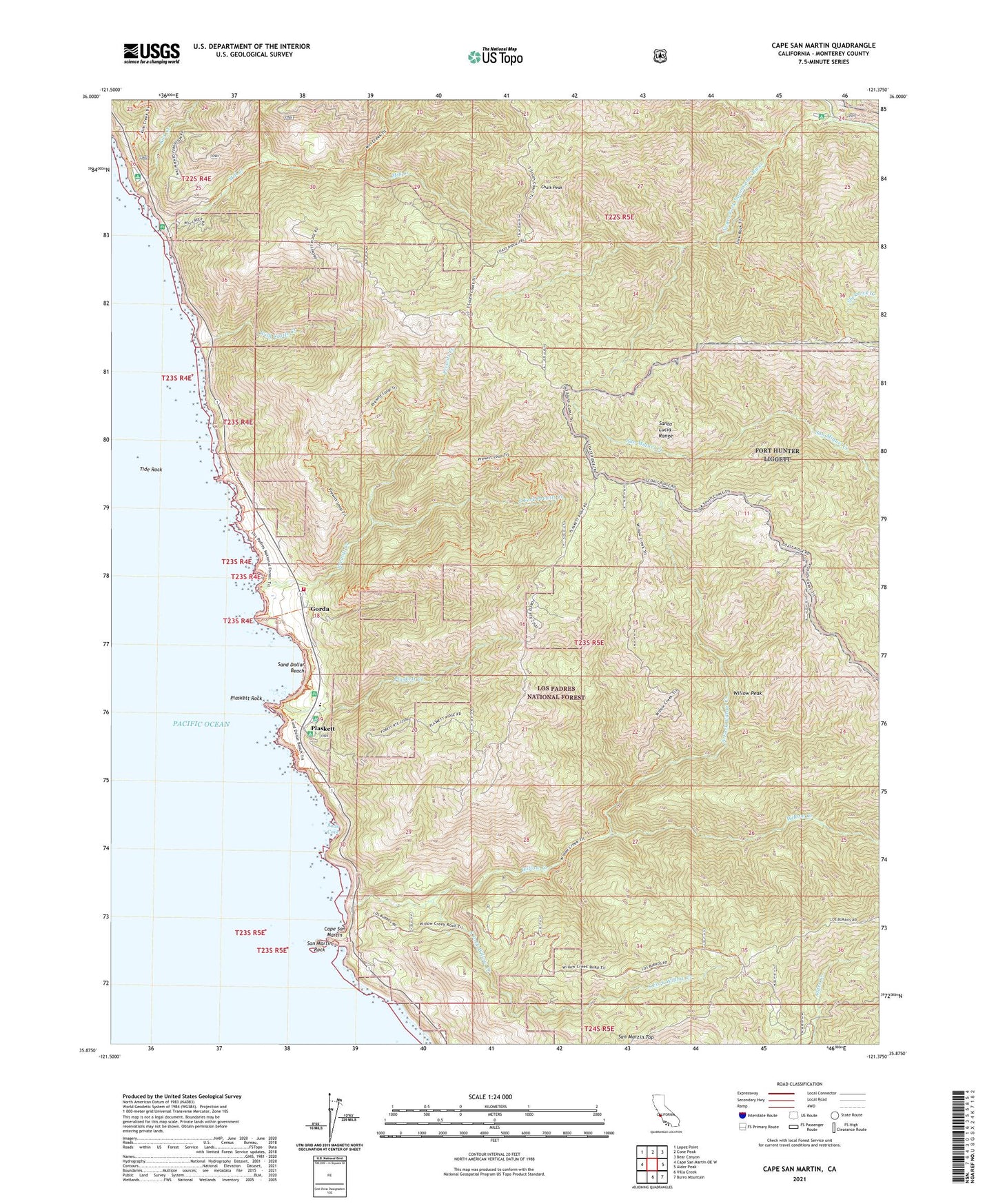
2021 topographic map quadrangle Cape San Martin in the state of California. Scale: 1:24000. Based on the newly updated USGS 7.5' US Topo map series, this map is in the following counties: Monterey. The map contains contour data, water features, and other items you are used to seeing on USGS maps, but also has updated roads and other features. This is the next generation of topographic maps. Printed on high-quality waterproof paper with UV fade-resistant inks.
Quads adjacent to this one:
West: Cape San Martin OE W
Northwest: Lopez Point
North: Cone Peak
Northeast: Bear Canyon
East: Alder Peak
Southeast: Burro Mountain
South: Villa Creek
This map covers the same area as the classic USGS quad with code o35121h4.
Contains the following named places: Alder Creek Campground, Alms Campground, Apple Campground, Big Sur Volunteer Fire Brigade Station 3, Bird Rock, Buclimo Mine, Camp Nacimiento, Cape San Martin, Chalk Peak, Chalk Peak Camp, Gorda, Gorda Mine, Gorda School, Jade Cove, Kirk Creek, Kirk Creek Campground, Krenkels Ranch, Melville Mine, Miguel Campground, Mill Creek, Mill Creek Campground, Mill Creek Picnic Area, Negro Fork Nacimiento River, North Fork Willow Creek, Pacific Valley K - 12 School, Plaskett, Plaskett Creek, Plaskett Creek Campground, Plaskett Rock, Prewitt Creek, Prewitt Ridge Campground, San Martin Rock, San Martin Top, Sand Dollar Beach, Sand Dollar Picnic Area, South Fork Prewitt Creek, South Fork Willow Creek, Stag Rustic Campsite, Sycamore Flat Campground, Tide Rock, White Valley Campground, Wild Cattle Creek, Willow Creek, Willow Creek Picnic Area, Willow Peak