MyTopo
Cone Peak California US Topo Map
Couldn't load pickup availability
Also explore the Cone Peak Forest Service Topo of this same quad for updated USFS data
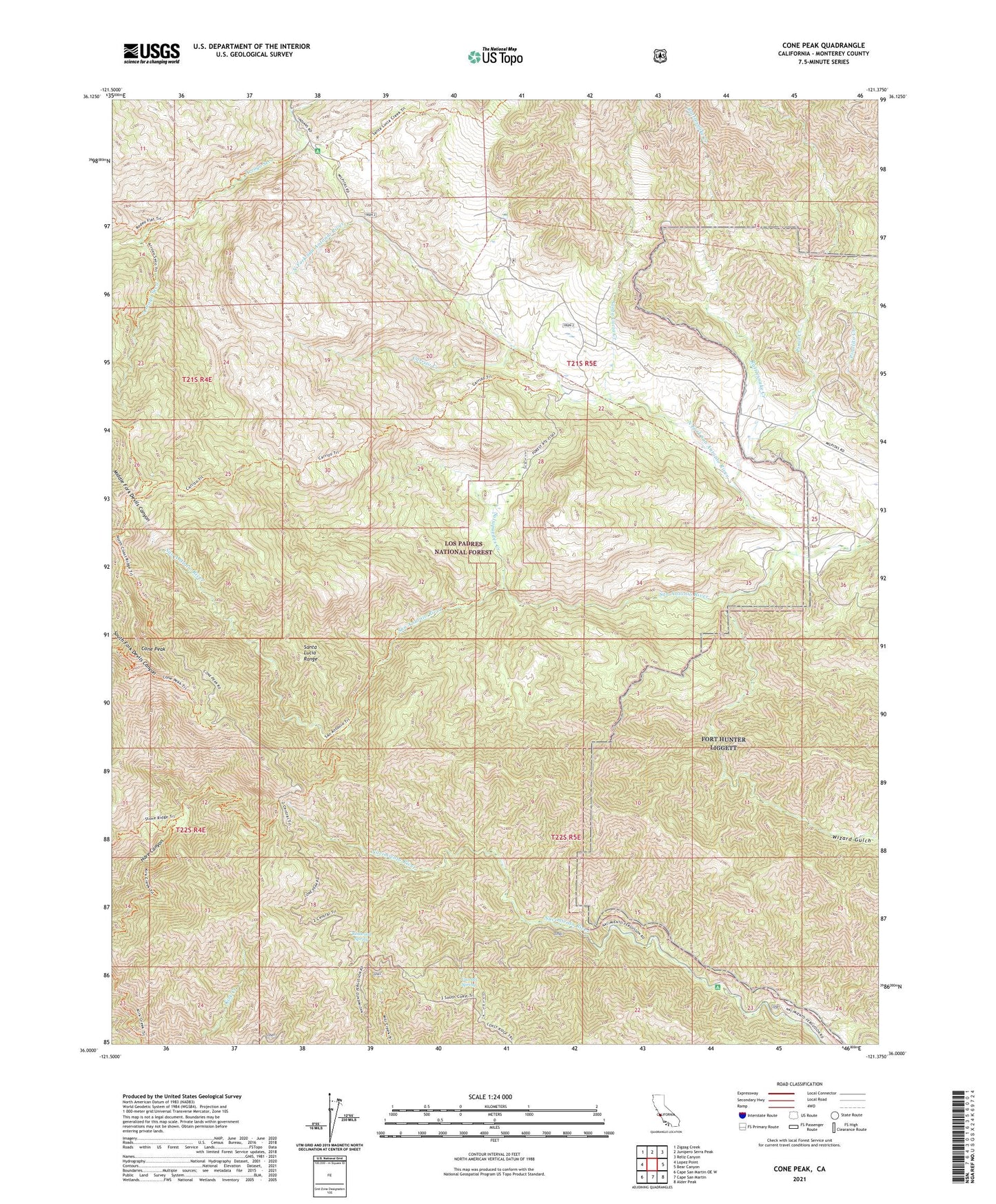
2021 topographic map quadrangle Cone Peak in the state of California. Scale: 1:24000. Based on the newly updated USGS 7.5' US Topo map series, this map is in the following counties: Monterey. The map contains contour data, water features, and other items you are used to seeing on USGS maps, but also has updated roads and other features. This is the next generation of topographic maps. Printed on high-quality waterproof paper with UV fade-resistant inks.
Quads adjacent to this one:
West: Lopez Point
Northwest: Zigzag Creek
North: Junipero Serra Peak
Northeast: Reliz Canyon
East: Bear Canyon
Southeast: Alder Peak
South: Cape San Martin
Southwest: Cape San Martin OE W
This map covers the same area as the classic USGS quad with code o36121a4.
Contains the following named places: ABC Camp Rustic Campsite, Arroyo Seco Trail, Avila Ranch, Carrals Spring, Carrizo Creek, Carrizo Springs Rustic Campsite, Cone Peak, Cook Springs Camp, Forks Rustic Campsite, Fresno Campground, Girard Trail, Indian Ranger Station, Madrone Rustic Campsite, Merle Ranch, Nacimiento Recreation Site, Nacimiento Station, Nacimiento Summer Camp, North Fork San Antonio River, Pinal Creek, Pinalito Creek, Rattlesnake Creek, Redwood Spring, Roosevelt Creek, Salsipuedes Creek, San Antionio Rustic Campsite, Santa Lucia Creek, Santa Lucia Memorial Park, Santa Lucia Range, The Indian, Vicente Flat, Wizard Gulch