MyTopo
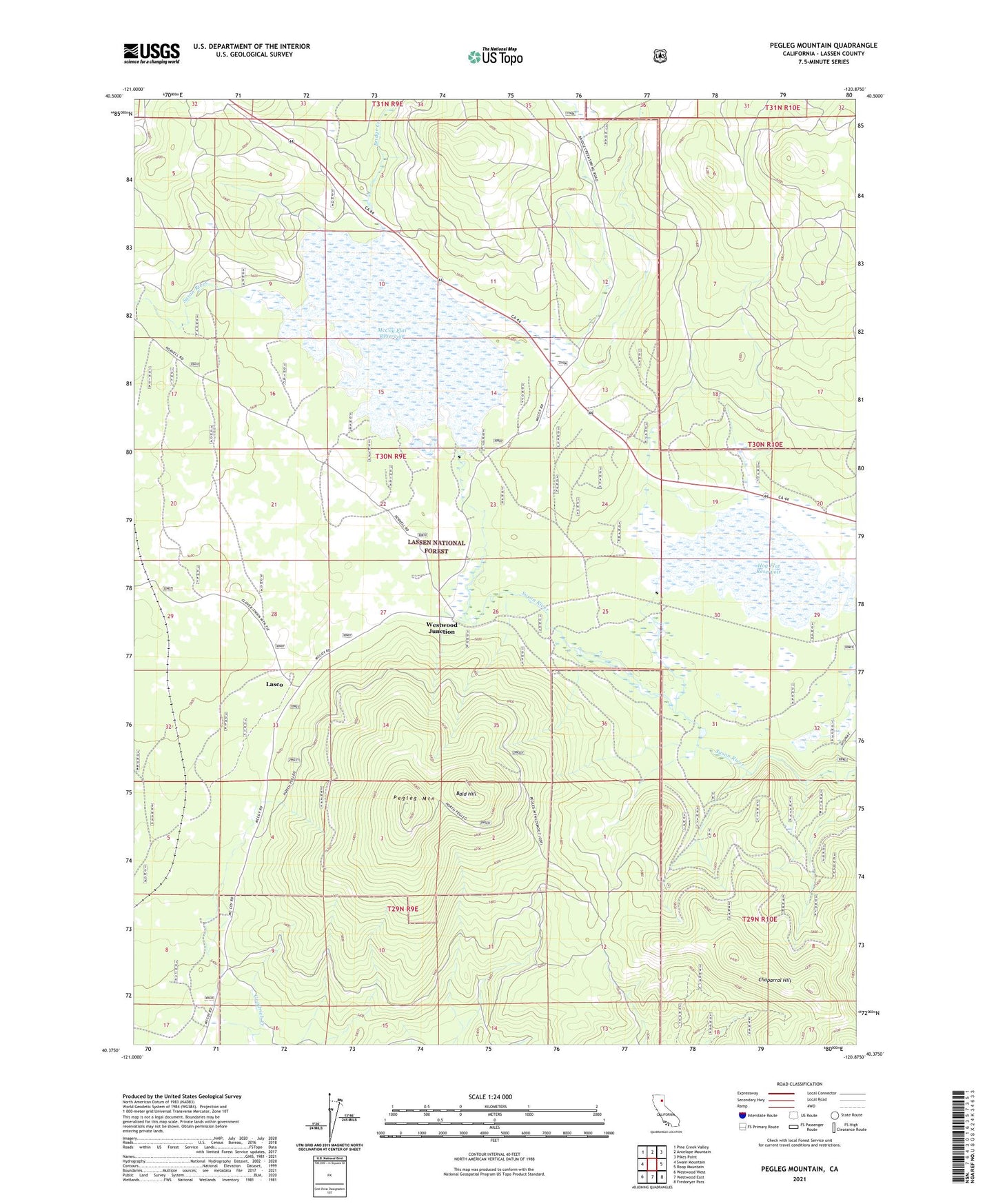
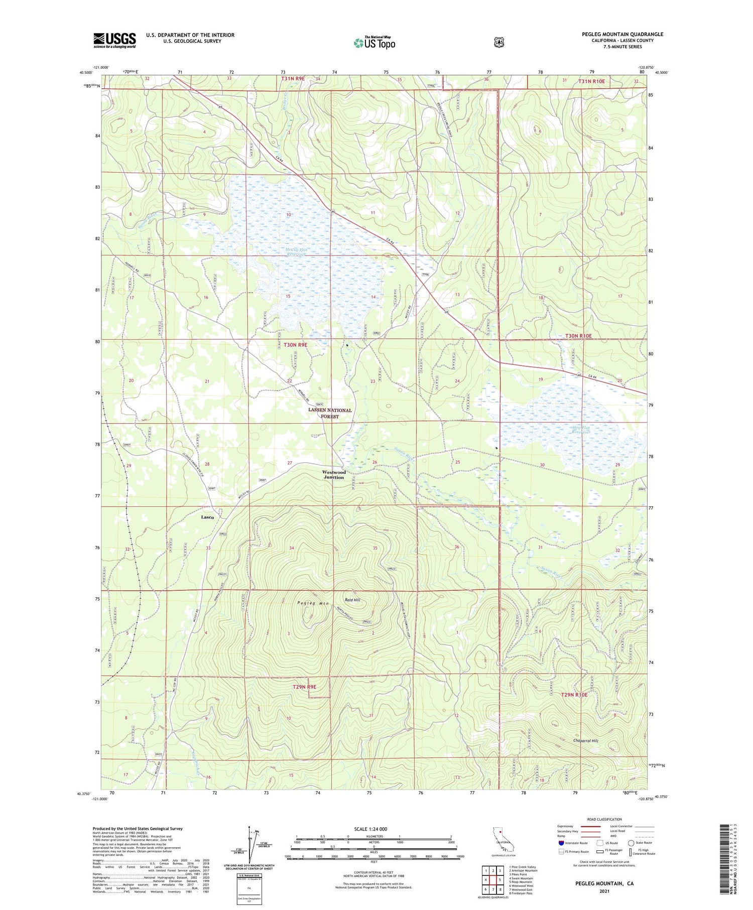
Pegleg Mountain California US Topo Map
Couldn't load pickup availability
Also explore the Pegleg Mountain Forest Service Topo of this same quad for updated USFS data
2021 topographic map quadrangle Pegleg Mountain in the state of California. Scale: 1:24000. Based on the newly updated USGS 7.5' US Topo map series, this map is in the following counties: Lassen. The map contains contour data, water features, and other items you are used to seeing on USGS maps, but also has updated roads and other features. This is the next generation of topographic maps. Printed on high-quality waterproof paper with UV fade-resistant inks.
Quads adjacent to this one:
West: Swain Mountain
Northwest: Pine Creek Valley
North: Antelope Mountain
Northeast: Pikes Point
East: Roop Mountain
Southeast: Fredonyer Pass
South: Westwood East
Southwest: Westwood West
Contains the following named places: Bald Hill, Bridge Creek, Chaparral Hill, Coyote Corral, Hog Flat 236 Dam, Hog Flat Reservoir, Lasco, McCoy Flat 236-003 Dam, McCoy Flat Reservoir, Pegleg Lookout, Pegleg Mountain, Westwood Junction