MyTopo
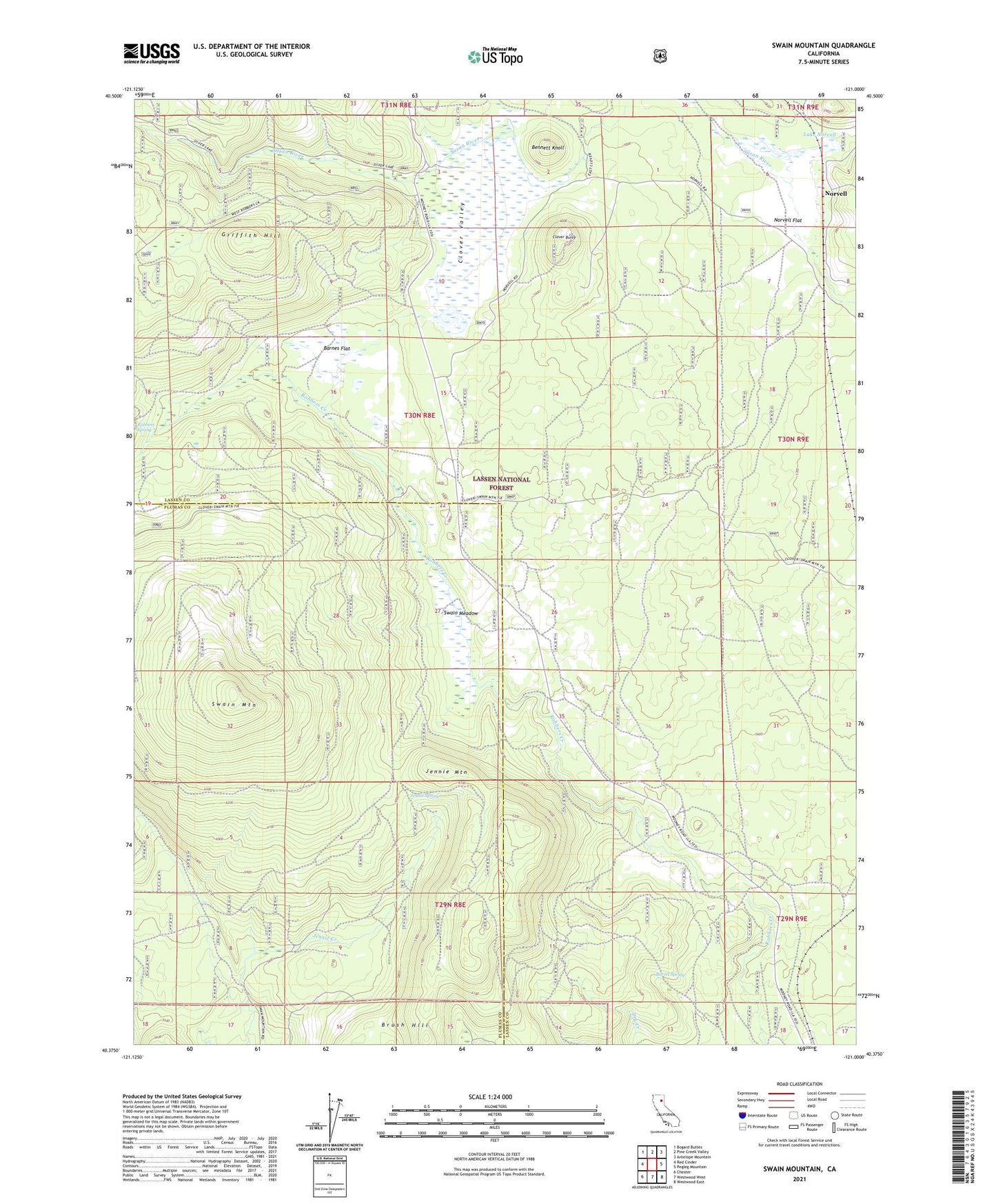
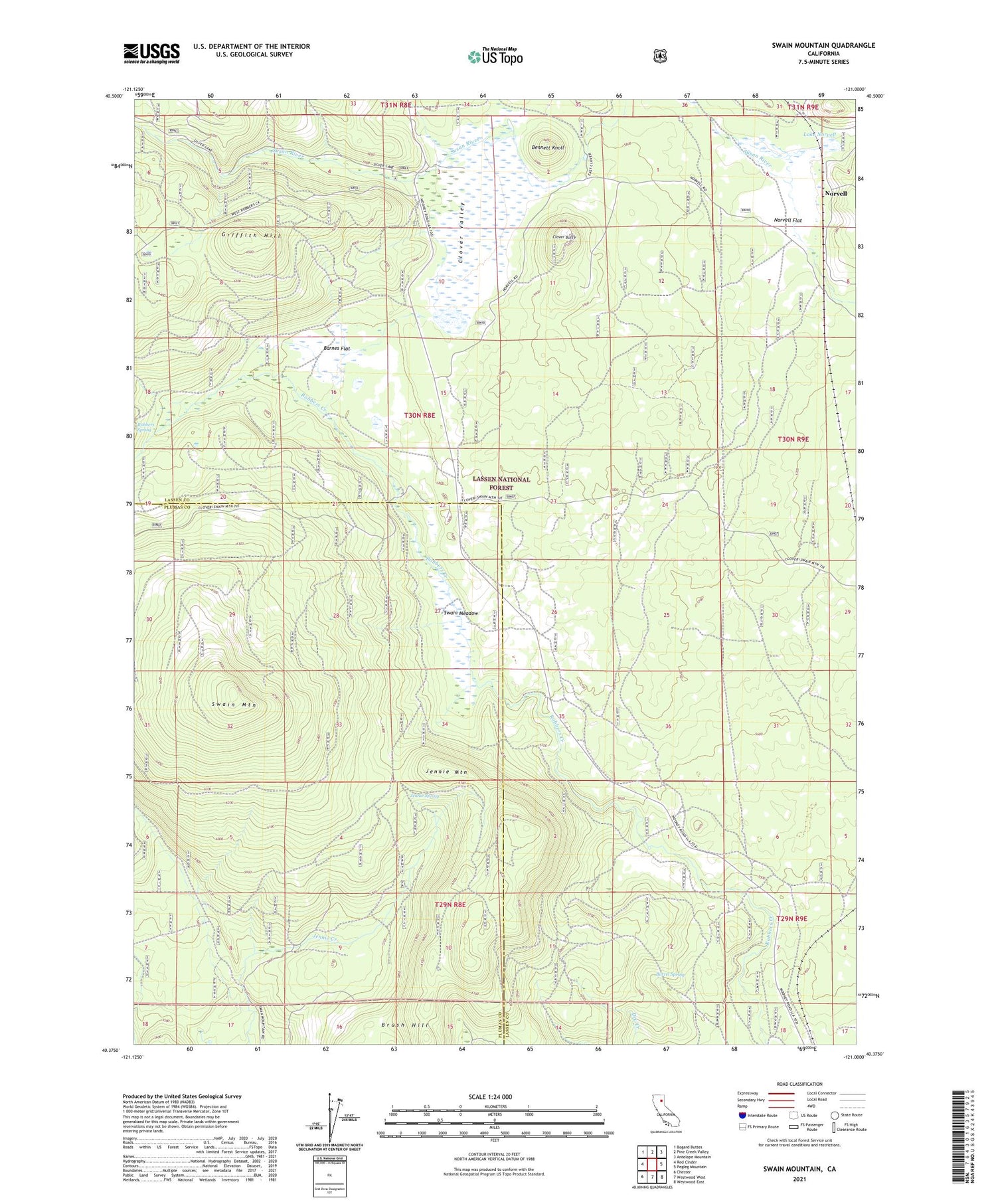
Swain Mountain California US Topo Map
Couldn't load pickup availability
Also explore the Swain Mountain Forest Service Topo of this same quad for updated USFS data
2021 topographic map quadrangle Swain Mountain in the state of California. Scale: 1:24000. Based on the newly updated USGS 7.5' US Topo map series, this map is in the following counties: Lassen, Plumas. The map contains contour data, water features, and other items you are used to seeing on USGS maps, but also has updated roads and other features. This is the next generation of topographic maps. Printed on high-quality waterproof paper with UV fade-resistant inks.
Quads adjacent to this one:
West: Red Cinder
Northwest: Bogard Buttes
North: Pine Creek Valley
Northeast: Antelope Mountain
East: Pegleg Mountain
Southeast: Westwood East
South: Westwood West
Southwest: Chester
This map covers the same area as the classic USGS quad with code o40121d1.
Contains the following named places: Barnes Flat, Barrel Spring, Bennett Knoll, Brush Hill, Clover Butte, Clover Valley, Griffith Hill, Jennie Mountain, Jennie Spring, Johnson Trail, Lake Norvell, Norvell, Norvell Flat, Susan River Campground, Swain Meadow, Swain Mountain, Swain Mountain Experimental Forest, Swain Snowmobile Parking