MyTopo
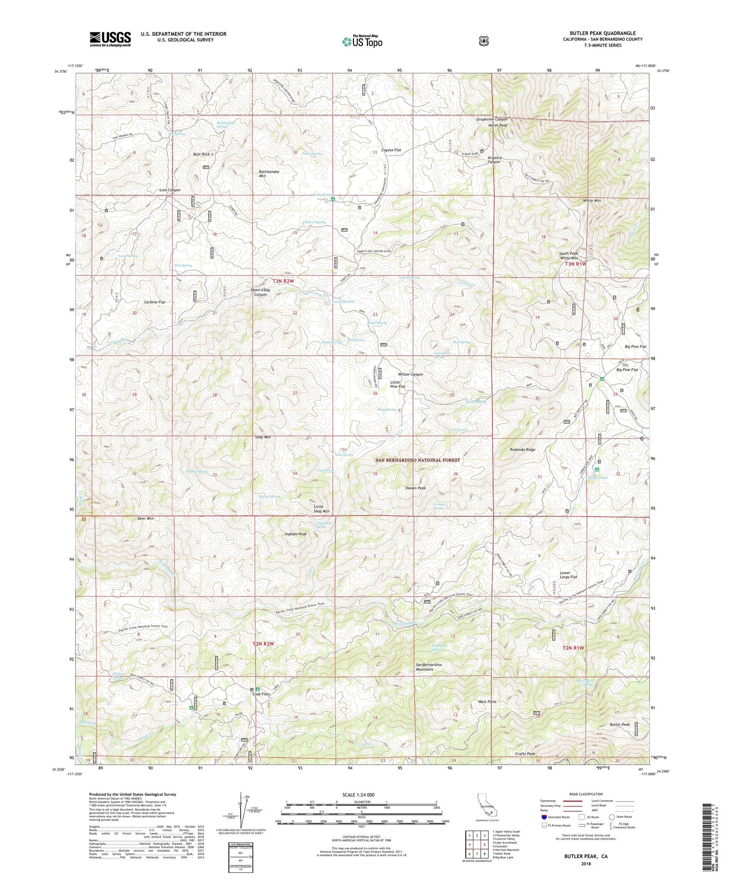
Butler Peak California US Topo Map
Couldn't load pickup availability
Also explore the Butler Peak Forest Service Topo of this same quad for updated USFS data
2021 topographic map quadrangle Butler Peak in the state of California. Scale: 1:24000. Based on the newly updated USGS 7.5' US Topo map series, this map is in the following counties: San Bernardino. The map contains contour data, water features, and other items you are used to seeing on USGS maps, but also has updated roads and other features. This is the next generation of topographic maps. Printed on high-quality waterproof paper with UV fade-resistant inks.
Quads adjacent to this one:
West: Lake Arrowhead
Northwest: Apple Valley South
North: Fifteenmile Valley
Northeast: Lucerne Valley
East: Fawnskin
Southeast: Big Bear Lake
South: Keller Peak
Southwest: Harrison Mountain
This map covers the same area as the classic USGS quad with code o34117c1.
Contains the following named places: Balanced Rock Mine, Barrel Spring, Big Pine Flat, Big Pine Flat Campground, Big Pine Flat Forest Station, Burns Spring, Butler Peak, Butt Rock, Carbine Flat, Chipmunk Spring, Chukar Spring, Cienega Larga, Cienega Redonda, Cienega Spring, Cox Creek, Cox Spring, Coxey Meadow, Coxey Ranch, Coyote Flat, Crab Creek, Crab Flats, Crafts Peak, Cup Spring, Dawn o'Day Canyon, Deer Mountain, Devils Hole, Dishpan Spring, Hawes Peak, Hawes Ranch, Holcomb Crossing Group Campground, Hopi Spring, Horse Spring, Horse Spring Campground, Ingham Peak, Ironwood Campsite, Jackrabbit Spring, Liberty Mine, Lightning Spring, Line Spring, Little Pine Flat, Little Shay Mountain, Lizard Spring, Lower Larga Flat, Luna Spring, Mill Spring, Mud Spring, Muddy Spring, North Peak, Oak Spring, Pine Spring, Pinon Spring, Rattlesnake Mountain, Rattlesnake Spring, Redonda Ridge, Shay Mountain, Shay Spring, Sheep Creek, Snake Spring, Snow Slide Spring, South Peak White Mountain, Tent Peg Group, West Point, White Mountain, Willow Canyon