
MyTopo
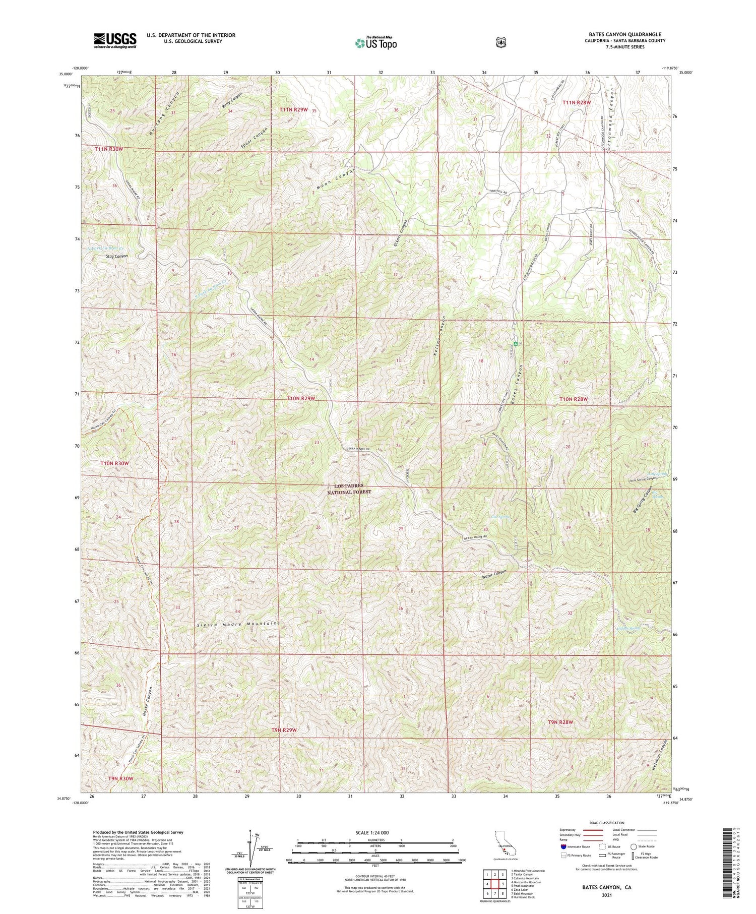
Bates Canyon California US Topo Map
Couldn't load pickup availability
Also explore the Bates Canyon Forest Service Topo of this same quad for updated USFS data
2021 topographic map quadrangle Bates Canyon in the state of California. Scale: 1:24000. Based on the newly updated USGS 7.5' US Topo map series, this map is in the following counties: Santa Barbara. The map contains contour data, water features, and other items you are used to seeing on USGS maps, but also has updated roads and other features. This is the next generation of topographic maps. Printed on high-quality waterproof paper with UV fade-resistant inks.
Quads adjacent to this one:
West: Manzanita Mountain
Northwest: Miranda Pine Mountain
North: Taylor Canyon
Northeast: Caliente Mountain
East: Peak Mountain
Southeast: Hurricane Deck
South: Bald Mountain
Southwest: Zaca Lake
This map covers the same area as the classic USGS quad with code o34119h8.
Contains the following named places: Bates Canyon, Bates Canyon Campground, Big Spring, Big Spring Canyon, Cole Spring, Cole Spring Campground, Docs Spring Campground, Eckart Canyon, Hidden Spring, Little Spring, Little Spring Canyon, Moon Canyon, Rines Recreation Site, White Oaks Guard Station


