MyTopo
Caliente Mountain California US Topo Map
Couldn't load pickup availability
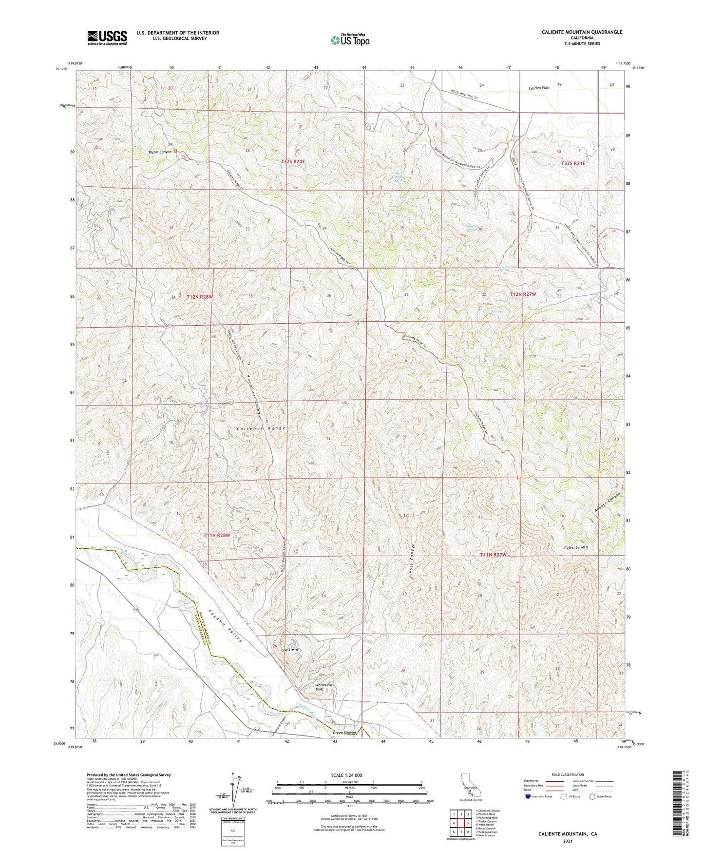
2021 topographic map quadrangle Caliente Mountain in the state of California. Scale: 1:24000. Based on the newly updated USGS 7.5' US Topo map series, this map is in the following counties: San Luis Obispo, Santa Barbara. The map contains contour data, water features, and other items you are used to seeing on USGS maps, but also has updated roads and other features. This is the next generation of topographic maps. Printed on high-quality waterproof paper with UV fade-resistant inks.
Quads adjacent to this one:
West: Taylor Canyon
Northwest: Chimineas Ranch
North: Painted Rock
Northeast: Panorama Hills
East: Wells Ranch
Southeast: New Cuyama
South: Peak Mountain
Southwest: Bates Canyon
Contains the following named places: Black Sulphur Spring, Caliente Mountain, Caliente Range, Chalk Mountain, Cottonwood Spring, Goat Spring, Government Eighteen Oil Field, Green Canyon, Morales Canyon, Morales Canyon Oil Field, Post Canyon, Russel Ranch Oil Field, Schoolhouse Canyon, Selby Ranch, Sulphur Spring, Taylor Canyon Oil Field, Washburn Ranch, Whiterock Bluff