MyTopo
Peak Mountain California US Topo Map
Couldn't load pickup availability
Also explore the Peak Mountain Forest Service Topo of this same quad for updated USFS data
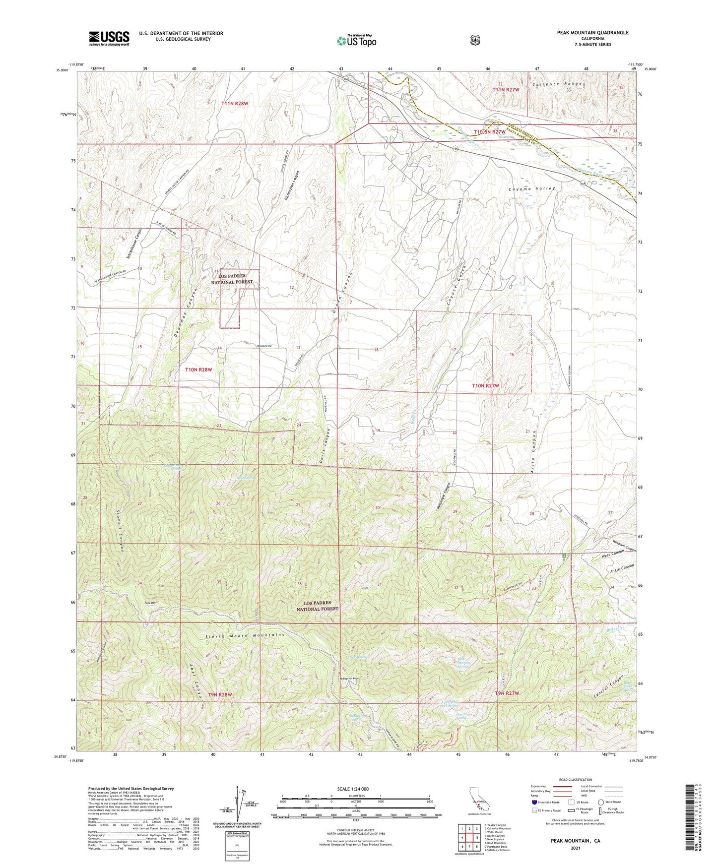
2021 topographic map quadrangle Peak Mountain in the state of California. Scale: 1:24000. Based on the newly updated USGS 7.5' US Topo map series, this map is in the following counties: Santa Barbara, San Luis Obispo. The map contains contour data, water features, and other items you are used to seeing on USGS maps, but also has updated roads and other features. This is the next generation of topographic maps. Printed on high-quality waterproof paper with UV fade-resistant inks.
Quads adjacent to this one:
West: Bates Canyon
Northwest: Taylor Canyon
North: Caliente Mountain
Northeast: Wells Ranch
East: New Cuyama
Southeast: Salisbury Potrero
South: Hurricane Deck
Southwest: Bald Mountain
Contains the following named places: Aliso Campground, Aliso Canyon, Bitter Creek Spring, Buck Opening Spring, Caliente Ranch, Coyote Gulch, Davis Canyon, Deadman Canyon, Deer Spring, Heath Spring, Hinsdale Ranch, Hog Pen Spring, Hog Pen Spring Rustic Campsite, Johnston Spring, McPherson Camp, McPherson Campground, McPherson Peak, Messenger Canyon, Peak Mountain, Richardson Canyon, Richardson Spring, Sierra Madre Mountains, Stovall Canyon, Upper Hog Pen Spring, Wells Creek, West Canyon, ZIP Code: 93254