MyTopo
Big Basin California US Topo Map
Couldn't load pickup availability
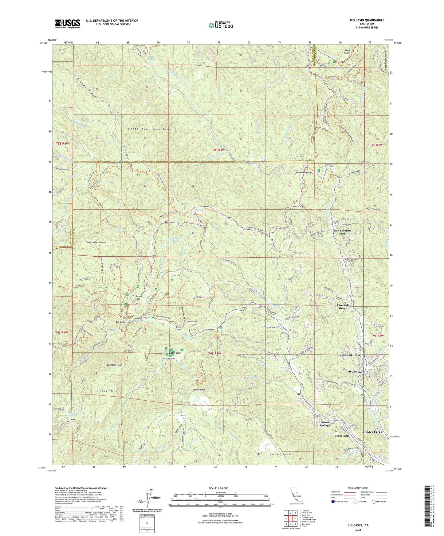
2021 topographic map quadrangle Big Basin in the state of California. Scale: 1:24000. Based on the newly updated USGS 7.5' US Topo map series, this map is in the following counties: Santa Cruz, San Mateo. The map contains contour data, water features, and other items you are used to seeing on USGS maps, but also has updated roads and other features. This is the next generation of topographic maps. Printed on high-quality waterproof paper with UV fade-resistant inks.
Quads adjacent to this one:
West: Franklin Point
Northwest: La Honda
North: Mindego Hill
Northeast: Cupertino
East: Castle Rock Ridge
Southeast: Felton
South: Davenport
Southwest: Point Ano Nuevo
This map covers the same area as the classic USGS quad with code o37122b2.
Contains the following named places: Basin Trail, Ben Lomond Youth Conservation Camp, Big Basin, Big Basin Post Office, Big Basin Redwoods State Park, Big Basin Redwoods State Park Headquarters, Blooms Creek, Blooms Creek Campground, Blooms Creek Trail, Boulder Creek Census Designated Place, Boulder Creek Fire Protection District Substation, Boulder Creek Golf and Country Club, Bracken Brae, Bracken Brae Creek, Bulls Spring, Butano Ridge, Butano Ridge Loop Trail, Buzzards Roost, Camp Ben Lomond, Camp Campbell, Circle Group Camp, Creeping Forest Trail, Dool Trail, Eagle Rock, Eagle Rock Lookout, East Ridge Trail, Fall Creek, Foreman Creek, Forest Park, Forest Springs, Forest Swimming Pool, Governors Camp, Hare Creek, Hilton Airport, Hollow Tree Trail, Huckleberry Campground, Iverson Creek, Iverson Trail, Jamison Creek, Jay Trail Camp, Kings Creek, Lane Trail Camp, Little Basin, Little Boulder Creek, Locatelli Ranch, Lockheed Martin Space Systems Company, Maddocks Creek, McAbee Mountain, Meteor Trail, Mount McAbee Overlook, Oak Site 1-065 Dam, Ocean Grove Charter School, Ocean View Summit, Oil Creek, Opal Creek, Peavine Creek, Pine Mountain, Pine Mountain Trail, Portola Trail, Redwood Grove, Redwood Trail, Rices Junction, Riverside Grove, Rogers Creek, San Lorenzo Park, Sempervirens 1-02 Dam, Sempervirens Campground, Sempervirens Creek, Sempervirens Reservoir, Sequoia Group Camp, Sequoia Trail, Shadowbrook Trail, Silver Creek, Slate Creek, Spring Creek, Sunset Trail, Two Bar Creek, Union Creek, Wastahi Campground, Waterman Creek, Waterman Gap, Wildwood, ZIP Code: 95006