MyTopo
Davenport California US Topo Map
Couldn't load pickup availability
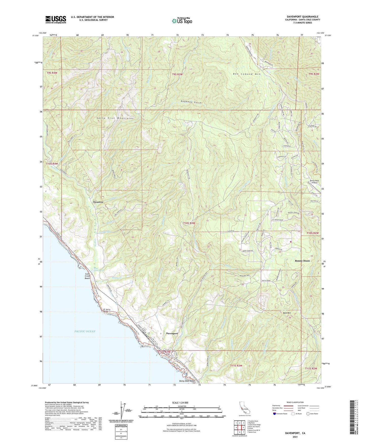
2021 topographic map quadrangle Davenport in the state of California. Scale: 1:24000. Based on the newly updated USGS 7.5' US Topo map series, this map is in the following counties: Santa Cruz. The map contains contour data, water features, and other items you are used to seeing on USGS maps, but also has updated roads and other features. This is the next generation of topographic maps. Printed on high-quality waterproof paper with UV fade-resistant inks.
Quads adjacent to this one:
West: Point Ano Nuevo
Northwest: Franklin Point
North: Big Basin
Northeast: Castle Rock Ridge
East: Felton
Southeast: Santa Cruz
South: Santa Cruz OE W
This map covers the same area as the classic USGS quad with code o37122a2.
Contains the following named places: Agua Puera Creek, Agua Puerca y las Trances, Archibald Creek, Arroyo De La Laguna, Bald Mountain, Ben Lomond Mountain, Berry Creek, Big Creek, Big Creek Fire Station, Big Creek Powerhouse, Bonnie Doon Substation, Bonny Doon, Bonny Doon Airport, Bonny Doon Census Designated Place, Bonny Doon Elementary School, Bonny Doon Fire Station, Bonny Doon Limestone Quarry, Boyer Creek, California Coastal National Monument, Davenport, Davenport Census Designated Place, Davenport Landing, Davenport Overlook, Davenport Post Office, Deadman Gulch, East Branch Liddell Creek, El Jarro Point, Little Creek, Mill Creek, Mill Creek 630 Dam, Molino Creek, Olives Landing, Pacific Elementary School, Reggiardo Creek, San Vicente, San Vicente Creek, Scott Creek, Scott Creek Beach, Scott Creek Marsh, Seaside School, Skyline Ranch, Swanton, Warrenella Ranch, West Liddell Creek, West Santa Cruz Division, Winter Creek, ZIP Code: 95017