MyTopo
Ventana Cones California US Topo Map
Couldn't load pickup availability
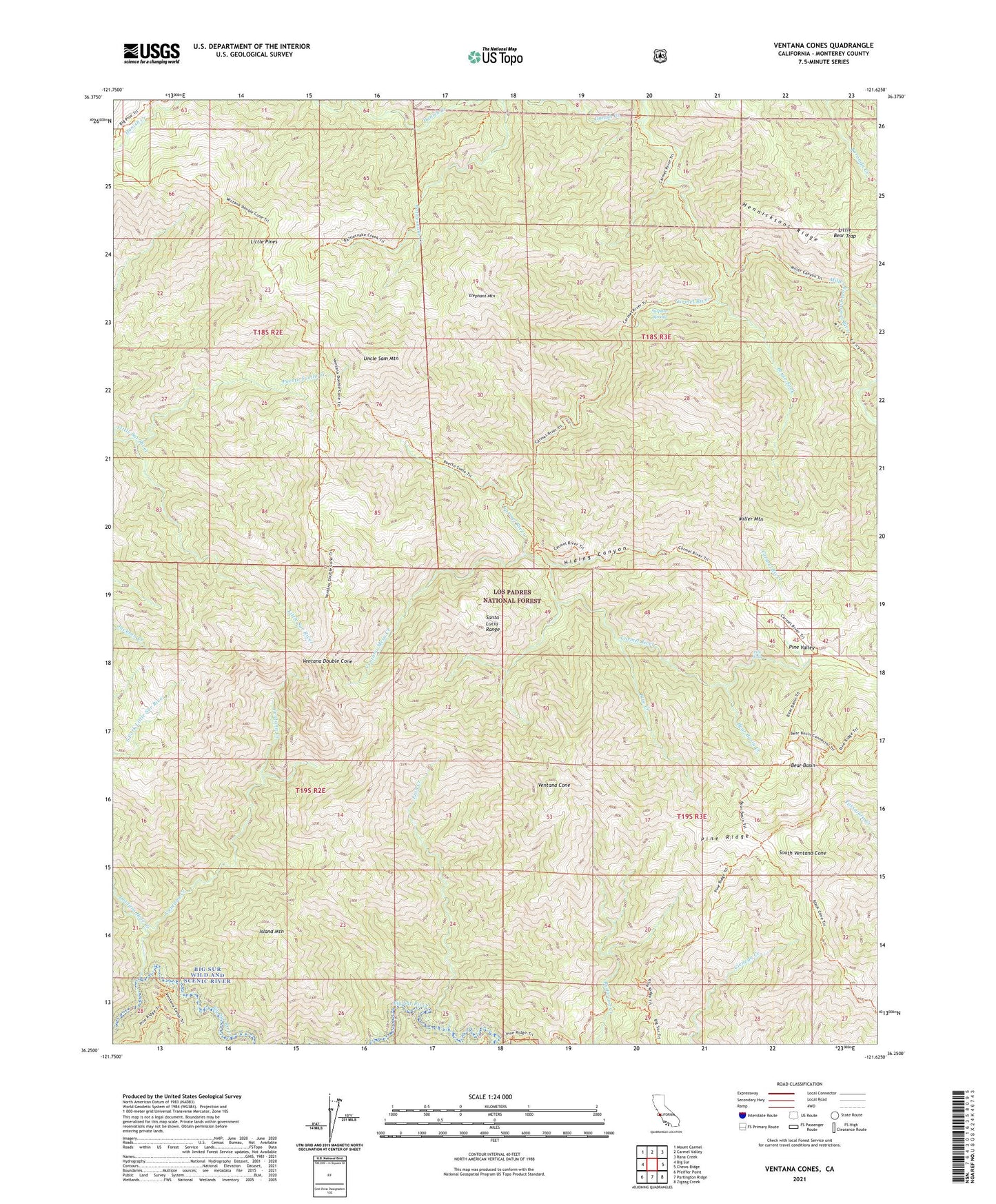
2021 topographic map quadrangle Ventana Cones in the state of California. Scale: 1:24000. Based on the newly updated USGS 7.5' US Topo map series, this map is in the following counties: Monterey. The map contains contour data, water features, and other items you are used to seeing on USGS maps, but also has updated roads and other features. This is the next generation of topographic maps. Printed on high-quality waterproof paper with UV fade-resistant inks.
Quads adjacent to this one:
West: Big Sur
Northwest: Mount Carmel
North: Carmel Valley
Northeast: Rana Creek
East: Chews Ridge
Southeast: Zigzag Creek
South: Partington Ridge
Southwest: Pfeiffer Point
This map covers the same area as the classic USGS quad with code o36121c6.
Contains the following named places: Bear Basin, Bear Basin Camp, Bear Basin Creek, Blue Creek, Bluff Camp Recreation Site, Bruce Fork, Buckskin Flat Camp, Carmel River Camp, Carmel River Trail, Clover Basin Camp, Danish Creek, Dolores Creek, Doolans Hole Creek, Elephant Mountain, Hennicksons Ridge, Hennicksons Ridge Trail, Hiding Canyon, Hiding Canyon Camp, Island Mountain, Lion Creek, Little Bear Trap, Little Pines, Little Pines Camp, Lone Pine Camp, Miller Canyon, Miller Canyon Camp, Miller Canyon Rustic Campsite, Miller Fork Carmel River, Miller Mountain, Pat Springs Camp, Pine Falls, Pine Ridge, Pine Ridge Camp, Pine Ridge Trail, Pine Valley, Pine Valley Rustic Campsite, Puerto Suello Creek, Rattlesnake Campground, Redwood Creek Camp, Round Rock Camp, South Ventana Cone, Sulpher Springs Camp, Sulphur Spring, Sulphur Springs Camp, Uncle Sam Mountain, Ventana Camp, Ventana Cone, Ventana Creek, Ventana Double Cone, Ventana Mesa Creek, Ventana Trail