MyTopo
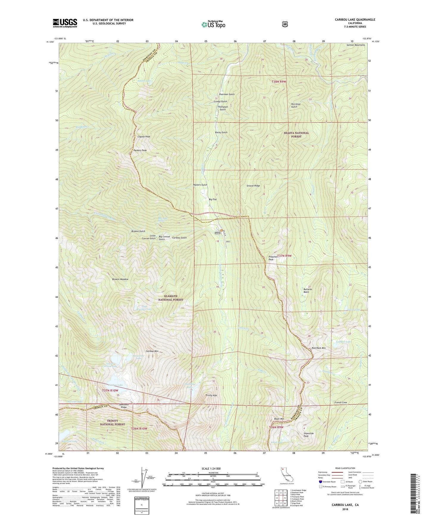
Caribou Lake California US Topo Map
Couldn't load pickup availability
Also explore the Caribou Lake Forest Service Topo of this same quad for updated USFS data
2022 topographic map quadrangle Caribou Lake in the state of California. Scale: 1:24000. Based on the newly updated USGS 7.5' US Topo map series, this map is in the following counties: Siskiyou, Trinity. The map contains contour data, water features, and other items you are used to seeing on USGS maps, but also has updated roads and other features. This is the next generation of topographic maps. Printed on high-quality waterproof paper with UV fade-resistant inks.
Quads adjacent to this one:
West: Thompson Peak
Northwest: Grasshopper Ridge
North: Deadman Peak
Northeast: Billys Peak
East: Ycatapom Peak
Southeast: Covington Mill
South: Siligo Peak
Southwest: Mount Hilton
This map covers the same area as the classic USGS quad with code o41122a8.
Contains the following named places: Abrams Cabin, Adams Creek, Adams Lake, Big Conrad Gulch, Big Flat, Big Flat Campground, Black Mountain, Blue Lady Spring, Browns Gulch, Browns Meadow, Bullards Basin, Caribou Gulch, Caribou Lake, Caribou Meadows, Caribou Mountain, Carter Cabin, Coyote Peak, Crosby Gulch, Dorleska Mine, Emerald Lake, French Cove, Grouse Ridge, Gulick Creek, Gulick Mine, Hardscrabble Creek, Hickory Creek, Josephine Lake, Kidd Creek, Lakeview Ranch, Landers Lake, Le Roy Mine, Little Caribou Lake, Little Conrad Gulch, Lower Caribou Lake, Lower Nash Mine, Moraine Lake, Mountain Meadow Ranch, North Fork Adams Creek, Packers Gulch, Packers Peak, Packers Peak Cabin, Petrified Gulch, Pin Creek, Poorman Gulch, Preachers Peak, Red Rock Mountain, Rocky Gulch, Sawtooth Ridge, Snowslide Lake, Snowslide Peak, Sunrise Creek, Thompson Gulch, Union Creek, Union Lake, Upper Nash Mine, Ward Lake, Yellow Rose Mine