MyTopo
Ycatapom Peak California US Topo Map
Couldn't load pickup availability
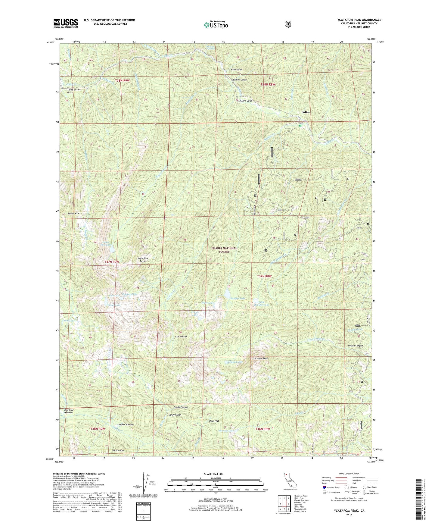
2021 topographic map quadrangle Ycatapom Peak in the state of California. Scale: 1:24000. Based on the newly updated USGS 7.5' US Topo map series, this map is in the following counties: Trinity. The map contains contour data, water features, and other items you are used to seeing on USGS maps, but also has updated roads and other features. This is the next generation of topographic maps. Printed on high-quality waterproof paper with UV fade-resistant inks.
Quads adjacent to this one:
West: Caribou Lake
Northwest: Deadman Peak
North: Billys Peak
Northeast: Tangle Blue Lake
East: Carrville
Southeast: Trinity Center
South: Covington Mill
Southwest: Siligo Peak
This map covers the same area as the classic USGS quad with code o41122a7.
Contains the following named places: Battle Creek, Battle Mountain, Bear Creek, Benson Gulch, Boulder Creek, Boulder Lake, Chinkhollow Creek, Coffee, Coffee Creek Guard Station, Coffee Creek Ranch, Conway Lake, Crystal Creek, Cub Wallow, Deacon Creek, Deer Flat, East Fork Coffee Creek, Foster Lake, Fosters Cabin, Found Lake, Goldfield Campground, Goldfield Ranger Station, Goldfish Campground, Kickapoo Waterfall, Lady Slipper Mine, Landers Creek, Liberty Mine, Lilypad Lake, Lion Lake, Little Boulder Lake, McGuire Gulch, Mumford Meadow, Nicholas Creek, North Fork Coffee Creek, Parker Creek, Parker Meadow, Poison Canyon, Sandy Gulch, Shimmy Lake, Slide Gulch, Sugar Pine Butte, Sugar Pine Creek, Sugar Pine Lake, Tapie Lake, The Cedars, Three Sisters Gulch, Union Lakes, Wagner Creek, Ycatapom Peak, ZIP Code: 96091