
MyTopo
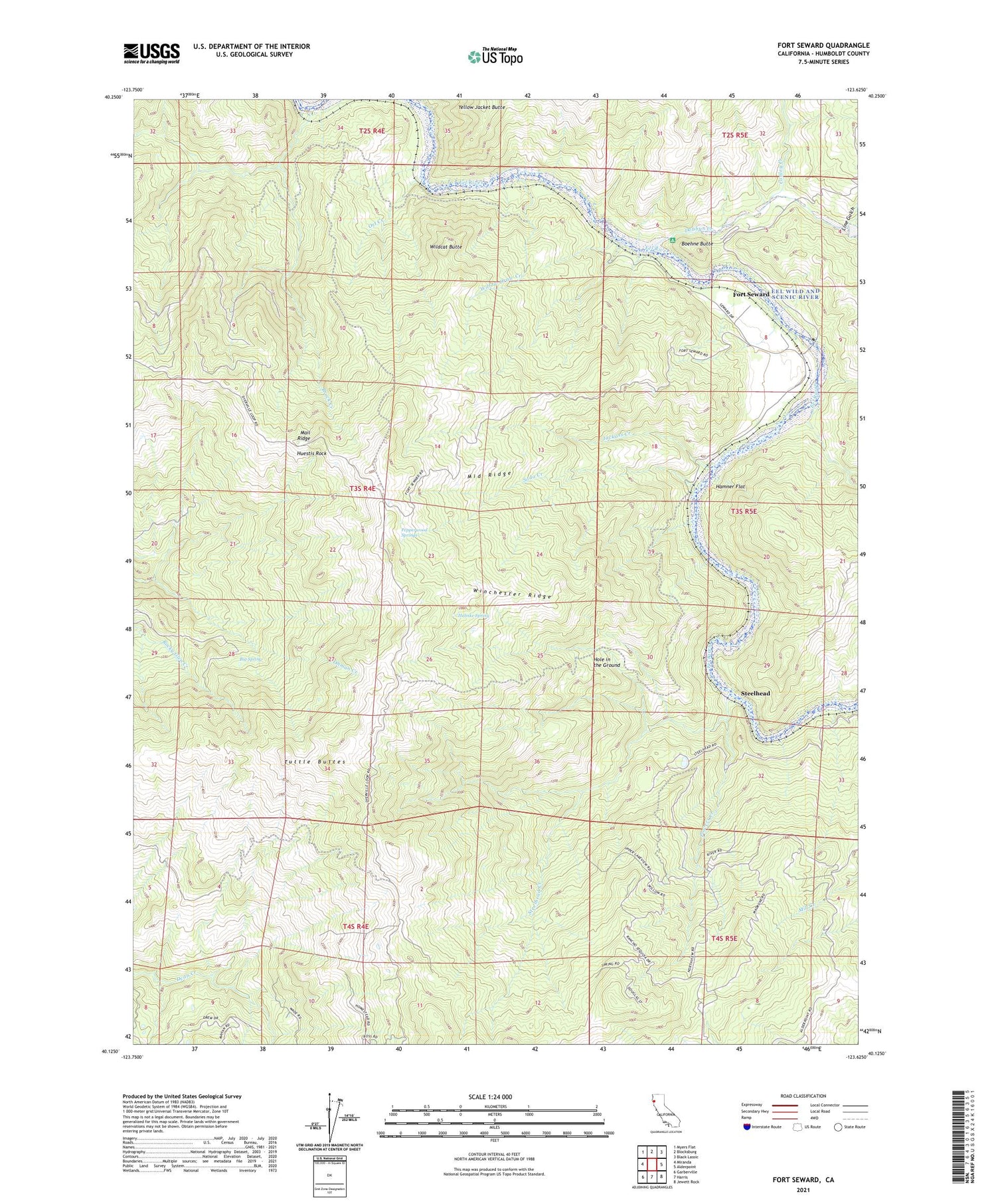
Fort Seward California US Topo Map
Couldn't load pickup availability
2021 topographic map quadrangle Fort Seward in the state of California. Scale: 1:24000. Based on the newly updated USGS 7.5' US Topo map series, this map is in the following counties: Humboldt. The map contains contour data, water features, and other items you are used to seeing on USGS maps, but also has updated roads and other features. This is the next generation of topographic maps. Printed on high-quality waterproof paper with UV fade-resistant inks.
Quads adjacent to this one:
West: Miranda
Northwest: Myers Flat
North: Blocksburg
Northeast: Black Lassic
East: Alderpoint
Southeast: Jewett Rock
South: Harris
Southwest: Garberville
This map covers the same area as the classic USGS quad with code o40123b6.
Contains the following named places: Big Spring, Boehne Butte, Brock Creek, Conley Creek, Dobbyn Creek, Fort Seward, Hamner Flat, Helmke Spring, Hole in the Ground, Hubbard Station, Huestis Rock, Hurlbutt Ranch, Jackass Creek, Line Gulch, Middle Ridge, Ort Creek, Pepperwood Springs, Powers Creek, Soda Creek, Steelhead, Steelhead Creek, Tuttle Buttes, Wildcat Butte, Willow Draw Creek, Winchester Ridge, Woods Mine, Yellow Jacket Butte, ZIP Codes: 95511, 95559


