MyTopo
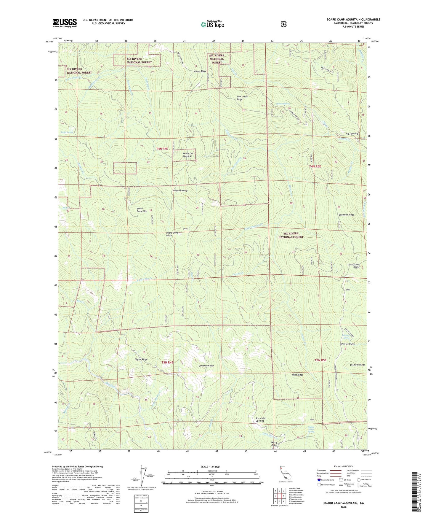
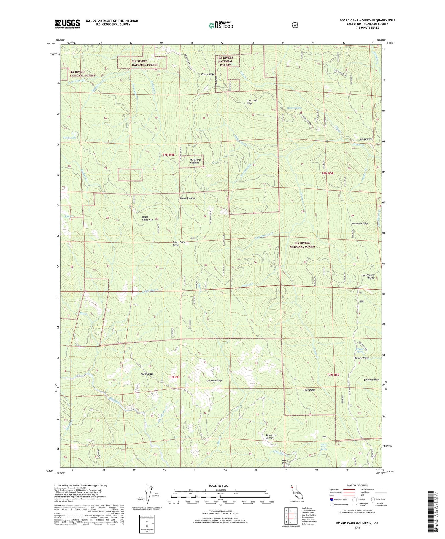
Board Camp Mountain California US Topo Map
Couldn't load pickup availability
Also explore the Board Camp Mountain Forest Service Topo of this same quad for updated USFS data
2022 topographic map quadrangle Board Camp Mountain in the state of California. Scale: 1:24000. Based on the newly updated USGS 7.5' US Topo map series, this map is in the following counties: Humboldt. The map contains contour data, water features, and other items you are used to seeing on USGS maps, but also has updated roads and other features. This is the next generation of topographic maps. Printed on high-quality waterproof paper with UV fade-resistant inks.
Quads adjacent to this one:
West: Mad River Buttes
Northwest: Maple Creek
North: Grouse Mountain
Northeast: Hennessy Peak
East: Sims Mountain
Southeast: Blake Mountain
South: Showers Mountain
Southwest: Yager Junction
Contains the following named places: Big Opening, Board Camp Butte, Board Camp Mountain, Brays Opening, Brays Opening Creek, Cameron Ridge, Carson Creek, Cow Creek, Cow Creek Ridge, Deadman Ridge, Deer Creek Ranch, Delmont Ridge, Dinsmores, East Fork Bug Creek, Fork Camp, Gravelly Bar Creek, Greenwood Creek, Grouse Creek Tractor Trail, Homers Spring, Kinsey Ridge, Little Deer Creek, Nolan Cabin, Panther Creek, Pilot Ridge, Ridge Cabin, Smokehouse Creek, Snow Camp Creek, Starvation Opening, Taylor Ridge, Tri Board Camp, Twin Lakes, Twin Lakes Creek, White Oak Creek, White Oak Opening, Whiting Ridge, Whiting Spring, Windy Ridge, Yellow Jacket Spring