MyTopo
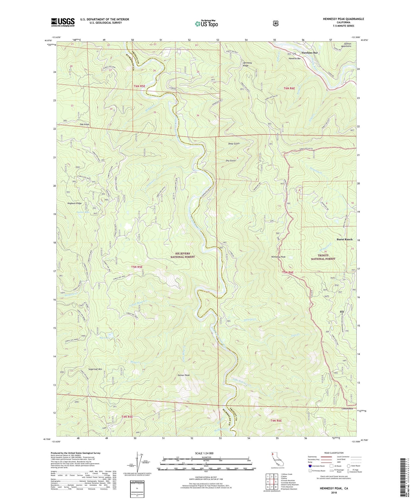
Hennessy Peak California US Topo Map
Couldn't load pickup availability
Also explore the Hennessy Peak Forest Service Topo of this same quad for updated USFS data
2022 topographic map quadrangle Hennessy Peak in the state of California. Scale: 1:24000. Based on the newly updated USGS 7.5' US Topo map series, this map is in the following counties: Humboldt, Trinity. The map contains contour data, water features, and other items you are used to seeing on USGS maps, but also has updated roads and other features. This is the next generation of topographic maps. Printed on high-quality waterproof paper with UV fade-resistant inks.
Quads adjacent to this one:
West: Grouse Mountain
Northwest: Willow Creek
North: Salyer
Northeast: Denny
East: Ironside Mountain
Southeast: Hyampom Mountain
South: Sims Mountain
Southwest: Board Camp Mountain
This map covers the same area as the classic USGS quad with code o40123g5.
Contains the following named places: Ammon Creek, Big Lake, Burnt Ranch Census Designated Place, Castle Rock, Cedar Grove Ranch, Coon Creek, Cow Creek, Deep Gulch, Dry Gulch, Dry Lake, Gainor Peak, Gary Creek, Gray Creek, Hawkins Bar, Hells Half Acre Creek, Hennessy Peak, Hennessy Ridge, Hogback Ridge, Icebox Creek, Ironsides Museum, Little Mingo Creek, Mahala Creek, McAlister Creek, Mingo Creek, North Fork Mingo Creek, Oak Knob, Pony Creek, Saddle Ridge, Sucker Lake, Sugarloaf Mountain, Surprise Creek, Todd Ranch