
MyTopo
Borrego Mountain California US Topo Map
Couldn't load pickup availability
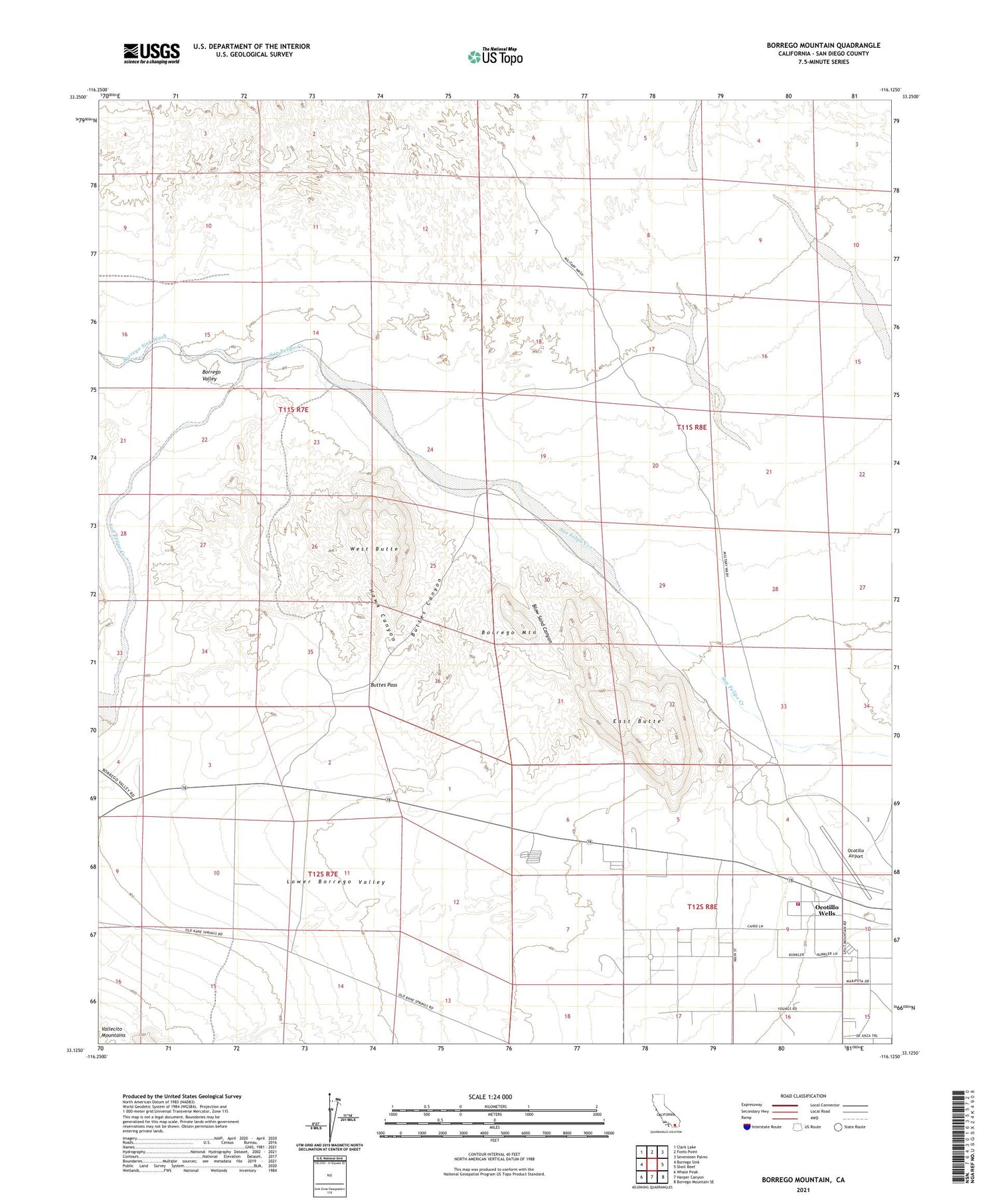
2021 topographic map quadrangle Borrego Mountain in the state of California. Scale: 1:24000. Based on the newly updated USGS 7.5' US Topo map series, this map is in the following counties: San Diego. The map contains contour data, water features, and other items you are used to seeing on USGS maps, but also has updated roads and other features. This is the next generation of topographic maps. Printed on high-quality waterproof paper with UV fade-resistant inks.
Quads adjacent to this one:
West: Borrego Sink
Northwest: Clark Lake
North: Fonts Point
Northeast: Seventeen Palms
East: Shell Reef
Southeast: Borrego Mountain SE
South: Harper Canyon
Southwest: Whale Peak
This map covers the same area as the classic USGS quad with code o33116b2.
Contains the following named places: Benson Lake, Big Wash, Blow Sand Canyon, Borrego Badlands, Borrego Mountain, Borrego Mountain Wash, Borrego Sink Wash, Borrego Valley, Buttes Canyon, Buttes Pass, Cactus Garden, East Butte, Fault Wash, Hawk Canyon, Hills of the Moon Wash, Ocotillo Airport, Ocotillo Wells, Ocotillo Wells State Vehicular Recreation Area, Ocotillo Wells Volunteer Fire Department, Rainbow Wash, The Slot, Third Wash, West Butte


