
MyTopo
Breckenridge Mountain California US Topo Map
Couldn't load pickup availability
Also explore the Breckenridge Mountain Forest Service Topo of this same quad for updated USFS data
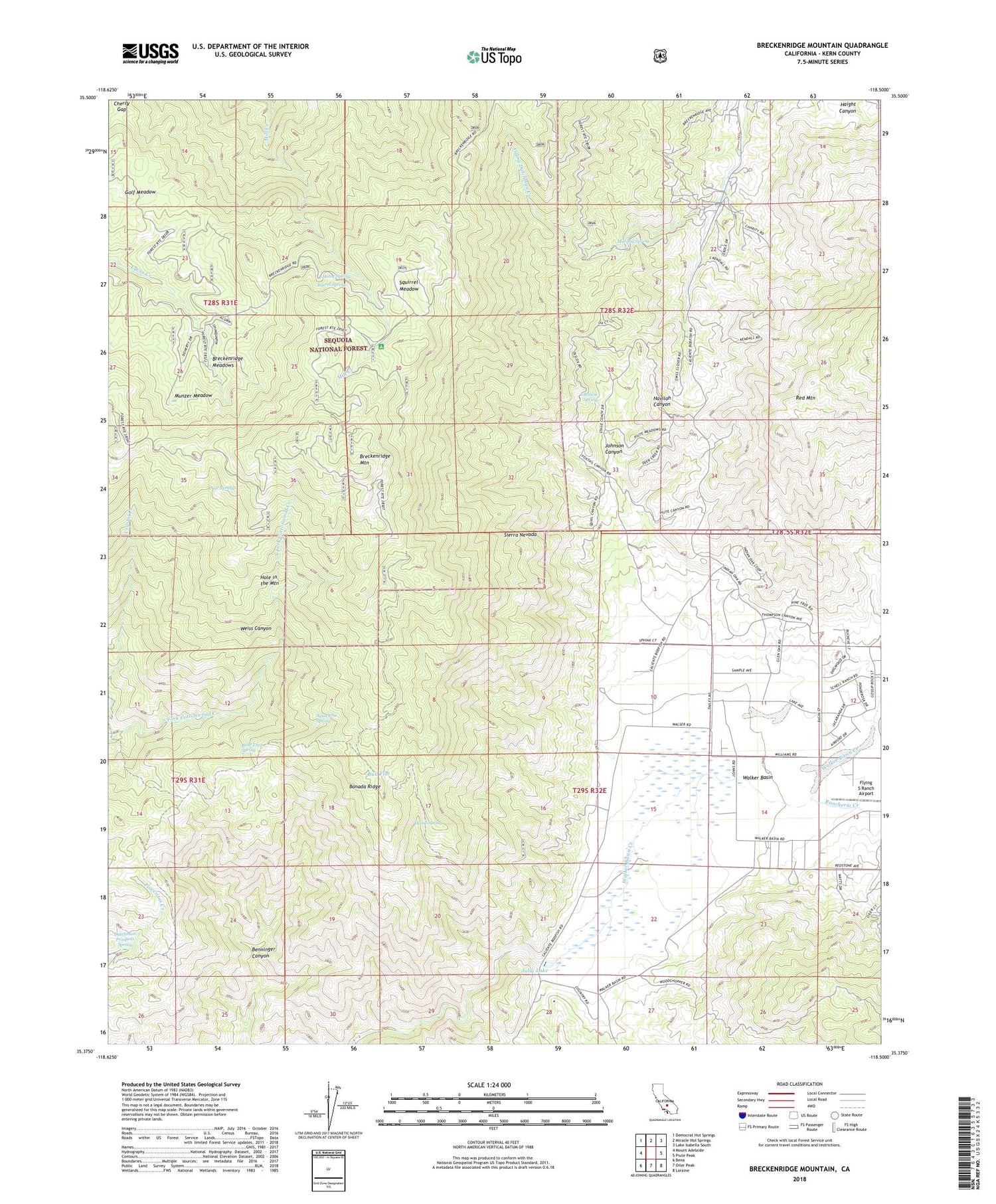
2022 topographic map quadrangle Breckenridge Mountain in the state of California. Scale: 1:24000. Based on the newly updated USGS 7.5' US Topo map series, this map is in the following counties: Kern. The map contains contour data, water features, and other items you are used to seeing on USGS maps, but also has updated roads and other features. This is the next generation of topographic maps. Printed on high-quality waterproof paper with UV fade-resistant inks.
Quads adjacent to this one:
West: Mount Adelaide
Northwest: Democrat Hot Springs
North: Miracle Hot Springs
Northeast: Lake Isabella South
East: Piute Peak
Southeast: Loraine
South: Oiler Peak
Southwest: Bena
This map covers the same area as the classic USGS quad with code o35118d5.
Contains the following named places: Agua Fria Spring, Banada Ridge, Barrel Spring, Bear Trap Spring, Breckenridge, Breckenridge Campground, Breckenridge Fire Tower, Breckenridge Lodge, Breckenridge Meadows, Breckenridge Mountain, Breckenridge Mountain Lookout, Bull Flat, Cherry Gap, Deer Springs, Dutchman Prospect Spring, Flying Dutchman Creek, Flying S Ranch Airport, Golf Meadow, Hole in the Mountain, Home Spring, Johns Ranch, Johnson Canyon, Johnson Spring, Julia Lake, KBAK-TV (Bakersfield), KERO-TV (Bakersfield), Knox Ranch, Lazells Ranch, Lightner Ranch, Metoe Spring, Munzer Meadow, Murphy Spring, Rancheria Creek, Rankin Ranch, Shead Ranch, Squirrel Meadow, Tungsten Chief Mill, Tungsten Chief Mine, Walker Basin, Walker Basin School, Weiss Canyon, Williams Ranch


