MyTopo
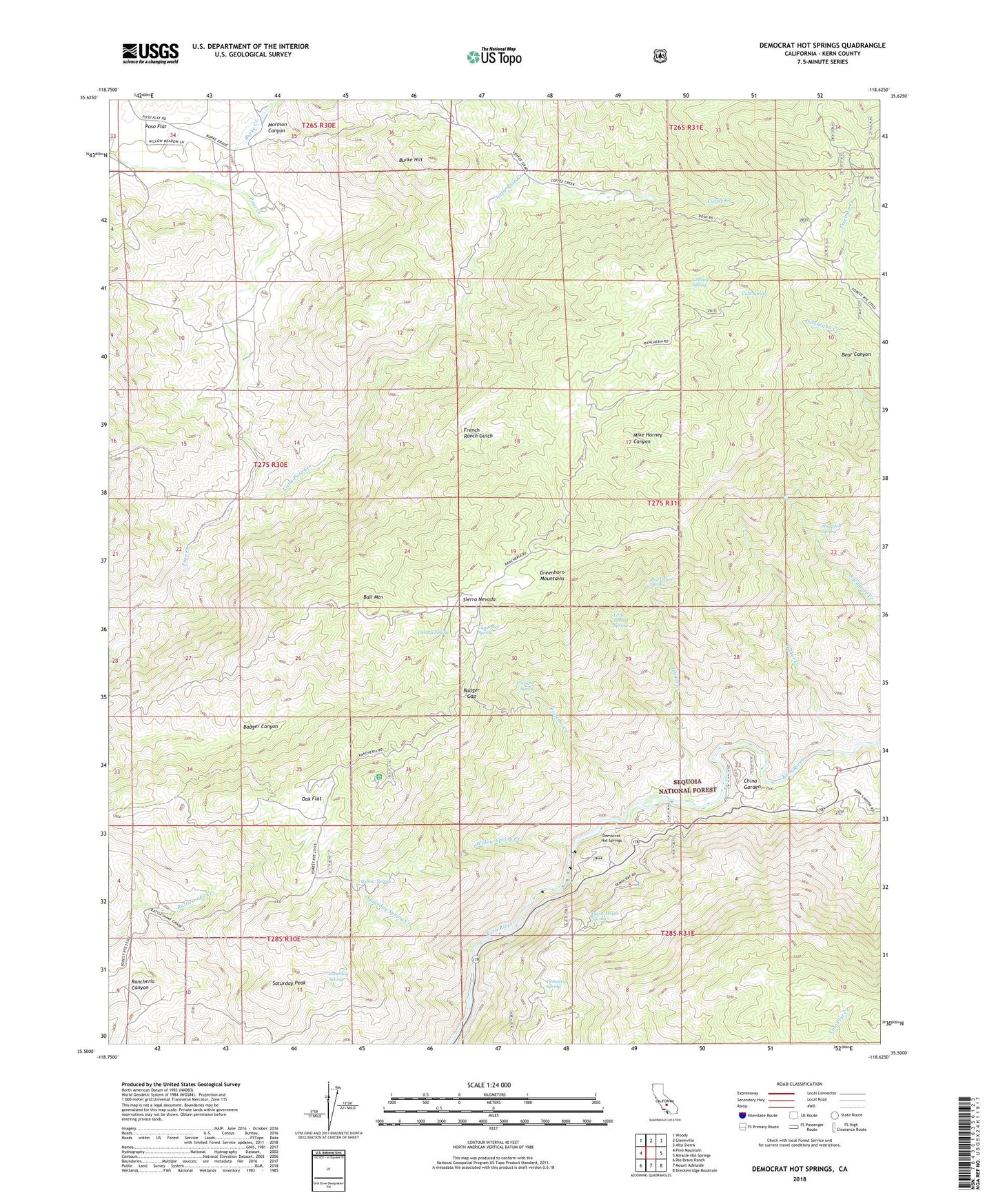
Democrat Hot Springs California US Topo Map
Couldn't load pickup availability
Also explore the Democrat Hot Springs Forest Service Topo of this same quad for updated USFS data
2022 topographic map quadrangle Democrat Hot Springs in the state of California. Scale: 1:24000. Based on the newly updated USGS 7.5' US Topo map series, this map is in the following counties: Kern. The map contains contour data, water features, and other items you are used to seeing on USGS maps, but also has updated roads and other features. This is the next generation of topographic maps. Printed on high-quality waterproof paper with UV fade-resistant inks.
Quads adjacent to this one:
West: Pine Mountain
Northwest: Woody
North: Glennville
Northeast: Alta Sierra
East: Miracle Hot Springs
Southeast: Breckenridge Mountain
South: Mount Adelaide
Southwest: Rio Bravo Ranch
This map covers the same area as the classic USGS quad with code o35118e6.
Contains the following named places: Badger Gap, Ball Mountain, Big Tenant Spring, Burke Creek, Burke Hill, Callioud Spring, Canary Spring, Caughran Spring, China Garden, Coffee Creek, Cold Spring, Cow Flat Creek, Democrat Fire Station, Democrat Guard Station, Democrat Hot Springs, Democrat Spring, Diversion Number 1 104-002 Dam, French Ranch, French Ranch Gulch, Greenhorn School, Hog Hole Spring, Little Poso Creek, Little Tenant Spring, Mike Harney Canyon, Mormon Canyon, Oak Flat, Oak Flat Lookout, Oscar Meyer Spring, Poso Flat, Prefedio Creek, Prefedio Spring, Saturday Peak, Saturday Spring, Saturday Spring Creek, Smith Ranch, Tenant Creek, Tucker Creek, Willow Spring, Willow Spring Creek