MyTopo
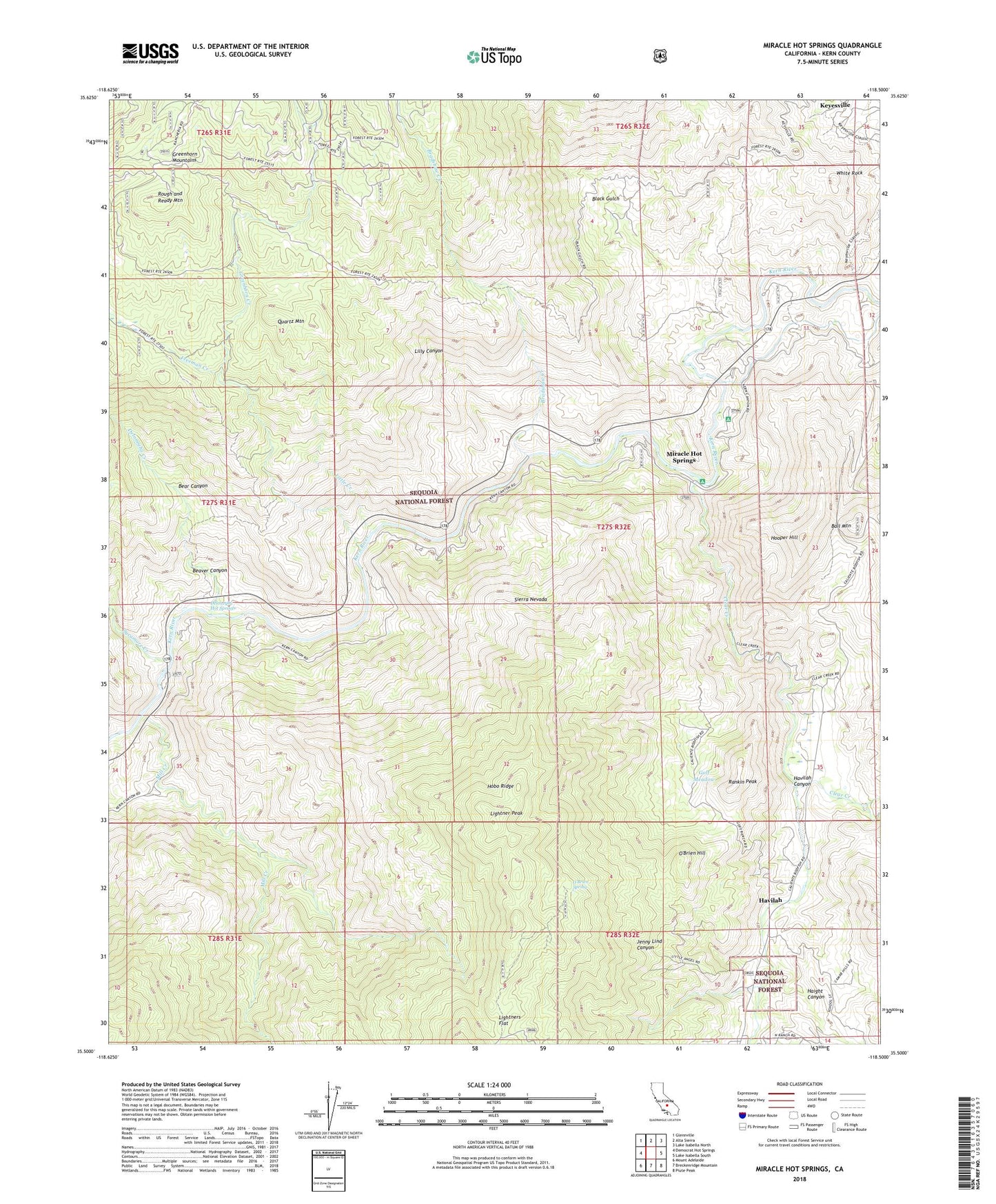
Miracle Hot Springs California US Topo Map
Couldn't load pickup availability
Also explore the Miracle Hot Springs Forest Service Topo of this same quad for updated USFS data
2022 topographic map quadrangle Miracle Hot Springs in the state of California. Scale: 1:24000. Based on the newly updated USGS 7.5' US Topo map series, this map is in the following counties: Kern. The map contains contour data, water features, and other items you are used to seeing on USGS maps, but also has updated roads and other features. This is the next generation of topographic maps. Printed on high-quality waterproof paper with UV fade-resistant inks.
Quads adjacent to this one:
West: Democrat Hot Springs
Northwest: Glennville
North: Alta Sierra
Northeast: Lake Isabella North
East: Lake Isabella South
Southeast: Piute Peak
South: Breckenridge Mountain
Southwest: Mount Adelaide
This map covers the same area as the classic USGS quad with code o35118e5.
Contains the following named places: Ball Mountain, Bear Canyon, Beaver Canyon, Black Gulch, Borel Powerhouse, Bradshaw Creek, Clear Creek, Comet Mine, Davis Campground, Davis Forest Service Station, Delonegha Creek, Delonegha Hot Springs, Freeman Creek, Friday Mine, Goff Ranch, Golf Meadow, Greenhorn Creek, Haight Canyon, Havilah, Havilah Canyon, Havilah Forest Service Station, Hobo Campground, Hobo Forest Service Station, Hobo Ridge, Hooper Hill, Jenny Lind Canyon, Lightner Peak, Lightners Flat, Lilly Canyon, Little Creek, Lone Star Mine, Mammoth Mine, Mayflower Mine, McKeadney Mine, Mill Creek, Miracle Hot Springs, O'Brien Hill, O'Brien Spring, Petersburg, Peterson Landmark Object, Quartz Mountain, Rankin Peak, Rough and Ready Mountain, Southern Cross Mine, Sycamore Creek, Uncle Sam Mine, White Rock