MyTopo
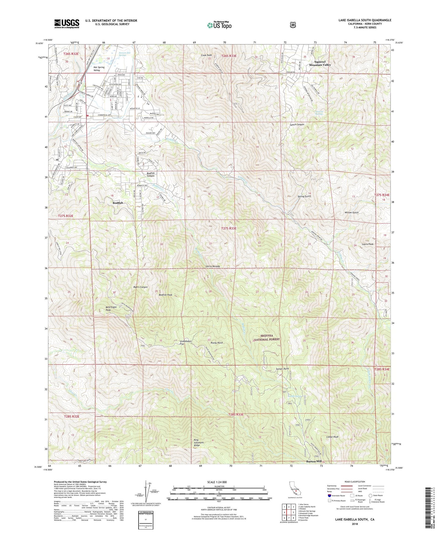
Lake Isabella South California US Topo Map
Couldn't load pickup availability
Also explore the Lake Isabella South Forest Service Topo of this same quad for updated USFS data
2021 topographic map quadrangle Lake Isabella South in the state of California. Scale: 1:24000. Based on the newly updated USGS 7.5' US Topo map series, this map is in the following counties: Kern. The map contains contour data, water features, and other items you are used to seeing on USGS maps, but also has updated roads and other features. This is the next generation of topographic maps. Printed on high-quality waterproof paper with UV fade-resistant inks.
Quads adjacent to this one:
West: Miracle Hot Springs
Northwest: Alta Sierra
North: Lake Isabella North
Northeast: Weldon
East: Woolstalf Creek
Southeast: Claraville
South: Piute Peak
Southwest: Breckenridge Mountain
This map covers the same area as the classic USGS quad with code o35118e4.
Contains the following named places: Bald Eagle Peak, Bodfish, Bodfish Canyon, Bodfish Census Designated Place, Bodfish Creek, Bodfish Peak, Bodfish Post Office, Borel Canal, Brady Ranch, Burton Mill, Cook Peak, Cook Peak Lookout, Devils Hole Mine, Devils Hole North Prospect, Devils Hole South Prospect, Double S Ranch, Drunkards Dream Mine, East Fork Erskine Creek, Erskine Creek, Faust Mill, Faust Mine, Flood Ranch, Garfield, Gautche Springs, Glen Olive Mine, Harrington Ranch, Heavens Delight Mine, Hot Spring Valley, Iconoclast Mine, James Morden Mine, Jeanette Grant Mine, Josephine Mine, Juniper Hills Country Club, Kern County Fire Department Station 72 - Lake Isabella, Kern Valley High School, Kernvale, KKRV-FM (Kernville), KVLI-FM (Lake Isabella), Lake Isabella, Lake Isabella Division, Laura Peak, Laurel Mine, Liebel Peak, Liebel Ranch, Lynch Canyon, Middle Fork Erskine Creek, Myers Canyon, Myers Ranch, Opportunity SubSection Number 4 Prospect, Rocky Hill Prospect, Rocky Point, Russell Ranch, Saddle Spring, Scovern Hot Springs, Seventyfour Mine, South Fork Erskine Creek, Spring Gulch, Squirrel Mountain Valley, Squirrel Mountain Valley Census Designated Place, Studebaker Flat, Summit Continuation High School, Sunset Point, Tom Moore Mine, Tripoli Prospect, Uffert Park, Valley View Mine, Vaughn School, Virginia Mine, Wallace Elementary School, White Rock Mine, Willow Gulch, ZIP Codes: 93205, 93240