MyTopo
Butte Meadows California US Topo Map
Couldn't load pickup availability
Also explore the Butte Meadows Forest Service Topo of this same quad for updated USFS data
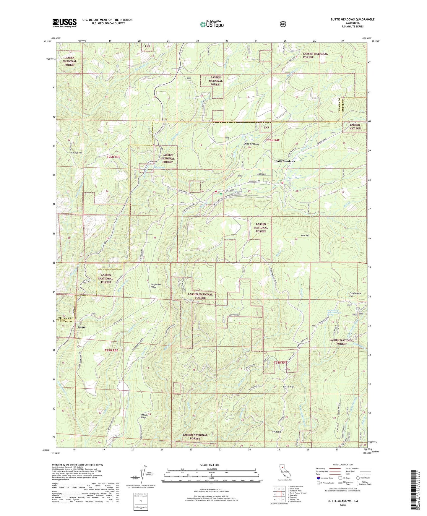
2022 topographic map quadrangle Butte Meadows in the state of California. Scale: 1:24000. Based on the newly updated USGS 7.5' US Topo map series, this map is in the following counties: Butte, Tehama. The map contains contour data, water features, and other items you are used to seeing on USGS maps, but also has updated roads and other features. This is the next generation of topographic maps. Printed on high-quality waterproof paper with UV fade-resistant inks.
Quads adjacent to this one:
West: Devils Parade Ground
Northwest: Barkley Mountain
North: Onion Butte
Northeast: Humboldt Peak
East: Jonesville
Southeast: Kimshew Point
South: Stirling City
Southwest: Cohasset
This map covers the same area as the classic USGS quad with code o40121a5.
Contains the following named places: Bolt Creek, Bottle Creek, Bottle Hill, Bull Creek, Bull Hill, Butte County Fire Department Station 10, Butte Meadows, Butte Meadows Campground, Butte Meadows Census Designated Place, Butte Meadows Post Office, Butte Meadows Recreation Site, Camp Lassen, Carpenter Ridge, Cascade Creek, Cedar Creek, Chaparral Guard Station, Chico Meadows, Coon Creek, Cornelia Lott Sank Memorial Spring, Cuddleback Flat, Department of Forestry and Fire Protection United States Forest Service Butte Meadows, Glenburn, Hawkins Camp, Ike Dye Hill, Lomo, Philbrook Creek, Secret Creek, Soda Springs, Soda Springs Campground, Thatcher Ridge, West Branch Camp, ZIP Code: 95942