
MyTopo
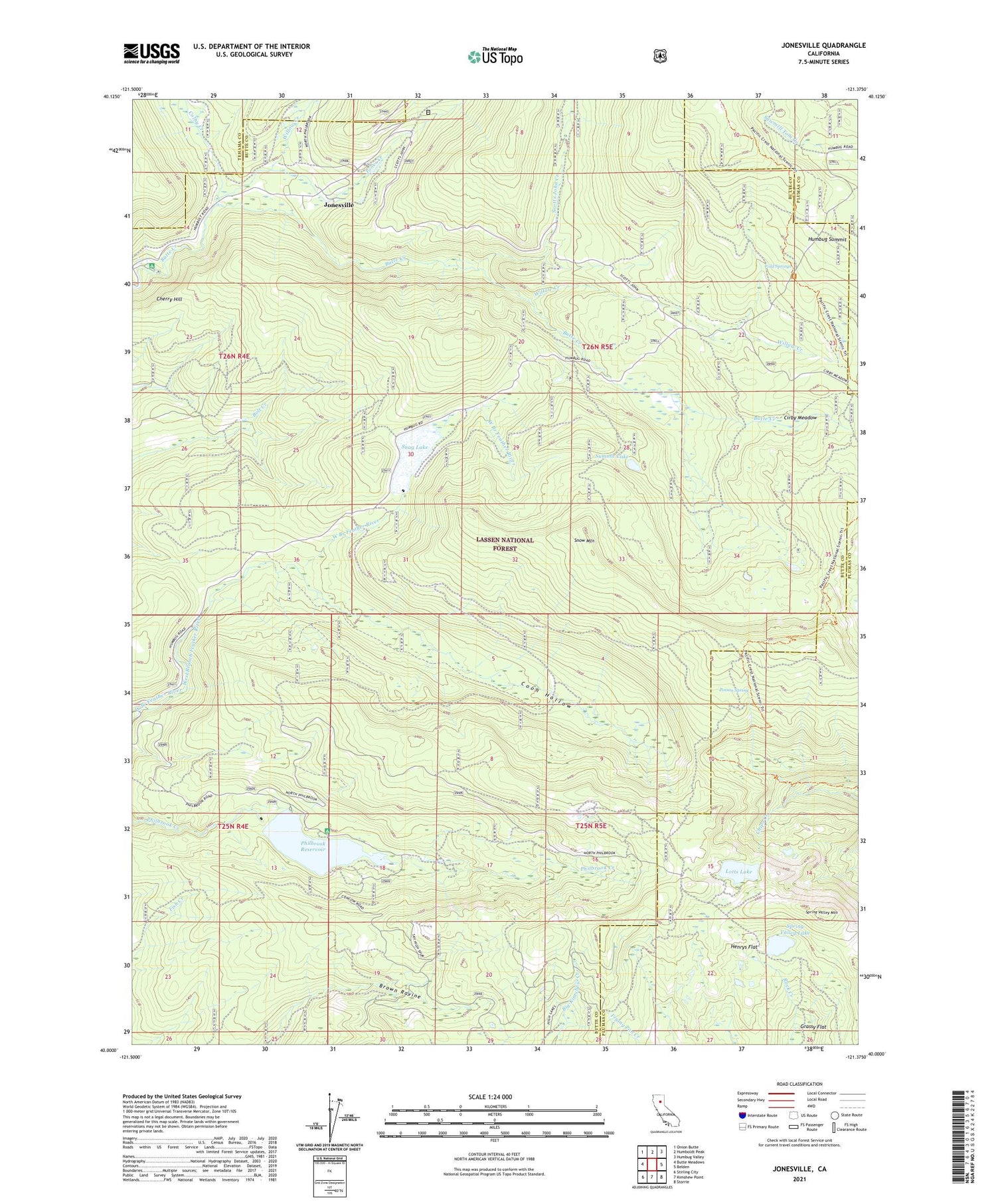
Jonesville California US Topo Map
Couldn't load pickup availability
Also explore the Jonesville Forest Service Topo of this same quad for updated USFS data
2021 topographic map quadrangle Jonesville in the state of California. Scale: 1:24000. Based on the newly updated USGS 7.5' US Topo map series, this map is in the following counties: Butte, Plumas, Tehama. The map contains contour data, water features, and other items you are used to seeing on USGS maps, but also has updated roads and other features. This is the next generation of topographic maps. Printed on high-quality waterproof paper with UV fade-resistant inks.
Quads adjacent to this one:
West: Butte Meadows
Northwest: Onion Butte
North: Humboldt Peak
Northeast: Humbug Valley
East: Belden
Southeast: Storrie
South: Kimshew Point
Southwest: Stirling City
This map covers the same area as the classic USGS quad with code o40121a4.
Contains the following named places: Butte Creek House, Carr Mine, Cherry Hill, Cherry Hill Campground, Cirby Meadow, Colby Creek, Cold Springs, Coon Hollow, Dresser Camp, Grassy Flat, Henrys Flat, Humbug Summit, Jones Creek, Jonesville, Lotts Lake, Philbrook 97-008 Dam, Philbrook Lake Boat Ramp, Philbrook Lake Campground, Philbrook Reservoir, Poison Spring, Round Valley 97-009 Dam, Scotts John Creek, Sky High Mine, Snag Lake, Snow Mountain, Spring Valley Lake, Spring Valley Lake 1-073 Dam, Spring Valley Mountain, Summit Lake, Willow Creek


