
MyTopo
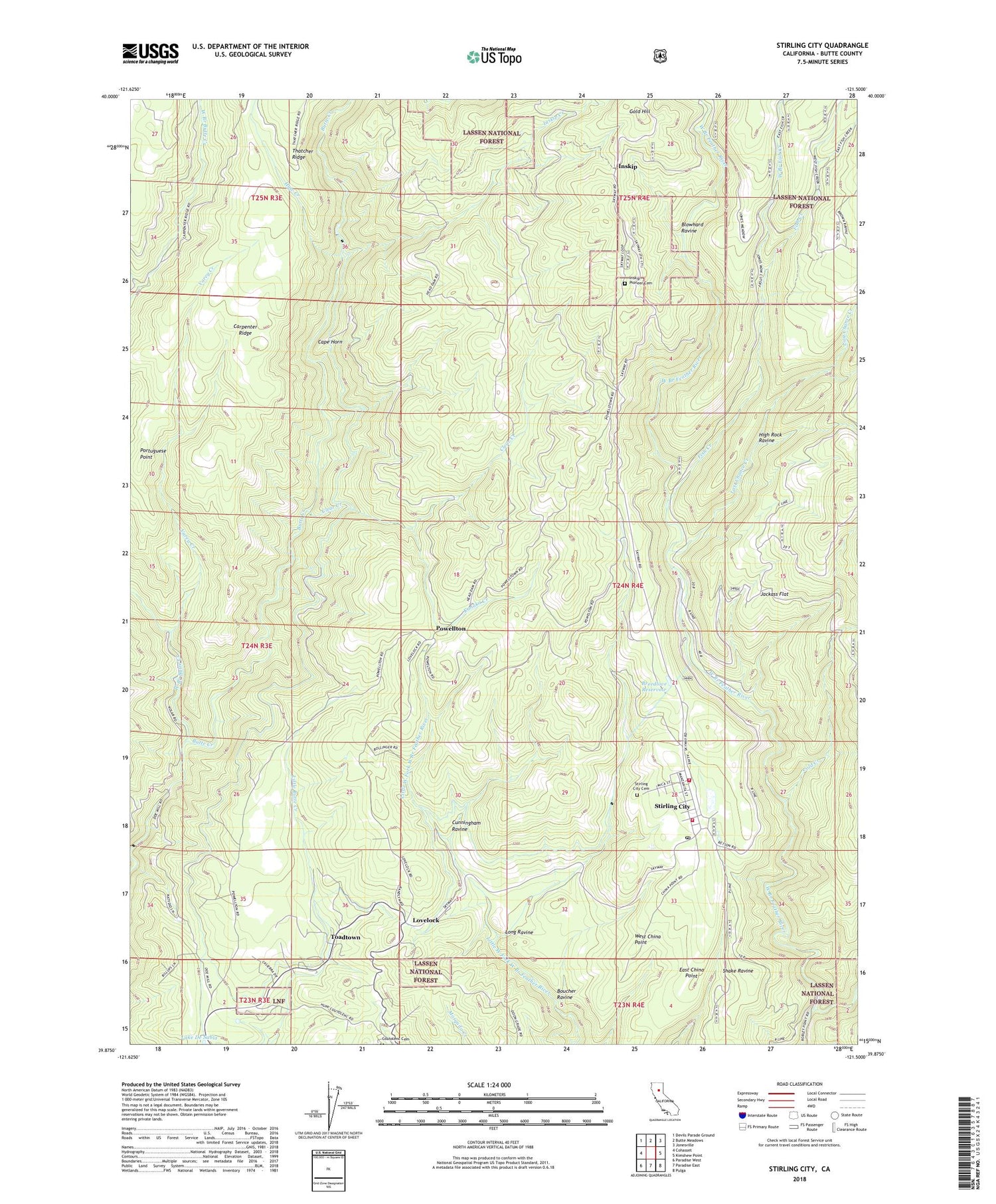
Stirling City California US Topo Map
Couldn't load pickup availability
Also explore the Stirling City Forest Service Topo of this same quad for updated USFS data
2022 topographic map quadrangle Stirling City in the state of California. Scale: 1:24000. Based on the newly updated USGS 7.5' US Topo map series, this map is in the following counties: Butte. The map contains contour data, water features, and other items you are used to seeing on USGS maps, but also has updated roads and other features. This is the next generation of topographic maps. Printed on high-quality waterproof paper with UV fade-resistant inks.
Quads adjacent to this one:
West: Cohasset
Northwest: Devils Parade Ground
North: Butte Meadows
Northeast: Jonesville
East: Kimshew Point
Southeast: Pulga
South: Paradise East
Southwest: Paradise West
This map covers the same area as the classic USGS quad with code o39121h5.
Contains the following named places: Big Kimshew Creek, Black Diamond Mine, Blowhard Ravine, Boucher Ravine, Breedlove Reservoir, Butte County Fire Department Station 12, California Department of Forestry and Fire Protection Station 13 Stirling City, Cape Horn, Clear Creek, Cold Creek, Cunningham Ravine, Discovery Creek, Dix Mine, Doon Camp, East China Point, Ewalt Camp, Fish Creek, Forks of Butte, Gold Hill, Greek Ranch Camp, Haw Creek, High Rock Ravine, Horace Brakebill Elementary School, Inskip, Inskip Creek, Inskip Pioneer Cemetery, Jackass Flat, Kanaka Creek, Last Chance Creek, Long Ravine, Lovelock, Paradise Division, Portuguese Point, Powellton, Retson Camp, Royal Drift Mine, Stirling City, Stirling City Cemetery, Stirling City Census Designated Place, Stirling City Post Office, Toadtown, Toadtown Grave, Varey Creek, West Branch Butte Creek, West Branch Fish Creek, West China Point, ZIP Codes: 95954, 95978


