MyTopo
Kimshew Point California US Topo Map
Couldn't load pickup availability
Also explore the Kimshew Point Forest Service Topo of this same quad for updated USFS data
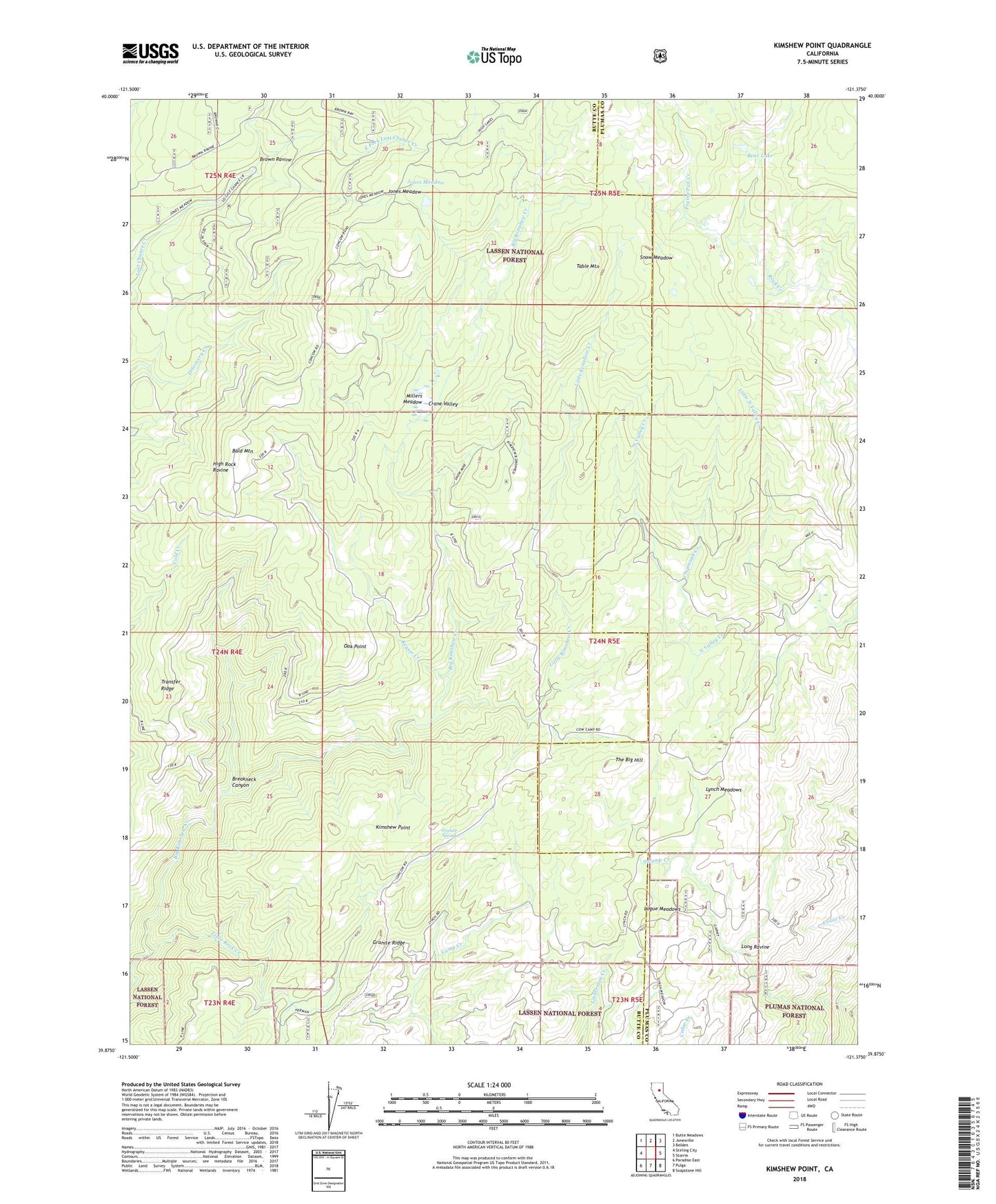
2022 topographic map quadrangle Kimshew Point in the state of California. Scale: 1:24000. Based on the newly updated USGS 7.5' US Topo map series, this map is in the following counties: Butte, Plumas. The map contains contour data, water features, and other items you are used to seeing on USGS maps, but also has updated roads and other features. This is the next generation of topographic maps. Printed on high-quality waterproof paper with UV fade-resistant inks.
Quads adjacent to this one:
West: Stirling City
Northwest: Butte Meadows
North: Jonesville
Northeast: Belden
East: Storrie
Southeast: Soapstone Hill
South: Pulga
Southwest: Paradise East
This map covers the same area as the classic USGS quad with code o39121h4.
Contains the following named places: Bald Mountain, Bear Lake, Breakneck Canyon, Brown Ravine, Campbell Cow Camp, Chipmunk Creek, Crane Valley, East Fork Last Chance Creek, Frying Pan Creek, Granite Ridge, Granite Spring, Jones Meadow, Keyser Creek, Kimshew Point, Little Kimshew Creek, Little North Valley Creek, Little Rock Creek, Logue Meadows, Long Ravine, Lynch Meadows, Millers Meadow, North Valley, Oak Point, Ramsey Bar, Snow Meadow, Snow Mine, Table Mountain, The Big Hill, Transfer Ridge